Norfolk WalksWalking Routes & Hiking Trails
Find Norfolk walks from the list below which features the best walking routes in the area. Most are circular walks and are listed from the shortest and easiest to the longest more challenging routes.
The Norfolk walks listed below include easy circular walks to more demanding and longer routes. The low-lying landscape is devoid of hills. All walks are free to download and print, and all routes have GPS files. The walks feature attractive countryside, a superb coastline, villages, churches and historic buildings. Long distance footpaths including the Norfolk Coast Path and the Peddar's Way offer an excellent basis for shorter circular walks.
| Walk | Description | Grade | Miles |
|---|---|---|---|
| 2307★ | Blakeney from Morston Quay | easy | 2.00 |
| 1600★ | Morston Salt Marshes from Morston Quay | easy | 2.50 |
| 1992★ | Horsey Gap from Horsey | easy | 3.70 |
| 1640★ | Snettisham Beach RSPB reserve from Shepherd's Port | easy | 4.00 |
| 2081★ | Holkham Gap and West Beach from Wells-next-the-Sea | easy | 4.00 |
| 3732★ | Morston, Blakeney & Cley next the Sea | easy | 4.00 |
| 2401★ | Salthouse from Cley-next-the-Sea | easy | 4.00 |
| 3608★ | Martham Ferry & River Thurne from West Somerton | easy | 4.00 |
| 2922★ | Old Hunstanton to Thornham by the Coast Path | easy | 4.50 |
| 2101★ | Holkham Park circular | easy | 4.50 |
| 2240★ | The River Bure & Upton from Acle | easy | 5.00 |
| 3640★ | Thornham Circular | easy | 5.00 |
| 1804★ | Blakeney & Cley next the Sea | easy | 5.00 |
| 1855★ | Horsey Circular | easy | 5.10 |
| 3348★ | River Yare & Claxton from Rockland Staithe | easy | 5.20 |
| 3609★ | Winterton Ness from West Somerton | easy | 5.40 |
| 1035★ | Burnham Market | easy | 5.50 |
| 3678★ | Brampton & the Bure Valley from Buxton | easy/mod | 6.00 |
| 3514★ | Brancaster to Burnham Overy Staithe | easy | 6.00 |
| 3416★ | Hunstanton from South Beach, Heacham | easy | 6.00 |
| 2436★ | The Nar Valley from Castle Acre | easy | 6.10 |
| 2239★ | River Bure and Tunstall Dike from Acle | easy | 6.10 |
| 2151★ | Metton & Felbrigg Hall | easy/mod | 6.20 |
| 2297★ | Honing & East Ruston Circular | easy/mod | 6.40 |
| 3694★ | River Thurne & Hickling Broad from Potter Heigham | easy/mod | 6.40 |
| 2129★ | River Ant & How Hill from Ludham | easy | 6.70 |
| 1654★ | Cley next the Sea & Salthouse | easy | 6.70 |
| 2127★ | The Brecks from near Thompson | easy | 6.80 |
| 2246★ | Tittleshall, Mileham & Godwick | easy/mod | 7.00 |
| 1834★ | Shelton & Fritton Common from Tyrrels Wood | easy/mod | 7.00 |
| 2128★ | Stokesby & Muck Fleet from Fleggburgh | easy | 7.10 |
| 3306★ | Holme next the Sea and Thornham | easy/mod | 7.50 |
| 1908★ | Wells-next-the-Sea & Holkham Park | easy/mod | 8.00 |
| 2446★ | Rockland St Mary Circular | easy/mod | 8.10 |
| 3256★ | Great Bircham & Fring Circular | easy/mod | 8.40 |
| 2653★ | Sheringham to Cley-next-the-Sea | easy/mod | 8.50 |
| 2075★ | Tyrrel's Wood and Boudicca Way | easy/mod | 8.50 |
| 2320★ | Muck Fleet & River Bure from near Oby | easy/mod | 8.70 |
| 2839★ | St Benet's Abbey & How Hill from Ludham | easy/mod | 8.80 |
| 1730★ | Blakeney Point from Cley-next-the-Sea | moderate | 9.00 |
| 3254★ | Holkham & Holkham Park Circular | moderate | 10.20 |
★ GPS file ☩ Route profile
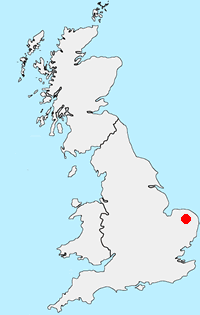
Location Map
Norfolk Guide
The county of Norfolk lies in Eastern England. Its northern and eastern boundaries are the North Sea and to the northwest, The Wash. Norfolk is a largely rural county and well-known for its network of rivers and lakes known as the Broads. This area is not a national park although it has a similar status to a national park. Norfolk's low-lying land and easily eroded cliffs, many of which are composed of chalk and clay, make it vulnerable to weathering by the sea with the coast between Kelling and Lowestoft Ness in Suffolk the most at risk. Norfolk is a popular tourist area with several major attractions. There are many seaside resorts, with some having Britain's finest beaches including those at Great Yarmouth, Cromer and Holkham. In addition to protected area of the Broads, there is also the Norfolk Coast National Landscape (formerly AONB). Many areas of the coast are wild bird reserves. Tow national trails, The Norfolk Coast Path and The Peddar's Way.
Other walks in Britain - For a list of all the areas where walks are available go to the Main Walk Index.
Walk grading - Learn how each walk is assessed and select a walk to suit your ability and experience by going to Walk Grading Details.
Messaging & Social Media
Message Walking Britain and follow the latest news.

Mountain Weather
Stay safe on the mountains with detailed weather forecasts - for iOS devices or for Android devices.