North Yorkshire WalksWalking Routes & Hiking Trails
Find North Yorkshire walks from the list below which features the best walking routes in the area. Most of routes are circular walks although there are a few linear hikes. The walks are listed from the shortest and easiest to the longest more challenging routes. The walks are divided into sub areas so you can find specific walks.
Lower Wharfedale, Cracoe, Burnsall & Bolton Abbey Walks
Yorkshire Dales National Park
Walking Highlights. Personal favourites include the Valley of Desolation and Simon's Seat, Barden Fell, the Rylestone Edges above Cracoe and Trollers Gill. An easy walk full of interest is Barden Bridge and the Strid from Bolton Abbey.
Where to stay - Skipton, Burnsall, Ilkley and Addingham are convenient for walking in this area.
| Walk | Description | Grade | Miles |
|---|---|---|---|
| 1576★ | Embsay Reservoir | easy | 1.00 |
| 1001★ | Barden Bridge & the Strid | easy | 4.00 |
| 3109★ | Rylstone Edges & Cracoe from Rylstone | easy/mod | 6.00 |
| 1811★ | Sharp Haw in Airedale | easy/mod | 7.00 |
| 1946★ | Valley of Desolation & Simon's Seat | moderate | 8.40 |
| 1280★ | Trollers Gill | moderate | 9.00 |
| 1249★ | Simon's Seat | moderate | 10.00 |
| 2574★ | Valley of Desolation & Barden Fell | moderate | 11.00 |
| 2000★ | Wharfedale Circular | moderate | 13.50 |
Upper Wharfedale, Grassington, Kettlewell & Buckden Walks
Yorkshire Dales National Park
Walking Highlights. This is a fine area for walking with varied terrain. Personal favourites include an ascent of Buckden Pike, following the Dales Way between Kettlewell and Yockenthwaite, Conistone Dib and Capplestone Gate plus the hike from Kettlewelll into Littondale and Arncliffe.
Where to stay - Grassington, Kettlewell, Starbotton, Buckden and Hubberholme are convenient for walking in this area.
| Walk | Description | Grade | Miles |
|---|---|---|---|
| 1846★ | Garnshaw House & Linton Falls from Grassington | easy | 3.00 |
| 2611★ | Hebden Gill from Hebden | easy | 4.00 |
| 1573★ | Grimwith Reservoir | easy | 4.50 |
| 1277★ | Starbotton & Kettlewell circular | easy/mod | 5.00 |
| 3301★ | Conistone to Grassington via the Dib | easy | 5.00 |
| 2493★ | Cow Close Gill Waterfalls | easy/mod | 5.40 |
| 1407★ | Thorpe & Burnsall from Linton | easy/mod | 6.20 |
| 1278★ | Cosh & Foxup | easy/mod | 6.50 |
| 2610★ | Hebden Gill & Cupola Corner | easy/mod | 6.50 |
| 2423★ | Capplestone Gate & Conistone Pie | easy/mod | 6.80 |
| 2332★ | Mastilles Lane & Bordley from Kilnsey | easy/mod | 6.80 |
| 3262★ | Copplestone Gate and Conistone Pie from Conistone | easy/mod | 7.00 |
| 1632★ | Arncliffe & Starbotton from Kettlewell | moderate | 7.00 |
| 1294★ | Arncliffe & Kettlewell Circular | moderate | 7.00 |
| 1250★ | Great Whernside | moderate | 8.00 |
| 1254★ | Yockenthwaite & Hubberholme | moderate | 8.00 |
| 2132★ | Buckden Pike and Hubberholme | moderate | 8.40 |
| 1292★ | Linton & Thorpe Fell & Cracoe | moderate | 9.00 |
| 1281★ | Buckden Pike | moderate | 10.50 |
| 1145★ | Grassington, Mastilles Lane & Conistone Dib | moderate | 11.25 |
| 1645★ | Grassington, Mastilles Lane & Conistone Dib | moderate | 12.00 |
Malhamdale & Malham Cove Walks
Yorkshire Dales National Park
Walking Highlights. Some of my favourite Yorkshire Dales walks are in the area around Malham. Personal highlights include the easy walk to Malham Cove, any walks including Gordale Scar and the 'five-star' walk from Malham Tarn to Malham Cove returning via the Watlowes dry valley.
Where to stay - Malham is the prefered centre for walking in this area. However Settle and Gargrave are convenient alternatives.
| Walk | Description | Grade | Miles |
|---|---|---|---|
| 3577★ | Malham Cove from Malham | easy | 3.00 |
| 2737★ | The River Aire & Kirkby Malham from Malham | easy | 3.00 |
| 2704★ | Kirkby Malham & Hanlith from Malham | easy | 4.00 |
| 3092★ | Malham Cove, Malham Tarn & Watlowes | easy | 4.40 |
| 1274★ | Nappa Cross & Malham | easy/mod | 5.50 |
| 2066★ | Winterburn Reservoir circular | easy | 6.00 |
| 1377★ | Calton and Hanlith Moors | easy/mod | 6.50 |
| 1239★ | Gordale Scar & Malham Cove | easy/mod | 6.50 |
| 3307★ | Gargrave to Flasby | easy/mod | 6.50 |
| 3107★ | Flasby Fell from Flasby | easy/mod | 6.50 |
| 2385★ | Airton & Bell Busk Circular | easy/mod | 6.80 |
| 1701★ | Bordley Hall & Malham Moor from Threshfield Moor | easy/mod | 7.00 |
| 1051★ | Gordale Scar & Malham Cove (Route 2) | moderate | 7.00 |
| 2602★ | Gordale Scar & Malham Cove (Route 3) | moderate | 9.10 |
| 1282★ | Malham Tarn & Arncliffe | moderate | 12.50 |
Lower Ribblesdale, Settle & Langcliffe Walks
Yorkshire Dales National Park
Walking Highlights. Lower Ribblesdale offers a variety of easier walks amidst the limestone scenery so typical of this part of the Yorkshire Dales. Favourite walks include Attermire Scar and Catrigg Force, the Norber Erratics and Sulber Gate, and Giggleswick Scar.
Where to stay - Settle, Clapham, Austwick, Stainforth and Langcliffe are convenient for walking in this area.
| Walk | Description | Grade | Miles |
|---|---|---|---|
| 1740★ | Attermire Scar & Victoria Cave | easy/mod | 5.10 |
| 1105★ | Settle Circular | easy/mod | 6.00 |
| 1403★ | Attermire Scar and Catrigg Force | easy/mod | 6.50 |
| 2082★ | Attermire Scar, Catrigg Force & Langcliffe | easy/mod | 7.50 |
| 1548★ | Rye Loaf Hill from Settle | moderate | 7.60 |
| 2603★ | Feizor & Giggleswick Scar from Settle | easy/mod | 8.00 |
| 1251★ | The Norber Erratics & Sulber Gate | moderate | 8.00 |
| 2620★ | Sulber Gate & Crummack Dale from Austwick | moderate | 9.50 |
| 2617★ | Nappa Cross & Victoria Cave from Langcliffe | moderate | 9.50 |
| 1404★ | Oxenber and Wharfe Woods from Langcliffe | moderate | 10.50 |
| 2649★ | Attermire Scar & Malham Tarn from Stainforth | mod/hard | 16.50 |
Upper Ribblesdale & Three Peaks Walks
Yorkshire Dales National Park
Walking Highlights. The 'Big Three' peaks of Whernside, Ingleborough and Pen-y-ghent are the focus of walking in this area. Yorkshire Dales walks to these summits do not involve any technical difficulties hence their popularity. Personal favourites also include the Norber Erratics, the Ingleton Waterfalls Walk and walks starting from Dentdale.
Where to stay - Settle, Horton-in-Ribblesdale, Clapham and Ingleton all provide an ideal base for walking in this area.
| Walk | Description | Grade | Miles |
|---|---|---|---|
| 3091★ | Ingleton Waterfalls Walk | easy | 4.30 |
| 3094★ | Norber & Norber Erractics | easy/mod | 6.30 |
| 3392★☩ | Darnbrook Fell & Fountains Fell | moderate | 6.40 |
| 1013★☩ | Pen-y-ghent | moderate | 6.50 |
| 1500★☩ | Pen-y-ghent via Horton Scar | moderate | 6.75 |
| 1208★☩ | Ingleborough & Park Fell | moderate | 7.50 |
| 3599★ | Clapham, Oxenber Woods, Feizor & Settle | easy/mod | 7.50 |
| 3340★ | Blea Moor & Denthead from Ribblehead | moderate | 8.20 |
| 1121★☩ | Pen-y-ghent & Plover Hill | moderate | 9.00 |
| 3032★☩ | Gragareth & Great Coum from Yordas Cave | moderate | 9.00 |
| 3500★☩ | Ingleborough (northern approach) | moderate | 9.50 |
| 1248★☩ | Trow Gill, Ingleborough & Long Scar | moderate | 9.50 |
| 1184★☩ | Whernside & Scales Moor | moderate | 11.00 |
| 2796★☩ | Ingleborough via Gaping Gill & Norber | moderate | 13.00 |
| 1926★☩ | Pen-y-ghent & Littondale | hard | 16.00 |
| 3433★☩ | Yorkshire Three Peaks from Horton-in-Ribblesdale | very hard | 24.50 |
Wensleydale Walks
Yorkshire Dales National Park
Walking Highlights. Wensleydale is the only dale not named after its river. The dale is wide with the River Ure following a gentle course through green pastures. Semer Water located on the side of the dale is my favourite place to walk as are routes through the valley. Aysgarth Falls especially after heavy rain are well worth including in a walk.
Where to stay - Hawes, Askrigg, Bainbridge, Aysgarth, Carperby and West Burton all provide an ideal base for walking in this area.
| Walk | Description | Grade | Miles |
|---|---|---|---|
| 2286★ | Gayle & Aysgill Force from Hawes | easy | 3.50 |
| 3384★ | Aysgarth Falls and Caperby | easy | 4.00 |
| 2265★ | Semer Water, Stalling Busk & Marsett | easy | 4.00 |
| 2363★ | Drumaldrace (Wether Fell) from Burtersett | easy/mod | 5.20 |
| 3524★ | Semer Water and Cam High Road from Bainbridge | easy/mod | 5.70 |
| 1694★ | Nappa Hall & Whitfield Gill Force | easy/mod | 6.00 |
| 1680★ | Haw Lane & Aysgarth Moor | easy/mod | 6.30 |
| 3333★ | Redmire Force & the Templar's Chapel from West Witton | easy/mod | 6.70 |
| 2155★ | Mossdale & Cotterdale | easy/mod | 7.90 |
| 3624★☩ | Great Shunner Fell from Hardraw | mod/hard | 9.20 |
| 1055★ | Penhill & West Burton | moderate | 10.00 |
| 3621★☩ | Great Shunner Fell & Lovely Seat | mod/hard | 11.40 |
| 2273★ | Dodd Fell Hill & Drumaldrace | moderate | 11.50 |
| 2822★ | Aysgarth & Castle Bolton | mod/hard | 14.50 |
Swaledale Walks
Yorkshire Dales National Park
Walking Highlights. Swaledale is my favourite dale and is characterised by its iconic field barns and stone walls. The area around Gunnerside is rich in industrial heritage. Favourite Yorkshire Dales walks include Gunnerside and Swinner Gills where you can explore the ruins of the lead mining industry. Just outside the National Park lies Nine Standards Rigg with its prominent cairns offering a wonderful view into the Eden Valley.
Where to stay - Thwaite, Muker, Keld, Gunnerside and Reeth all convenient for walking in this area.
| Walk | Description | Grade | Miles |
|---|---|---|---|
| 1253★ | Booze & Slei Gill from Langthwaite | easy | 2.50 |
| 3478★ | Cringley Hill & Scar House from Langthwaite | easy/mod | 4.80 |
| 3093★ | Bunton Hush, Blakethwaite & Gunnerside Gill | easy/mod | 5.50 |
| 1252★ | Great Pinseat | easy/mod | 5.50 |
| 2190★ | Calver Hill & Reeth Low Moor | easy/mod | 6.00 |
| 1341★ | Nine Standards Rigg | moderate | 6.00 |
| 1340★ | Muker & Upper Swaledale from Keld | easy/mod | 6.50 |
| 1197★ | Gunnerside & Swinner Gills | moderate | 8.50 |
| 1053★ | Swinner Gill and Muker | mod/hard | 8.50 |
| 1768★ | Thomas Gill and Ravenseat from Tan Hill | moderate | 8.70 |
| 1056★ | Gunnerside & Surrender Bridge | moderate | 10.25 |
North York Moors West Walks
North York Moors National Park
Walking Highlights. The western part of the North York Moors National Park contains some excellent walking. Predominantly moorland, the area is dissected by many valleys or dales. Generally the area is sparsely populated with few facilities in the hamlets and villages. Excellent North York Moors walks include those to Roseberry Topping, Captain Cook's Monument and Highcliff Nab. The Clevland Way crosses this area and provides a useful route for shorter circular walks. Other highlights include walks that include Rievaulx Abbey and routes in Rosedale.
Where to stay - Pickering, Thirsk, Helmsley, Great Ayton and Hutton-le-hole all provide convenient access for walking in this area.
| Walk | Description | Grade | Miles |
|---|---|---|---|
| 3581★ | Gormire Lake from Sutton Bank National Park Centre | easy/mod | 3.40 |
| 1893★ | Ainthorpe Rigg & Little Fryup Dale | easy/mod | 5.60 |
| 3718★ | Scarth Wood Moor from Osmotherley | easy/mod | 6.00 |
| 3418★ | Cringle Moor & the Wain Stones | easy/mod | 6.00 |
| 1330★ | Roseberry Topping & Captain Cook's Monument | easy/mod | 6.50 |
| 1921★ | Spaunton Moor from Chimney Bank | easy/mod | 8.10 |
| 3737★ | Commondale & Esk Valley | easy/mod | 8.20 |
| 1450★ | Little & Great Fryup Dales | moderate | 8.25 |
| 1622★ | Hawnby, Bilsdale West and Wetherhouse Moors | moderate | 8.30 |
| 1473★ | Hollin Hill to Square Corner by the Cleveland Way | moderate | 9.45 |
| 1538★ | Baysdale Circular | moderate | 9.45 |
| 2702★ | Ampleforth, Shallow Dale, Yearsley Moor & Wilderness | moderate | 9.50 |
| 1920★ | Rievaulx Moor from Cowhouse Bank | moderate | 9.50 |
| 1525★ | Beck Dale & Rievaulx from Helmsley | moderate | 9.75 |
| 1542★ | The Rudland Ridge from Ousegill Bridge | moderate | 10.10 |
| 1544★ | Chop Gate, Round Hill & Stumps Cross | moderate | 10.10 |
| 1469★ | Carlton Bank, Scugdale, Raisdale & Kirby Bank | moderate | 10.50 |
| 3187★ | Esklets and Rosedale Head from Westerdale | moderate | 11.00 |
| 3398★ | Rollgate Bank & Aumery Park from Fadmoor | moderate | 11.00 |
| 1674★ | Rosedale Valley circular from Little Blakey | moderate | 11.00 |
| 2685★ | Highcliff Nab and Guisborough Moor | moderate | 11.10 |
| 2029★ | Lastingham & Rosedale from Hutton-le-Hole | moderate | 12.00 |
| 1527★ | Farndale Circular from Little Blakey | moderate | 12.00 |
| 1524★ | Cold Kirby, Rievaulx Bridge & Wass | moderate | 12.50 |
| 1498★ | Kilburn White Horse, Cold Kirby, Murton, & Sutton Bank | moderate | 14.00 |
| 1468★ | Wain Stones, Bank Foot & Bloworth Crossing | moderate | 14.25 |
| 1497★ | High Paradise around Arden Great Moor from Square Corner | moderate | 14.25 |
| 1467★ | Cleveland Way - Roseberry Common to Tidy Brown Hill | moderate | 15.00 |
| 2566★ | Rievaulx Abbey from Kilburn, near Thirsk | mod/hard | 15.00 |
North York Moors East & Coast Walks
North York Moors National Park
Walking Highlights. The eastern part of the North York Moors National Park contains some excellent walking. Predominantly moorland with a rugged coastline, this part of the National Park features many dales that dissect the higher moors. Excellent North York Moors walks include coastal walking following the Cleveland Way especially around Robin Hood's Bay, the Hole of Horcum, and walks from Goathland. The Clevland Way follows the coast in this area and provides a useful basis for shorter circular walks.
Where to stay - Robin Hood's Bay, Whitby, Goathland and Pickering are convenient bases for walking in this area.
| Walk | Description | Grade | Miles |
|---|---|---|---|
| 3533★☩ | Mallyan Spout and Beck Hole from Goathland | easy | 3.00 |
| 3532★ | Runswick Bay to Staithes | easy | 3.80 |
| 3337★ | Dundale Pond from Levisham | easy | 4.80 |
| 3534★☩ | Dundale Pond & Hole of Horcum from Saltergate | easy/mod | 5.20 |
| 3585★☩ | Skelton Tower & Hole of Horcum from Levisham | easy/mod | 7.40 |
| 1012★ | Glaisdale, Great Fryup Dale and Eskdale | moderate | 7.50 |
| 2262★ | Goathland & Grosmont | easy/mod | 7.70 |
| 1464★ | Sleights Moor | easy/mod | 7.75 |
| 1395★ | Broxa & Broxa Forest | easy/mod | 8.25 |
| 1397★ | Hole of Horcum from Levisham Station | easy/mod | 8.50 |
| 3471★ | Robin Hood's Bay from Ravenscar | moderate | 8.50 |
| 1744★ | Hayburn Wyke & Ravenscar along the Cleveland Way | moderate | 8.50 |
| 1743★ | Sneaton Thorpe & Littlebeck from May Beck | moderate | 8.90 |
| 1887★ | Runswick Bay & Kettleness | moderate | 9.00 |
| 2091★ | Kettleness and Mickleby from Lythe | moderate | 9.70 |
| 1452★ | Leaholm Moor & Scaling Dam | moderate | 9.75 |
| 1867★ | Hole of Horcum & Bridestones from Lockton | moderate | 9.80 |
| 1623★ | Burn Howe Rigg from Jugger Howes | moderate | 10.00 |
| 2130★ | Robin Hood's Bay & Hawkser from Fylingthorpe | moderate | 10.00 |
| 2325★ | Troutsdale Circular | moderate | 10.10 |
| 1564★ | Hayburn Wyke from Scalby | moderate | 10.20 |
| 1396★ | Hole of Horcum and Saltergate Brow from Lockton | moderate | 10.25 |
| 1758★ | Newton House Plantation & Stony Leas | moderate | 10.30 |
| 2583★ | Iburndale and the Esk Valley from Stainsacre | moderate | 10.30 |
| 1675★ | The Esk Valley & Egton High Moor | moderate | 10.50 |
| 1922★ | Goathland & Howl Moors | moderate | 11.20 |
| 1930★ | Wheeldale Moor circular | moderate | 11.30 |
| 1602★ | Saltergate, Fylingdales & Allerston High Moor | moderate | 11.50 |
| 2077★ | Glaisdale Moor circular | moderate | 11.90 |
| 2665★ | Cawthorne Roman Camp Circular | moderate | 12.20 |
| 1476★ | Boulby Mine to Whitby by the Cleveland Way | moderate | 12.50 |
| 2563★ | Egton Bridge & Grosmont from Goathland | moderate | 12.50 |
South Pennines Walks
The South Pennines stretch from the northern boundary of the Peak District to the southern boundary of the Yorkshire Dales. Consisting of high rolling moorland, intersected by deep valleys, there is nowhere in this region that exceeds 2000 feet. The moors and valleys are where the old rivals, Lancashire and Yorkshire meet and where too the rival industries of cotton and wool.
| Walk | Description | Grade | Miles |
|---|---|---|---|
| 1793★ | Lothersdale | easy/mod | 6.00 |
| 2661★ | Keighley Moor Reservoir & Hitching Stone from Cowling | moderate | 9.50 |
Yorkshire Wolds Walks
A lovely area for walking with a rolling chalk plateau cut into by deep, steep sided dry valleys. The walking is generally easy with a number of attractive villages to explore.
| Walk | Description | Grade | Miles |
|---|---|---|---|
| 1738★ | The deserted village of Wharram St Percy | easy | 2.70 |
| 3515★ | Deepdale and the deserted village of Wharram St. Percy | easy | 5.00 |
| 1990★ | Settrington from North Grimston | easy/mod | 7.30 |
| 3247★ | Stockingdale and Muston from Hunmanby | easy/mod | 7.80 |
| 2703★ | Thixendale & Kirby Underdale | easy/mod | 8.50 |
| 1630★ | Filey, Camp Dale & Hunmanby | moderate | 10.50 |
| 3434★ | North Grimston, Birdsall & Wharram Percy | moderate | 12.10 |
Howardian Hills Walks
| Walk | Description | Grade | Miles |
|---|---|---|---|
| 3733★ | Coneysthorpe & Castle Howard from Welburn | easy/mod | 9.00 |
| 3126★ | Kirkham Priory & Pretty Wood from Low Hutton | moderate | 11.00 |
| 3121★ | Castle Howard & Coneysthorpe | moderate | 11.40 |
Nidderdale AONB Walks
| Walk | Description | Grade | Miles |
|---|---|---|---|
| 1572★ | Swinsty Reservoir | easy | 3.00 |
| 1571★ | Scar House & Angram Reservoirs | easy | 4.00 |
| 1574★ | Thruscross Reservoir | easy | 4.50 |
| 3726★ | Brimham Rocks Circular | easy | 4.70 |
| 3507★ | Dacre Banks Circular | easy/mod | 6.50 |
| 1929★ | River Ure & Nutwith Common from Masham | easy/mod | 6.60 |
| 1405★ | Thruscross Reservoir & Kex Gill Moor | easy/mod | 8.50 |
| 3528★ | Fountains Abbey & Markenfield Hall | moderate | 8.65 |
| 3659★ | Scar House Reservoir, Dale Edge & Middlesmoor | moderate | 9.00 |
| 2406★ | Ripon Rowel Walk Leg 4 - Ilton to Grewelthorpe | moderate | 10.50 |
| 2405★ | Ripon Rowel Walk Leg 3 - Sawley to Ilton | moderate | 11.00 |
| 2572★ | West Scrafton & Middlesmoor from Lofthouse | mod/hard | 18.00 |
Vale of York Walks
| Walk | Description | Grade | Miles |
|---|---|---|---|
| 1095★ | The Marton-cum-Grafton Eight | easy | 3.25 |
| 1358★ | Ripley & Knox circular | easy | 5.50 |
| 3602★ | Tadcaster and Newton Kyme | easy/mod | 6.10 |
| 1078★ | Hampsthwaite & Ripley Park | easy | 7.50 |
| 2404★ | Ripon Rowel Walk Leg 2 - South Stainley to Sawley | easy/mod | 8.50 |
| 1800★ | West of Harrogate without a car | easy/mod | 9.00 |
| 2403★ | Ripon Rowel Walk Leg 1 - Ripon to South Stainley | easy/mod | 10.00 |
| 1757★ | River Ouse & Moor Monkton FROM Nether Poppleton | moderate | 10.00 |
| 2407★ | Ripon Rowel Walk Leg 5 - Grewelthorpe to Ripon | moderate | 12.00 |
Vale of Pickering Walks
| Walk | Description | Grade | Miles |
|---|---|---|---|
| 1311★ | Slingsby & South Holme | easy/mod | 8.00 |
| 1631★ | Scarborough to Filey | moderate | 10.20 |
| 1704★ | Oswaldkirk, Nunnington & Harome circular | moderate | 11.50 |
Skipton Walks
| Walk | Description | Grade | Miles |
|---|---|---|---|
| 2861★ | Pinhaw Beacon from Lothersdale | easy | 4.00 |
| 3430★ | Farnhill Moor from Kildwick | easy/mod | 4.50 |
| 2304★ | East Marton and the Drumlins | easy/mod | 5.50 |
| 2657★ | Bradleys Both, near Skipton | easy/mod | 5.50 |
| 2904★ | Cross Hills to Skipton via Low Bradley | easy/mod | 6.50 |
| 2256★ | Great Stone of Fourstones | easy/mod | 6.70 |
Walks that start in adjacent counties / areas.
Walks that start in adjacent counties or areas but cross the boundary and include sections of the route within North Yorkshire.
| Walk | Description | Starts In |
|---|---|---|
| 1052★☩ | Whernside & Dentdale | Cumbria |
| 2409★ | The Upper Eden valley without a car | Cumbria |
| 3135★☩ | Dentdale & Bleamoor | Cumbria |
| 1970★☩ | Great Knoutberry Hill & Dent Head | Cumbria |
| 3584★☩ | Gragareth from Ireby | Lancashire |
| 2437★ | Bowland Knotts | Lancashire |
| 2090★ | Easington Beck & Staithes from Loftus | Redcar and Cleveland |
| 3160★ | Roseberry Topping and Captain Cook's Monument | Redcar and Cleveland |
| 2906★ | Circular from Wayrham Through Painsthorpe | East Yorkshire |
| 1842★ | Buttercrambe & Youlthorpe from Stamford Bridge | East Yorkshire |
| 2655★ | Wayram To Fridaythorpe Circular | East Yorkshire |
| 1905★ | Beamsley Beacon and Bolton Abbey | West Yorkshire |
| 1380★ | Bramham Park & Newton Kyme from Kiddal Bridge | West Yorkshire |
★ GPS file ☩ Route profile
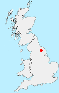
Location Map
North Yorkshire Guide
North Yorkshire is a large county and contains some of the finest walking in Britain. The Yorkshire Dales and North York Moors National Parks offer varied routes to suit all abilities with wonderful scenery. Outside of the two National Parks, there are many walks offering rural tranquillity and pleasant walking. The Pennine Way, Dales Way and Coast to Coast long distance paths offer excellent circular walks exploring the landscapes of this historic county.
Other walks in Britain - For a list of all the areas where walks are available go to the Main Walk Index.
Walk grading - Learn how each walk is assessed and select a walk to suit your ability and experience by going to Walk Grading Details.
Messaging & Social Media
Message Walking Britain and follow the latest news.

Mountain Weather
Stay safe on the mountains with detailed weather forecasts - for iOS devices or for Android devices.