South West Coast Path WalksWalking Routes & Hiking Trails
Find South West Coast Path walks from the list below which features the best walking routes in the area. Most of routes are circular walks although there are a few linear hikes. The walks are listed from the shortest and easiest to the longest more challenging routes. The walks are divided into sub areas so you can find specific walks.
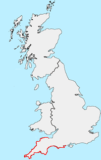
The South West Coast Path is the longest National Trails in the UK stretching for 630 miles from Minehead in North Somerset to Poole Harbour in Dorset. The path offers varied landscapes and seascapes. In places the path is challenging. Listed below area selection of circular and linear walks that use sections of this great National Trail. All routes include free GPX files.
SWCP Dorset Walks
The SWCP in Dorset covers the eastern section the Jurassic Coast. Highlights include Old Harry near Studland, the cliffs between Durlston Head and Kimmeridge Bay, and onto Lulworth Cove. Continuing east Durdle Door, White Nothe lead to Weymouth and Portland Bill. Chesil Beach, Abbotsbury, Bridport lead to Lyme Regis and the Devon border.
| Walk | Description | Grade | Miles |
|---|---|---|---|
| 1004★ | Durdle Door & Lulworth Cove | easy | 2.50 |
| 1329★ | Durdle Door & White Nothe from Lulworth Cove | moderate | 7.00 |
| 1331★ | Kimmeridge & Tyneham | easy/mod | 6.75 |
| 1533★ | Gad Cliff, Povington Hill & Tyneham | easy/mod | 4.50 |
| 1534★ | Swyre Head & Tyneham Cap from Kimmeridge | moderate | 11.75 |
| 1549★ | Golden Cap from Seatown | easy/mod | 4.00 |
| 1550★ | Charmouth & Lyme Regis Circular | easy/mod | 6.00 |
| 1551★ | Seatown and Charmouth via Golden Cap | easy/mod | 5.00 |
| 1597★ | The White Horse & Sutton Poyntz from Osmington | easy/mod | 4.00 |
| 1613★ | Studland & Old Harry Rocks | easy/mod | 8.50 |
| 1634★ | Old Harry & Ballard Down from Studland | easy/mod | 5.30 |
| 1995★ | Houns-tout & Swyre Head from Kimmeridge | moderate | 8.70 |
| 2289★ | Abbotsbury Castle and Chesil Beach | easy/mod | 6.00 |
| 2370★ | The Fleet from Langton Herring | easy/mod | 7.00 |
| 2391★ | West Bay & Burton Cliff | easy | 4.50 |
| 2440★ | White Nothe & Moigns Down from Osmington | moderate | 10.50 |
| 2568★ | Egmont Point & Kimmeridge Bay from Tyneham | moderate | 14.00 |
| 2575★ | Durdle Door & Lulworth Cove | moderate | 10.00 |
| 2579★ | Purbeck Coast from Swanage | moderate | 10.00 |
| 2580★ | Golden Cap & Charmouth | easy/mod | 5.00 |
| 2771★ | Lyme Regis & Uplyme Circular | easy/mod | 5.50 |
| 2827★ | Rodden & Langton Herring from Abbotsbury | easy/mod | 9.20 |
| 3286★ | Dancing Ledge & Durlston Head from Langton Matravers | easy/mod | 7.00 |
| 3389★ | Bindon Hill and the Fossil Forest from Lulworth | easy/mod | 4.00 |
| 3396★ | Agglestone & Old Harry Rocks | easy/mod | 6.40 |
| 3523★ | Abbotsbury & Portesham Circular | easy | 5.20 |
SWCP Devon South Coast Walks
The western section of the Jurassic Coast continues via Seaton, Sidmouth and Budleigh Salterton to reach Exmouth. The path continues west after crossing the Exe estuary through the resorts of Dawlish, Teignmouth, and Torquay to reach the bust harbour at Brixham. At Kingswear the River Dart is crossed before reaching Slapton Sands, Start Point before crossing several estuaries to reach Plymouth and the River Tamar.
| Walk | Description | Grade | Miles |
|---|---|---|---|
| 1323★ | Broadsands Beach and Brixham | easy | 4.00 |
| 1636★ | Danger Point & Ladram Bay from Otterton | easy/mod | 6.00 |
| 1795★ | Beer & Branscombe Circular | easy/mod | 5.50 |
| 1857★ | Start Point & East Prawle | moderate | 8.20 |
| 1866★ | East Prawle & Prawle Point | easy/mod | 4.10 |
| 1975★ | Erme Mouth | moderate | 9.00 |
| 2012★ | Wembury Bay & St Peter's Church from Noss Mayo | easy/mod | 6.00 |
| 2030★ | Budleigh Salterton, East Devon | easy/mod | 7.00 |
| 2230 | Exploring Plymouth | easy | 6.50 |
| 2279★ | Salcombe Regis & Weston Mouth | easy/mod | 5.10 |
| 2371★ | Kingswear to Brixham | moderate | 10.80 |
| 2461★ | Warren Point & Bolt Tail from Bantham | moderate | 9.00 |
| 2474★ | East Prawle Coast Circular | easy/mod | 5.60 |
| 3041★ | Thurlestone circular | easy | 4.00 |
| 3112★ | Soar Mill Cove & Bolt Head from Higher Soar | easy/mod | 6.50 |
| 3276★ | Gara Point & Stoke Point from Noss Mayo | easy/mod | 7.00 |
| 3427★ | Slapton Sands & Stokenham from Torcross | easy/mod | 8.00 |
| 3431★ | Beeson to Salcombe | mod/hard | 12.00 |
| 3432★ | Salcombe to Thurlestone | mod/hard | 11.00 |
| 3587★☩ | Kingswear from Coleton Fishacre | moderate | 7.00 |
SWCP Cornwall South Coast Walks
From Saltash Rame Head and Long Sands lead to Looe, Polperro and Fowey. Continuing west Gribbin Head, Mevagissey and Dodman Point are followed by the Roseland Peninsula with Nare Head offering splendid views. Falmouth and the Helford River lead to Lizard Point. After passing pretty Kynance Cove Penzance and Newlyn provide plenty of maritime interest before reaching Land's End.
| Walk | Description | Grade | Miles |
|---|---|---|---|
| 1027★ | Nare Head & Portloe | moderate | 7.00 |
| 1031★ | Polruan & Lanteglos Church | easy/mod | 4.25 |
| 1032★ | Kynance Cove, Cadgwith & The Lizard | moderate | 8.00 |
| 1033★ | Dodman Point & Gorran Haven | mod/hard | 11.00 |
| 1226★ | Land's End & Sennen Cove from Porthcurno | moderate | 6.50 |
| 1778★ | Maenporth and Helford Passage Circular | easy/mod | 8.00 |
| 1783★ | Gorran Haven & Dodman Point | easy/mod | 5.00 |
| 2001★ | Coverack & Lowland Point | easy/mod | 4.20 |
| 2003★ | Cowlands, Coombe & Roundwood Quay from Trelissick | easy/mod | 9.00 |
| 2007★ | Helford Passage & Frenchman's Creek | easy/mod | 7.00 |
| 2009★ | Gillan & Nare Point from Porthallow | easy | 4.70 |
| 2010★ | Housel Bay & Bass Point from the Lizard | easy | 3.50 |
| 2088★ | Rosemullion Head & Mawnan | easy | 4.00 |
| 2298★ | Porthgwarra & St Levan Circular | easy | 4.80 |
| 2354★ | Merry Maidens & Lamorna Cove | easy | 4.10 |
| 2392★ | The Lizard Circular | easy/mod | 5.90 |
| 2614★ | St Loy's Cove & Logan Rock | moderate | 8.50 |
| 3501★ | Penzance to Porthcurno via Mousehole and Lamorna | moderate | 11.00 |
SWCP Cornwall North Coast Walks
Turning east, relics of tin mining litter the first section through to St Ives. The attractive north coast through to Newquay offers rugged cliffs and the wide expanse of Perran Beach. The route continues along the cliff tops to Padstow and the River Camel. Polzeath, Port Isaac, Tintagel and Boscastle all provide excellent walking before reaching Bude and the Devon border.
| Walk | Description | Grade | Miles |
|---|---|---|---|
| 1028★ | Chun Quoit and Botallack | moderate | 8.00 |
| 1029★ | Tintagel to Boscastle | moderate | 9.00 |
| 1076★ | Dizzard Point & Crackington Haven | moderate | 8.00 |
| 1081★ | Zennor & St Ives coast path | mod/hard | 11.00 |
| 1223★ | Morvah to Zennor coast | moderate | 5.50 |
| 1225★ | Sennen Cove & Botallack from St Just | moderate | 7.50 |
| 1961★ | Porthcothan to Watergate Bay | easy/mod | 6.80 |
| 1996★ | Woodford & Hollygrove Wood | easy/mod | 5.10 |
| 2267★ | Godrevy Point & Hell's Mouth | easy/mod | 5.20 |
| 2294★ | St. Agnes to Porthtowan | easy/mod | 5.00 |
| 2462★ | The Rumps & Pentire Point | easy/mod | 4.00 |
| 2730★ | St Gennys & Castle Point from Crackington Haven | easy/mod | 3.00 |
| 2731★ | Cambeak & Crackington Haven | easy/mod | 4.30 |
| 3264★ | Port Quin & Port Isaac Circular | easy/mod | 5.70 |
| 3738★ | Polzeath & Pentire Point from Rock | moderate | 11.40 |
SWCP Devon North Coast Walks
Excellent walking continues east. Highlights include Hartland Point, the pretty village of Clovelly before crossing the River Torridge near Bideford and the River Taw at Barnstaple. Another section of clifftop walking leads to Barnstaple after which the SWCP enters the Exmoor National Park passing through Lynton and Lynmouth. The final section around Foreland Point leads to the Somerset border.
| Walk | Description | Grade | Miles |
|---|---|---|---|
| 1047★ | Abbotsham Cliff beach and Kipling's Tor, Westward Ho! | easy | 3.50 |
| 1261★ | Hartland Point circular | moderate | 10.00 |
| 1262★ | Watersmeet & Foreland Point | mod/hard | 10.50 |
| 1719★ | Clovelly & the South West Coast Path | easy/mod | 6.00 |
| 1788★ | Welcombe Mouth and Darracott | moderate | 6.00 |
| 1797★ | Morthoe, Morte Point & Bull Point circular | easy/mod | 6.00 |
| 1824★ | Hartland Point Circular | easy | 3.00 |
| 1910★ | Countisbury and Watersmeet from Lynmouth | easy/mod | 4.50 |
| 2028★ | Croyde to Baggy Point Circular | easy | 5.50 |
| 2161★ | Appledore to Westward Ho! | easy | 4.50 |
| 2295★ | Buck's Mill & Peppercombe | easy/mod | 6.20 |
| 3207★ | Knap Head to Mansley Cliff | moderate | 8.00 |
| 3208★ | Stoke & Hartland Quay | moderate | 6.40 |
| 3390★☩ | Heddon Valley from Woody Bay | moderate | 5.30 |
| 3391★☩ | Valley of Rocks frrom Lynton | easy/mod | 3.80 |
| 3393★☩ | Great Hangman Hill | easy/mod | 4.30 |
| 3394★☩ | Holdstone Down & Trentishoe | moderate | 7.00 |
| 3729★☩ | Foreland Point | moderate | 5.00 |
| 3755★ | Dizzard Point, Millook from Penhalt Cliff | moderate | 6.00 |
SWCP Somerset Walks
Continuing through the Exmoor National Park the SWCP continues through Porlock and over Selworthy Beacon before descending to the resort of Minehead.
| Walk | Description | Grade | Miles |
|---|---|---|---|
| 1221★ | Selworthy Beacon & North Hill from Bossington | moderate | 8.50 |
| 3725★☩ | Selworthy Beacon from Selworthy | easy/mod | 5.50 |
Note - Walks are listed in numerical order.
★ GPS file ☩ Route profile
Location Map
Other walks in Britain - For a list of all the areas where walks are available go to the Main Walk Index.
Walk grading - Learn how each walk is assessed and select a walk to suit your ability and experience by going to Walk Grading Details.
Messaging & Social Media
Message Walking Britain and follow the latest news.

Mountain Weather
Stay safe on the mountains with detailed weather forecasts - for iOS devices or for Android devices.