Suffolk WalksWalking Routes & Hiking Trails
Find Suffolk walks from the list below which features the best walking routes in the area. Most are circular walks and are listed from the shortest and easiest to the longest more challenging routes.
The Suffolk walks listed below range from easy circular walks to longer routes. All walks are free to download and print and all routes have GPS files. The walks include the countryside, coast, and estuaries of the County. The routes also explore the Suffolk Coast and Heaths AONB. Some of the walks feature attractive villages, historic houses and churches and areas where you can observe birds and wildlife.
| Walk | Description | Grade | Miles |
|---|---|---|---|
| 2237★ | Somerleyton & Herringfleet Hills | easy | 3.50 |
| 3660★ | Stour Valley & Dedham from Flatford Mill | easy | 3.50 |
| 2014★ | Southwold | easy | 4.00 |
| 1775★ | Walberswick Circular | easy | 4.50 |
| 3618★ | Brent Eleigh from Lavenham | easy | 5.00 |
| 3603★ | Blythburgh from Wenhaston | easy | 5.00 |
| 2017★ | Pin Mill to Shotley Gate | easy | 5.50 |
| 2096★ | Alton Water, Stutton & Tattingstone | easy | 5.50 |
| 1446★ | Sudbury circular from Long Melford | easy | 5.50 |
| 3724★ | River Box from Stoke-by-Nayland | easy | 6.00 |
| 3245★ | Woolpit and Rattelesden circular | easy/mod | 6.00 |
| 1648★ | Church End & Erwarton from Shotley Gate | easy | 6.00 |
| 2374★ | Freston Circular | easy/mod | 6.60 |
| 2476★ | Moulton & Gazeley Circular | easy | 6.70 |
| 3411★ | Buxhall to Drinkstone Green | easy/mod | 7.50 |
| 2149★ | Circuit of Alton Water | easy/mod | 7.60 |
| 2242★ | Cavenham Heath and Lark Valley from Mildenhall | easy/mod | 7.80 |
| 1445★ | Historic Long Melford | easy/mod | 8.00 |
| 1639★ | Erwarton, Church End & River Orwell from Pin Mill | easy/mod | 8.00 |
| 1529★ | Aldeburgh and Thorpeness Circular | easy/mod | 8.50 |
| 3267★ | Ramsholt, River Deben and Shottisham Circular | easy/mod | 9.20 |
| 1448★ | Lavenham circular from Long Melford | easy/mod | 9.75 |
| 3642★ | Shotley Gate & Ewarton from Chelmondiston | moderate | 10.60 |
| 2428★ | The Rivers Ore & Alde from Orford | easy/mod | 11.00 |
Walks that start in adjacent counties / areas.
Walks that start in adjacent counties or areas but cross the boundary and include sections of the route within Suffolk.
| Walk | Description | Starts In |
|---|---|---|
| 3658★ | Manningtree, Flatford Mill and Dedham | Essex |
| 3263★ | Clare and Cavendish Circular | Essex |
★ GPS file ☩ Route profile
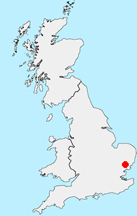
Location Map
Suffolk Guide
The County of Suffolk is in the East of England. Much of the county is low lying although there are a few hills, especially in the west. Arable land predominates and contrasts with the watery landscape of The Broads in the north. A notable feature are the wide estuaries that offer a habitat for a variety of birds. The Suffolk Coast and Heaths is the only National Landscape (formerly AONB) in the county. The highest point is Great Wood Hill, near the village of Rede, which reaches 128 metres (420 ft).
Other walks in Britain - For a list of all the areas where walks are available go to the Main Walk Index.
Walk grading - Learn how each walk is assessed and select a walk to suit your ability and experience by going to Walk Grading Details.
Messaging & Social Media
Message Walking Britain and follow the latest news.

Mountain Weather
Stay safe on the mountains with detailed weather forecasts - for iOS devices or for Android devices.