West Sussex WalksWalking Routes & Hiking Trails
Find West Sussex walks from the list below which features the best walking routes in the area. Most are circular walks and are listed from the shortest and easiest to the longest more challenging routes.
The West Sussex walks listed below range from easy circular walks to longer routes across the downs. All walks are free to download and print and all routes have GPS files. The walks include the glorious countryside and scenic coastline. In addition, many of the routes allow you to explore attractive villages, historic houses and castles, and churches.
| Walk | Description | Grade | Miles |
|---|---|---|---|
| 3488★ | Devil's Dyke Circular | easy | 2.50 |
| 2828★ | Dell Quay from Chichester Marina | easy | 3.80 |
| 3406★ | The Wey & Arun Canal, Loxwood | easy | 4.50 |
| 1629★ | The River Arun & South Stoke from Amberley | easy | 4.60 |
| 2487★ | Littlehampton to Climping | easy | 5.00 |
| 2368★ | Bosham & Fishbourne | easy | 5.20 |
| 3548★☩ | Stoughton, Kingley Vale & Bow Hill from Stoughton Down | easy/mod | 5.20 |
| 1425★ | Midhurst Way - Petworth to Midhurst | easy/mod | 5.50 |
| 1835★ | Treyford & Didling from Hooksway | easy/mod | 6.00 |
| 2232★ | Midhurst and Woolbeding from Easebourne | easy/mod | 6.00 |
| 1983★ | Edburton Hill from Fulking | easy/mod | 6.10 |
| 2835★ | Arundel to Amberley | easy | 6.20 |
| 1917★ | Rackham Hill from Amberley | easy/mod | 6.50 |
| 1872★ | Charlton, Singleton & Goodwood Circular | easy/mod | 6.50 |
| 3464★ | Rackham Hill & Kithurst Hill Circular | easy/mod | 6.70 |
| 2109★ | Upper Beeding to Washington by the South Downs Way | easy/mod | 7.00 |
| 1667★ | Blackpatch Hill & Harrow Hill from near Storrington | easy/mod | 7.20 |
| 3080★ | Arundel Park and the River Arun | easy/mod | 7.20 |
| 1782★ | Steyning Round Hill and No Man's Land | moderate | 7.50 |
| 1953★ | Balcombe & Ardingly Reservoir | easy/mod | 7.80 |
| 3305★ | Amberley Mount and Wepham Down from Burpham | easy/mod | 8.00 |
| 3213★ | Pyecombe, Devil's Dyke & Upper Beeding | easy/mod | 8.00 |
| 3078★ | Cissbury Ring & Chanctonbury Ring from Washington | easy/mod | 8.25 |
| 1048★ | Ardingly Reservoir | easy/mod | 8.50 |
| 1628★ | Bignor Hill and The Denture from Amberley | moderate | 8.70 |
| 1656★ | Thorney Island circular from Prinsted | easy/mod | 9.00 |
| 2043★ | Thorney Island from Emsworth | easy/mod | 9.00 |
| 2177★ | West Wittering to Chichester (New Lipchis Way) | easy/mod | 9.20 |
| 2044★ | Six Harbour Villages, Chichester | moderate | 10.00 |
| 3487★☩ | Edburton Hill & Devil's Dyke from Saddlescombe | hard | 10.50 |
| 1858★ | Cissbury Ring and Chanctonbury Ring from Steyning | moderate | 10.50 |
| 2236★ | Wolstonbury Hill and Pyecombe from Patcham | moderate | 11.00 |
| 1888★ | Cissbury Ring, Chanctonbury Ring & Coombes | moderate | 12.50 |
| 3310★ | Washington to Littleton Farm by the South Downs Way | moderate | 13.00 |
| 1466★ | Amberley and Arundel Circular | moderate | 13.00 |
| 2479★ | Worth Way from Three Bridges, near Crawley | moderate | 14.00 |
| 1423★ | Midhurst Way - Arundel to Midhurst | mod/hard | 19.00 |
| 1615★ | Amberley & East Dean Circular | mod/hard | 21.00 |
Walks that start in adjacent counties / areas.
Walks that start in adjacent counties or areas but cross the boundary and include sections of the route within West Sussex.
| Walk | Description | Starts In |
|---|---|---|
| 2684★ | Falmer to Pyecombe & Blackcap by South Downs Way | East Sussex |
| 3228★ | Black Down from Haslemere | Surrey |
| 1424★ | Midhurst Way - Haslemere Stn to Midhurst Bus Stn | Surrey |
★ GPS file ☩ Route profile
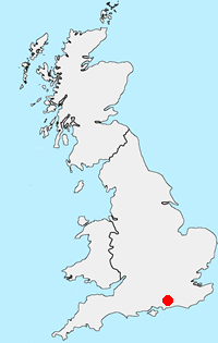
Location Map
West Sussex Guide
West Sussex lies in Southern England and offers a variety of scenic interest including Wealden, downland and coastal. The highest point of the county is Blackdown, at 280 metres (919 ft). Over half of West Sussex is protected countryside including part of the South Downs National Park and the Chichester Harbour National Landscape (formerly AONB). The most important long-distance footpath is the South Downs Way National Trail.
Other walks in Britain - For a list of all the areas where walks are available go to the Main Walk Index.
Walk grading - Learn how each walk is assessed and select a walk to suit your ability and experience by going to Walk Grading Details.
Messaging & Social Media
Message Walking Britain and follow the latest news.

Mountain Weather
Stay safe on the mountains with detailed weather forecasts - for iOS devices or for Android devices.