Garrigill, Alston & Nenthead
North Pennines Walk
Region - North Pennines
County/Area - Cumbria - North Pennines
Author - Andy Chaplin
Length - 13.1 miles / 21.3 km Ascent - 1350 feet / 409 metres
Time - 7 hours 50 minutes Grade - moderate
Maps 

| Ordnance Survey Explorer OL31 | Sheet Map | 1:25k | BUY |
| Anquet OS Explorer OL31 | Digital Map | 1:25k | BUY |
| Ordnance Survey Landranger 87 | Sheet Map | 1:50k | BUY |
| Anquet OS Landranger 87 | Digital Map | 1:50k | BUY |
Walk Route Description
Click image to see photo description.
This route is one of a series of circular or "there-and back" walks along the Pennine Way. This particular walk also includes a section of the Isaac's Tea Trail from Alston together with part of the Sea to Sea Cycle route or C2C as it is better known. In addition there is a chance to explore the market town of Alston, which is the highest market town in England lying about 1000 feet above sea level.
Park in the village of Garrigill as near to the George & Dragon as possible (Gris ref. NY745416). There is plenty of on-road parking in the village but this is a circular walk so guess where you will be coming back to?
Take the Pennine Way north west along the road out of the village then along the South Tyne river. After a mile and a half you cross over the river and continue along the east bank all the way to Alston. It is pretty easy low level walking and well signed all the way with only one deviation from a straight path at Bleagate.
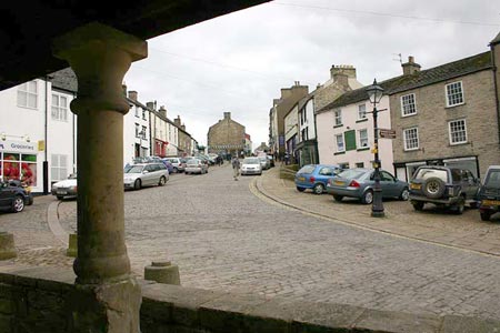
When the Pennine Way comes onto the A686 on the outskirts of Alston carry on into town, turn right up the hill past the church then left as the main road bends off to the right. The road goes amongst houses then becomes a track along the river Nent - at which point you join Isaac's Tea Trail. Alternatively, before you make your way out of Alston you may want to have a look around the town, the impressive church or visit the terminus of the narrow-gauge South Tyneside railway.
The onward section to Nenthead follows the south bank of the River Nent until the road up to and around Blagill. The Tea Trail follows the B6294 to Foreshield Bridge, picks up the river again to Nenthall, then climbs up above the road all the way into Nenthead.
From Nenthead take the road going south west climbing up to Nunnery Hill - which is part of the Sea to Sea cycle route - C2C. There are good views back to Nenthead mines then once over the top at Nunnery Hill there are views down to Garrigill way below in the South Tyne valley. Reaching the B6277 walk south to the path through Loaning Head which ends up as a fairly steep and narrow path back to Garrigill bridge and the George & Dragon.
Other walks nearby
| Walk 3758 | Tynehead and Ashgill Force from near Garrigill | easy/mod | 8.2 miles |
| Walk 2195 | Alston & Garrigill | easy/mod | 8.7 miles |
| Walk 1659 | Race Head & Sedling Rake from Wearhead | easy/mod | 6.0 miles |
| Walk 3274 | Cronkley Scar & Cauldron Snout | moderate | 8.0 miles |
| Walk 1683 | High Cup Nick & Cow Green Reservoir | moderate | 12.8 miles |
| Walk 3336 | Cauldron Snout | easy | 3.6 miles |
| Walk 3593 | Meldon Hill from Cow Green Reservoir | moderate | 9.2 miles |
| Walk 3071 | Cross Fell & Great Dun Fell from Kirkland | mod/hard | 12.0 miles |
| Walk 1715 | Dufton Pike & Dufton | easy | 5.0 miles |
| Walk 2393 | Weardale Circular from Westgate | easy/mod | 6.4 miles |
Recommended Books & eBooks
The Pennine Way - the Path, the People, the Journey
 A portrait of the The Pennine Way, Britain's oldest and best known long-distance footpath, stretching 268 miles from the Peak District to the Scottish Borders. This personal, thoughtful and often humorous story of the path's remarkable history, includes the experiences of walkers and local characters on this exhilarating and complex path.
More information
Walking the Lake District Fells - Wasdale
 Part of the Walking the Lake District Fells series, this guidebook covers a wide range of routes to 25 Lakeland summits that can be climbed from the Wasdale, Eskdale and Ennerdale valleys, with highlights including Scafell Pike, Great Gable and Pillar. Suggestions for longer ridge routes are also included.
More information
Messaging & Social Media
Message Walking Britain and follow the latest news.

Mountain Weather
Stay safe on the mountains with detailed weather forecasts - for iOS devices or for Android devices.