Ringing Roger & Grindslow Knoll from Edale
Peak District Walk
Nat Park - Peak District - Kinder Scout Edale
County/Area - Derbyshire
Author - Lou Johnson
Length - 5.5 miles / 8.9 km Ascent - 1450 feet / 439 metres
Time - 4 hours 10 minutes Grade - moderate
Maps 

| Ordnance Survey Explorer OL1 | Sheet Map | 1:25k | BUY |
| Anquet OS Explorer OL1 | Digital Map | 1:25k | BUY |
| Ordnance Survey Landranger 110 | Sheet Map | 1:50k | BUY |
| Anquet OS Landranger 110 | Digital Map | 1:50k | BUY |
Walk Route Description
Click image to visit gallery of 12 images.
This short but energetic Peak District walk provides an introduction to some of the features of the Kinder Plateau in the vicinity of Edale. Choose a good day as the views are worth seeing especially south across Edale to the Great Ridge. The route includes some mild scrambling which can easily be avoided.
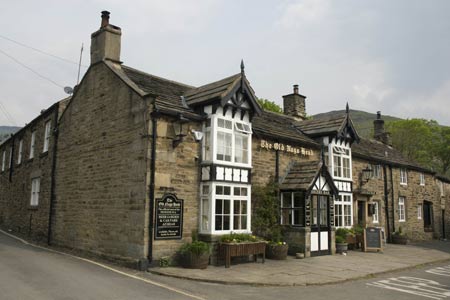
The start is the pay and display car park near the railway station in Edale (grid ref. SK124853). There are toilets here and there is a café and pub nearby. Leave the car park and walk up the lane into the village passing the church on your left to reach the 'Old Nag's Head' pub. This is the official southernmost point of the Pennine Way. Continue past the pub to reach a footpath sign on your right to Grindsbrook. Take this, cross the river and continue along the main paved path.
The path soon splits. Bear right here and start to climb almost immediately. The route zigzags up the hill side making for the obvious rocky outcrop of Ringing Roger. Reaching the base, you can either bear left and take the easier path on to the moor or the preferred route which does involve some use of hands to gain the top of the rocky outcrop.
From the top take the path heading roughly north-north-east to gain the main path around the edge of the Kinder Plateau. Turn west (left) on this and continue around the edge with a great view into Grindsbrook far below and longer views across Edale towards the Great Ridge. The going is level and you will pass some interesting wind-blown rock architecture to reach the head of Grindsbrook.
Here the path drops down to cross the stream and climbs out the other side to continue around the edge. At the junction of paths (grid ref. SK105872) leave the main path heading towards Edale Cross and take the smaller but obvious path south towards the summit of Grindslow Knoll. This hill also offers some fine views especially the retrospective look at virtually whole route covered so far.
The descent back into Edale starts immediately and care is needed to make sure you take the correct path. The path back to Edale is heading roughly south-east and is hidden from view when on the summit of Grindslow Knoll. However you will soon see it descending steeply as you start on the correct heading. The path is a little eroded in places but generally the going is easy and you are soon back at the Old Nag's Head. Turn right here and follow the lane back to the start.
Other walks nearby
| Walk 2522 | Rushup Edge & Edale from Mam Nick | moderate | 7.0 miles |
| Walk 1368 | Mam Tor, Upper Booth & Rushup Edge | moderate | 7.0 miles |
| Walk 1831 | Mam Tor & Hollins Cross from Mam Nick | easy | 3.0 miles |
| Walk 1688 | Old Dam & Sparrowpit from Mam Nick | moderate | 9.0 miles |
| Walk 1087 | Mam Tor & Cave Dale | moderate | 6.5 miles |
| Walk 1519 | Catleton & Speedwell Cavern Circular | easy | 4.3 miles |
| Walk 1521 | Cave Dale and Winnats Pass | easy | 4.5 miles |
| Walk 1665 | Hollins Cross & Lose Hill | easy/mod | 6.0 miles |
| Walk 3426 | Lose Hill & Hollins Cross | easy/mod | 5.0 miles |
| Walk 1489 | Blackden Brook, Kinder & Upper Ashop | moderate | 6.8 miles |
Recommended Books & eBooks
Great Mountain Days in the Pennines
 An inspirational guidebook to 50 classic walks on the rolling Pennine landscape. The graded routes, between 6 and 13 miles in length, cover classic Pennine fells and moorland such as Whernside, Ilkley Moor and Pendle Hill; exploring the North and South Pennines, Yorkshire Dales, Howgills and Dark Peak. Many routes are also suited to fell running.
More information
The Pennine Way
 Guidebook to the Pennine Way National Trail with OS map booklet. The 265 mile route from Edale to Kirk Yetholm takes three weeks to walk and is suitable for fit and experienced long distance walkers. The route crosses the Peak District, Yorkshire Dales and North Pennines National Parks. Includes separate OS 1:25,000 map booklet of the route.
More information
Messaging & Social Media
Message Walking Britain and follow the latest news.

Mountain Weather
Stay safe on the mountains with detailed weather forecasts - for iOS devices or for Android devices.