Sherbrook Valley & Katyn Memorial
Cannock Chase Walk
Region - Cannock Chase
County/Area - Staffordshire - Cannock Chase
Author - Lou Johnson
Length - 4.0 miles / 6.5 km Ascent - 350 feet / 106 metres
Time - 2 hours 20 minutes Grade - easy
Maps 

| Ordnance Survey Explorer 244 | Sheet Map | 1:25k | BUY |
| Anquet OS Explorer 244 | Digital Map | 1:25k | BUY |
| Ordnance Survey Landranger 127 | Sheet Map | 1:50k | BUY |
| Anquet OS Landranger 127 | Digital Map | 1:50k | BUY |
Walk Route Description
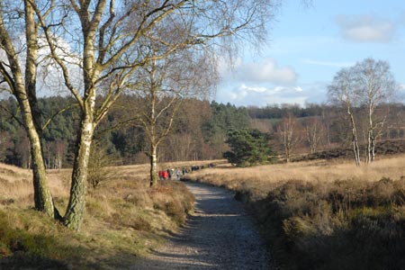
Click image to visit gallery of 6 images.
Cannock Chase provides many opportunities for walking. None of the routes in this Area of Outstanding Natural Beauty is challenging but all offer wide ranging views and some good exercise. In addition there are many items of interest to be seen along the way. This walk concentrates on areas with open views and avoids the forestry plantations that are dominant in some areas of the Chase.
This walk starts from the small car park adjacent to the Katyn Memorial (grid ref SJ980165) which is reached by turning east at Springslade Lodge on the road between Brocton Crossroads (on the A34) and Pye Green on the northern outskirts of Cannock. The Katyn Memorial remembers the many Poles who were massacred in WW2 and the inscription provides details of this sad event.
After parking return to the access road and turn left (east) and follow a broad path, a section of the Heart of England Way, for just under a kilometre descending to a junction of paths (grid ref SJ989165) with managed forestry immediately ahead in a broad valley. This is the upper section of the Sherbrooke Valley. Turn left here. There is a choice of paths on either side of the stream.
Cannock Chase has many paths and map reading can be problematic. However continue walking north to reach the junction with Pepperslade which is signed as a bridleway (grid ref SJ988177). Continue ahead following the stream. It is probably easier to stay on the west side of the stream from this point as it helps with navigation. Continuing north the main path does loops (easily seen on the map). There is a narrow often wet path that takes a short cut here. Reaching the next junction (grid ref SJ985186) turn left following the Staffordshire Way. After a short way bear left still following this long distance trail.
The path climbs steadily from this point soon meeting a wide cross path (grid ref SJ980184). Turn left and follow this south. Careful map reading is necessary from this point. Initially it is a case of staying with the main path which in some sections is the Heart of England Way. Description of the precise route is difficult as there are many paths not marked on maps. If in doubt stay on the HoE Way which will lead you back to Springside Lodge and the Katyn Memorial. However with careful map reading a more direct route is possible. A useful navigation landmark is the Post Office Communication tower which does provide some guidance.
If you have time then you can also visit the nearby Commonwealth and German War Cemetries.
Other walks nearby
| Walk 1324 | Glacial Boulder & Sherbrook | easy | 3.5 miles |
| Walk 1413 | Sherbrook, Stepping Stones & Freda's Memorial | easy | 6.0 miles |
| Walk 1801 | Three Memorials of Cannock Chase | easy | 3.5 miles |
| Walk 1731 | Highlights of Cannock Chase from Marquis Drive | easy/mod | 10.0 miles |
| Walk 2023 | Cannock Chase War Trail | moderate | 7.5 miles |
| Walk 1370 | Sherbrook Valley from Punch Bowl, Milford | easy | 4.0 miles |
| Walk 1189 | Cannock Chase Circular | easy | 6.5 miles |
| Walk 2911 | Seven Springs, Little Haywood, Shugborough & Milford | easy | 6.5 miles |
| Walk 2111 | Milford, Seven Springs, Little Haywood & Shugborough | easy | 6.0 miles |
| Walk 1802 | Shugborough Park from Milford | easy | 4.5 miles |
Recommended Books & eBooks
Walking in the Peak District - White Peak East
 Guidebook describing 42 half-day and day walks in the limestone landscapes of Derbyshire's White Peak, part of the Peak District National Park. One of two volumes, this book covers the east of the region, with potential bases including Bakewell, Eyam, Castleton, Birchover, Matlock and Wirksworth.
More information
Messaging & Social Media
Message Walking Britain and follow the latest news.

Mountain Weather
Stay safe on the mountains with detailed weather forecasts - for iOS devices or for Android devices.