Elidir Fawr, Mynydd Perfedd & Marchlyn Mawr reservoir
Snowdonia/Eryri Walk
Nat Park - Snowdonia - Glyders Tryfan
County/Area - Gwynedd
Author - Alwyn Williams
Length - 6.0 miles / 9.8 km Ascent - 2400 feet / 727 metres
Time - 5 hours 20 minutes Grade - moderate
Maps 

| Ordnance Survey Explorer OL17 | Sheet Map | 1:25k | BUY |
| Anquet OS Explorer OL17 | Digital Map | 1:25k | BUY |
| Ordnance Survey Landranger 115 | Sheet Map | 1:50k | BUY |
| Anquet OS Landranger 115 | Digital Map | 1:50k | BUY |
Walk Route Description
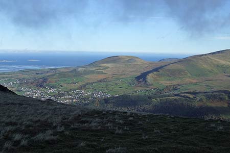
Click image to visit gallery of 3 images.
This Snowdonia (Eryri) walk takes in three mountains, namely Carnedd y Filiast, Mynydd Perfedd and Elidir Fawr. The route starts at the end of the access road to the Marchlyn Mawr reservoir from Deiniolen (Grid ref. SH604627). The reservoir feeds the Dinorwig Hydro-Electric Power Station which is built inside Elidir Fawr.
Head up through the gate and follow the access road uphill passing the old disused quarry on your right. Continuing on you will pass the Marchlyn Bach lake on your right. Follow the road until it forks (Grid ref. SH615624) and take the left fork.
After approx 100m the start of the path can be seen forking right up to a wooden stile. Continue on over the stile and follow the faint path up towards the shoulder. From the shoulder you can go left to an unnamed summit which looks down towards the Bethesda Quarry or continue right towards Carnedd Y Filiast. From the shoulder continue up the path over ground which becomes steadily rockier and eventually crossing large boulders to the summit of Carnedd Y Ffiliast (Grid ref. SH620627). There are spectacular views now of the Ogwen Valley, the Carneddau , Tryfan, the Glyders and Snowdon.
From the summit of Carnedd Y Ffiliast continue in a south easterly direction towards a wall with a stile, keeping the cliffs down to Ogwen on your left. Once over the wall follow the faint path towards the flat summit of Mynydd Perfedd. From here you see Elidir Fawr from its most dramatic side with large cliffs to the side of the summit and a very steep looking approach towards the summit itself.
From the summit shelter of Mynydd Perfedd head west towards the stile over the fence. Once you have crossed the stile take the right fork on the path towards the ridge (Grid ref. SH619615) which divides the summits on Mynydd Perfedd and Elidir Fawr. Follow the path across the rocks of Bwlch Marchlyn towards the rocky summit of Elidir Fawr whilst keeping the Marchlyn Mawr reservoir below you and to the right.
From the summit shelter of Elidir Fawr continue along the summit ridge for approx 200m and descend down the faint path in the scree towards the summit of Elidir Fach (Grid ref. SH603613). Once on the summit of Elidir Fach walk in a northerly direction towards the Marchlyn Bach reservoir. Keep the cliffs and the steep drop to your right whilst descending along the path until you reach a wall. Follow the wall down towards the Marchlyn Bach reservoir then cross the gate to reach the access road to Marchlyn Mawr reservoir. Follow the road back down to the start of the route.
Other walks nearby
| Walk 2626 | Snowdon & Garnedd Ugain from Llanberis | moderate | 9.3 miles |
| Walk 2558 | Carnedd Dafydd & Pen yr Ole Wen from Bethesda | mod/hard | 8.0 miles |
| Walk 1074 | The Glyders Traverse | very hard | 12.0 miles |
| Walk 1003 | Snowdon by the Llanberis Path | moderate | 9.0 miles |
| Walk 1681 | Moel Eilio & Moel Cynghorion from Llanberis | mod/hard | 10.0 miles |
| Walk 3057 | Moel Eilio from Llanberis | moderate | 7.0 miles |
| Walk 3059 | Moel Cynghorion & Snowdon from near Llanberis | very hard | 13.5 miles |
| Walk 2115 | Yr Elen, Carnedd Llewellyn & Carnedd Dafydd | hard | 9.5 miles |
| Walk 1315 | Drosgl and Gyrn Wigau from Rachub | moderate | 7.5 miles |
| Walk 3051 | Yr Elen from Gerlan | hard | 6.5 miles |
Recommended Books & eBooks
Snowdonia: 30 Low-level and easy walks - South
 Guidebook describing 30 walks in Snowdonia, Wales. Routes are mostly low level and on clear paths and showcase the region's beautiful scenery and rich history and culture. Part of a 2-volume set, this southern volume includes Trawsfynydd, Bala, Dolgellau, Machynlleth, the Harlech Coast and the valleys of the Mawddach and Dyfi.
More information
The Wales Coast Path
 A single guidebook to walking the whole Wales Coast Path - 1400km (870 miles) the length of Wales from Chester to Chepstow, including Anglesey, described in 57 stages. The route passes through the Snowdonia and Pembrokeshire National Parks and many AONBs and can be linked with the Offa's Dyke Path for a complete circuit of Wales.
More information
Messaging & Social Media
Message Walking Britain and follow the latest news.

Mountain Weather
Stay safe on the mountains with detailed weather forecasts - for iOS devices or for Android devices.