Amberley and Arundel Circular
South Downs Walk
Nat Park - South Downs
County/Area - West Sussex
Author - Peter Smyly
Length - 13.0 miles / 21.1 km Ascent - 1400 feet / 424 metres
Time - 7 hours 50 minutes Grade - moderate
Maps 

| Ordnance Survey Explorer OL10 | Sheet Map | 1:25k | BUY |
| Anquet OS Explorer OL10 | Digital Map | 1:25k | BUY |
| Ordnance Survey Landranger 198 | Sheet Map | 1:50k | BUY |
| Anquet OS Landranger 198 | Digital Map | 1:50k | BUY |
Walk Route Description
Click image to visit gallery of 9 images.
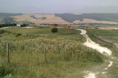
This circular route in West Sussex starts and finishes at Amberley and takes in a variety of scenery including part of the South Downs ridge, vistas of fields and hedgerows, some riverside walking and a visit to Arundel with its various attractions including the castle, cathedral and Arundel Park. Taking into account the ascent, the walk may feel longer than twelve miles given the additional effort involved in the cumulative height gain. A number of fine views rank among the highlights of the walk. The walk may also be of interest to botanists due to the variety of plants and flowers. In summer, the different colours of flower are one of the more pleasant aspects of the walk including pink rose bay willow herb, orange poppies and purple thistles.
From Amberley station, where there is a large car park, a path, parallel to the main road, leads away from the railway line to Titten Lane on the right, part of the South Downs Way (SDW). This road leads uphill and the SDW turns off, more steeply up through woods to the ridge that leads up on to the Downs at Amberley Mount. Continue along the South Downs Way for a further 600 metres to turn right at a public footpath sign shortly before the SDW climbs up to Rackham Hill. The path swings to the left with Rackham Hill rising on your left. After approximately 500 metres you reach a four-way junction of tracks (grid ref. TQ055122). Continue straight across the junction and follow the bridleway in a southerly direction to reach the gallops at Wepham Down. Continue straight ahead with Norfolk Clump above you on the right.
Follow the path as it follows a shallow valley to skirt with Home Farm on a hillside to the right. You join the Monarch Way (grid ref TQ048077) and the route leads through woods to reach a road just north of Warning Camp. Turn left along the road and take the next minor road on the right at Warningcamp. Next cross the railway line and Arundel Castle is now seen starkly ahead as the path reaches the River Arun with its boats and swans. Turn left along the river following the Monarch's Way (with the river to your right) and continue to the next bridge. Cross the bridge over the river into Arundel and follow the main road up the hill, passing the castle on the right and the cathedral on the left before the road leading up to Arundel Park appears on the right.
You are still on the Monarch's Way as you follow this tarmac road climbing gradually up to the plateau-like top of a hill with a castellated building. The onward route from here continues on the Monarch's Way as it makes its way through varied scenery, including some further ascent, before eventually descending to the banks of the River Arun. Turn left (with the river to your right) and follow the winding course of the river northwards. The Monarch's Way turns sharp left just before reaching the village of Houghton and leads into the village and a main road. Turn right and follow the road back to Amberley station taking care as the traffic can be busy on this section of the route.
Other walks nearby
| Walk 3305 | Amberley Mount and Wepham Down | easy/mod | 8.0 miles |
| Walk 1667 | Blackpatch Hill & Harrow Hill from near Storrington | easy/mod | 7.2 miles |
| Walk 3464 | Rackham Hill & Kithurst Hill Circular | easy/mod | 6.7 miles |
| Walk 3080 | Arundel Park and the River Arun | easy/mod | 7.2 miles |
| Walk 2835 | Arundel to Amberley | easy | 6.2 miles |
| Walk 1423 | Midhurst Way - Arundel to Midhurst | mod/hard | 19.0 miles |
| Walk 3310 | Washington to Littleton Farm by the South Downs Way | moderate | 13.0 miles |
| Walk 3078 | Cissbury Ring & Chanctonbury Ring from Washington | easy/mod | 8.3 miles |
| Walk 2487 | Littlehampton to Climping | easy | 5.0 miles |
| Walk 1425 | Midhurst Way - Petworth to Midhurst | easy/mod | 5.5 miles |
Recommended Books & eBooks
Walks in the South Downs National Park
 Guidebook with 40 circular walks throughout the South Downs National Park, exploring the beautiful chalk hills between Eastbourne and Winchester. The walks range from under 5 miles to 11 miles, including Beachy Head and the Seven Sisters, Ditchling Beacon and hundreds of prehistoric sites. Accessible all year, but wild flowers best in spring.
More information
The South Downs Way
 Guidebook to walking the South Downs Way National Trail, a 100 mile (160km) route between Winchester and Eastbourne through the South Downs National Park, described in both directions over 12 stages. Easy walking on ancient and historical tracks, taking in wooded areas, delightful river valleys and pretty villages. With 1:25K OS map booklet.
More information
Messaging & Social Media
Message Walking Britain and follow the latest news.

Mountain Weather
Stay safe on the mountains with detailed weather forecasts - for iOS devices or for Android devices.