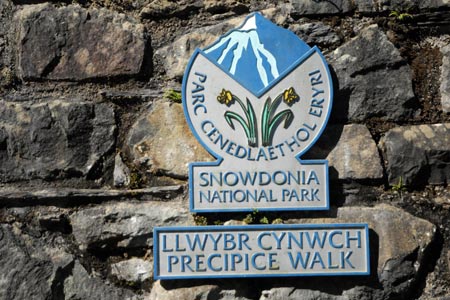
The Precipice Walk from near Dolgellau
Snowdonia/Eryri Walk
Nat Park - Snowdonia - Cadair Idris
County/Area - Gwynedd
Author - Lou Johnson
Length - 3.5 miles / 5.7 km Ascent - 400 feet / 121 metres
Time - 2 hours 10 minutes Grade - easy
Maps 

| Ordnance Survey Explorer OL23 | Sheet Map | 1:25k | BUY |
| Anquet OS Explorer OL23 | Digital Map | 1:25k | BUY |
| Ordnance Survey Landranger 124 | Sheet Map | 1:50k | BUY |
| Anquet OS Landranger 124 | Digital Map | 1:50k | BUY |
Walk Route Description
Click image to visit gallery of 9 images.
This short Snowdonia (Eryri) walk provides some great views and plenty of interest with very little effort. The Precipice walk is on private land and as such the paths are permissive and closed one day per year which at the time of writing is on the 1st February. The start is a small free car park (grid ref. SH745211) which is reached from the minor road runni9ng roughly north from Dolgellau to Llanfachreth. Note there are a couple of books stating the route starts in a completely different place so don't always believe what you read! The car park also has public toilets. This walk could also be combined with the The Torrent Walk nearby.
To start the walk take the path running behind the toilet block. This leads west beside a minor road which is followed for a short distance. A signed track leads off to the left. This leads past a solitary house after which you turn left following the signs to the "Precipice Walk". The path leads you past woodland on your left to reach an open space with a good view along the length of Llyn Cynwch.
Bear right here alongside the wall walking slightly uphill and follow the sign. This leads you onto a well maintained path that is quite narrow in places. Almost immediately the views open up initially to the north. The path swings round to head southwest and soon becomes a narrow trod high above the valley below to your right. The ground drops away quite steeply and sufferers from vertigo might find this a little worrying. However the path is quite safe and the exposure is not severe. Ahead you get a wonderful view down to the sea along the Mawddach Estuary as far as Barmouth.
The path eventually reaches less steep ground and the view ahead changes. Reaching a solitary bench you get a great view of the Cadair Idris ridge with its many summits. The path then turns east and descends once more to the shores of Llyn Cynwch. Turn left along the lake and follow the pleasant path through trees. Reaching the northern end of the lake retrace your steps back to the car park.
Other walks nearby
| Walk 2334 | The Torrent Walk near Dolgellau | easy | 1.6 miles |
| Walk 2551 | Rhobell Fawr from near Rhydymain | moderate | 5.7 miles |
| Walk 2811 | Rhobell Fawr and Ddualt from near Rhydymain | moderate | 8.5 miles |
| Walk 1499 | Rhobell Fawr and Dduallt from Llanfachreth | moderate | 12.0 miles |
| Walk 1107 | Waun Oer and Maesglase near Dinas Mawddwy | mod/hard | 11.0 miles |
| Walk 2937 | Aran Fawddwy northern approach | mod/hard | 8.4 miles |
| Walk 2475 | The Dyfi Hills Ridge | mod/hard | 9.8 miles |
| Walk 1172 | Cadair Idris by the Pony Path | mod/hard | 11.0 miles |
| Walk 2668 | Cadair Idris, Craig Cau and Cyfrwy by the Pony Path | mod/hard | 5.3 miles |
| Walk 1204 | Cadair Idris Minffordd Path | mod/hard | 6.0 miles |
Recommended Books & eBooks
Snowdonia: 30 Low-level and easy walks - North
 Guidebook describing 30 walks in Snowdonia, Wales. Routes are mostly low level and on clear paths and showcase the region's beautiful scenery and rich history and culture. Part of a 2-volume set, this northern volume includes the Snowdon area, the Ogwen and Conwy Valleys, Betws-y-Coed, Beddgelert, Ffestiniog and the coast.
More information
Great Mountain Days in Snowdonia
 Inspirational guidebook to 40 great mountain day walks and scrambles in Snowdonia. Inspirational routes for all abilities across the National Park with routes up Snowdon and Moel Eilio, the Glyderau, the Carneddau, Eifionydd, Siabod and the Moelwynion, Rhinogydd (the Harlech Dome), Migneint and the Arans and Cadair Idris and the Tarrens.
More information
Messaging & Social Media
Message Walking Britain and follow the latest news.

Mountain Weather
Stay safe on the mountains with detailed weather forecasts - for iOS devices or for Android devices.