Mynydd Mawr from Rhyd-Ddu
Snowdonia/Eryri Walk
Nat Park - Snowdonia - Moel Hebog Nantlle Ridge
County/Area - Gwynedd
Author - Lou Johnson
Length - 6.0 miles / 9.8 km Ascent - 1900 feet / 576 metres
Time - 4 hours 50 minutes Grade - moderate
Maps 

| Ordnance Survey Explorer OL17 | Sheet Map | 1:25k | BUY |
| Anquet OS Explorer OL17 | Digital Map | 1:25k | BUY |
| Ordnance Survey Landranger 115 | Sheet Map | 1:50k | BUY |
| Anquet OS Landranger 115 | Digital Map | 1:50k | BUY |
Walk Route Description
Click image to visit gallery of 12 images.
Mynydd Mawr stands in an isolated position to the northwest of Snowdon. The western and southern flanks of this striking mountain were a source of quality slate and the scars of this industry remain. Mynydd Mawr has two notable features of interest to walkers. The impressive line of crags named Craig y Bera will seen from above during this Snowdonia (Eryri) walk as will be the other feature, the large internal bowl of Cwm Planwydd.
This is a straightforward ascent of a Welsh mountain with the descent route simply following the line of ascent. The start is the pay and display car park by the Welsh Highland Railway Station at Rhyd-Ddu (grid ref. SH571526). Exit the car park and walk along the A4085 north towards Caernarfon. At the road junction in the centre of the village, turn left onto the B4418 to Nantlle. After approximately 100 metres at the end of the houses on the right hand side take the road leading into Baddgelert Forest. On quiet days there is also the chance of parking here (grid ref. SH568529) but do make sure you do not block access.
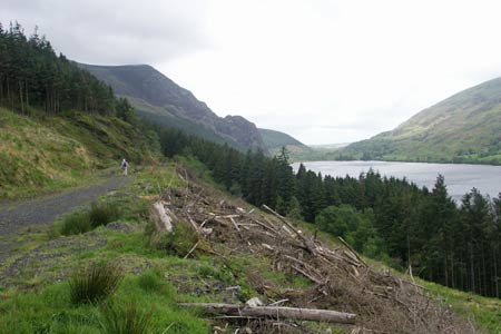
Continue along this forestry track passing a barrier. The track gains a little height with improving views across the valley to the northern summits of the Snowdon Massif. After about a kilometre the track crosses a footpath (grid ref. SH562540). The narrow path climbs through an area where the conifers have been felled to reach a fence at a stile. Cross the stile, turn right and follow the fence uphill gaining height quite quickly. Another stile provides access to open country and you can see the path climbing steadily towards the minor summit of Foel Rudd. As you climb this section you also get a good view along the crags of Craig Bera, which offer some challenging climbs to climbers.
Reaching the minor rocky summit of Foel Rudd, you begin to appreciate the massive Cwm Planwydd, which until now has been hidden from view. The gradient eases as you walk around the southern lip of this bowl with the crags of Craig Bera now on your immediate right. The path turns north and after a final section of ascent you reach the summit with its cairn and wind-shelter. The view is unrestricted and includes the Isle of Anglesey, the Menai Straits, the hills of the Lleyn Peninsula, Snowdon and many of its satellites plus a grandstand view of the Nantlle Ridge across the valley to the south.
Once you have taken in the view, return to the start using the outward route. There are other possible return routes but these have not been researched in detail and if you have detailed knowledge of other descent routes then please let me know.
Other walks nearby
| Walk 3613 | Moel Cynghorion from Llyn Cwellyn | moderate | 5.0 miles |
| Walk 3060 | Moel Lefn & Moel yr Ogof | moderate | 7.0 miles |
| Walk 2150 | Llyn Dinas and Cwm Bychan from Beddgelert | easy/mod | 6.0 miles |
| Walk 2560 | Moel Hebog, Moel yr Ogof & Moel Lefn from Beddgelert | mod/hard | 6.5 miles |
| Walk 1799 | Moel Hebog | moderate | 5.5 miles |
| Walk 1988 | Beddgelert, Moel Hebog, Meol yr Ogof & Moel Lefn | mod/hard | 6.8 miles |
| Walk 3074 | Mynydd Sygun | moderate | 4.5 miles |
| Walk 3231 | Moel Hebog, Meol yr Ogof and Moel Lefn from Beddgelert | mod/hard | 6.8 miles |
| Walk 1426 | Aberglaslyn and Cwm Bychan | easy/mod | 5.8 miles |
| Walk 1427 | Craflwyn circular from near Beddgelert | easy/mod | 2.5 miles |
Recommended Books & eBooks
Mountain Walking in Snowdonia
 Guidebook to 40 of Snowdonia's best day walks, with routes up Snowdon and Tryfan, including the Snowdon Horseshoe, Cadair Idris, Y Garn and The Rhinogs. The routes range from Grade 1 scrambles like Crib Goch or Bristly Ridge, to riverside and forest walks. Includes details of a 2-day traverse of all 15 of Snowdonia's 3000ft peaks.
More information
Snowdonia: 30 Low-level and easy walks - South
 Guidebook describing 30 walks in Snowdonia, Wales. Routes are mostly low level and on clear paths and showcase the region's beautiful scenery and rich history and culture. Part of a 2-volume set, this southern volume includes Trawsfynydd, Bala, Dolgellau, Machynlleth, the Harlech Coast and the valleys of the Mawddach and Dyfi.
More information
Messaging & Social Media
Message Walking Britain and follow the latest news.

Mountain Weather
Stay safe on the mountains with detailed weather forecasts - for iOS devices or for Android devices.