Wolstonbury Hill and Pyecombe from Patcham
South Downs Walk
Nat Park - South Downs
County/Area - West Sussex
Author - Jean Blemings
Length - 11.0 miles / 17.9 km Ascent - 1580 feet / 479 metres
Time - 7 hours 10 minutes Grade - moderate
Maps 

| Ordnance Survey Explorer OL11 | Sheet Map | 1:25k | BUY |
| Anquet OS Explorer OL11 | Digital Map | 1:25k | BUY |
| Ordnance Survey Landranger 198 | Sheet Map | 1:50k | BUY |
| Anquet OS Landranger 198 | Digital Map | 1:50k | BUY |
Walk Route Description
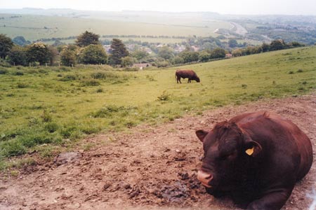
Click image to visit gallery of 6 images.
This is a South Downs walk starting from the outskirts of Brighton using Sussex Border path (SBP) to escape the environs of Brighton before carrying on over New Timber Hill and skirting the southern flanks of Wolstonbury hill before returning via the village of Pyecombe to regain another section of the Sussex Border Path to bring us back to the starting point.
The starting point of the walk is the junction of Vale Avenue with Mackie Avenue in Patcham opposite The Ladies Mile public house (Grid ref. TQ305088). This is served by the bus routes 5/5A or there is plenty of on street parking nearby. If travelling to the walk by car you may wish to park further up Vale Avenue nearer to Horsdean recreation ground.
Start by walking up Vale Avenue to the top where there is a slip road for traffic to join the A27 Brighton bypass. Cross over the first of these slip roads and use the road bridge to cross over the A27 and then cross over the slip road on the other side. (If you have children or do not like busy road crossings you can take an alternative route by branching off into the recreation ground on a obvious track that skirts round the eastern edge of the park that leads to a footbridge across the bypass - from the footbridge turn left and walk along the quieter access road running parallel with the bypass to reach the head of Vale Avenue where the road bridge crosses the bypass).
Once you have negotiated your way by whatever means to this point head off to the west along the access road (Braypool Lane) that hugs first the bypass and then turns to run in a more northerly direction parallel with the A23 which you cannot see due to the houses between you and the main London Road. Just before the last few houses look carefully for a waymark to your left that directs you to another footbridge crossing over the A23 and the railway line below. You now begin a long slow gradual ascent up a road that degenerates to a track passing another older brick bridge back over the railway to your right and winding past another couple of isolated properties before reaching a T junction by a barn at the top of the hill (Grid ref. TQ291094). Turn right here and continue to follow the wide track still rising up slowly into the more open countryside of the rolling downs.
You can still hear the roar of the traffic speeding along the A23 running parallel to your right and after a mile or so you may be able to spot the Pylons - two sandstone pillars flanking the main road that mark the boundary of the city of Brighton & Hove. When after a couple of miles you come to a junction of paths head onwards still on the SBP and passing through a couple of gates. Gradually the path dips down a little and becomes lined by scrub. To your left you can see the Saddlescombe road running along a valley in the downs.
Now you come to a junction with the South Downs Way (Grid ref. TQ275114). To the left is Saddlescombe Farm (they usually have free range eggs for sale and hand whittled walking sticks). The right hand path leads up over Haresdean to re-cross the A23 by the Pyecombe SDW crossing. Our route is to go straight on (not waymarked) where after 20 yards or so you come to a wide sunken track heading gently uphill. Turn right onto the track and follow it through an area of woodland. As you emerge the track swings slightly left and is more grassy and indistinct but keep following its slight indentation keeping a strange scrubby lump (possibly an overgrown dew pond?) to your right. The track leads eventually to gate set in a belt of woodland which you pass through, now heading gently downhill through grassy pastures in more open land with the buildings of Wayfield Farm ahead and to your right.
Keeping the farm on your right the track eventually leads down to the choice of a stile or double gates both of which lead to a footbridge enabling you to recross the A23. You arrive at the other side in part of the village of Pyecombe and need to take the lane directly ahead of you marked 'no through road'. This again degenerates into a track enclosed by vegetation and often muddy except in the driest of weather. Just after a view off to the left over quarry workings, you come to gate on your right at a junction of paths (Grid ref. TQ279137). Go through the gate ignoring an unmarked path through scrub on the right and keep on the wider more obvious track that also starts to turn back on itself so you end up climbing slowly up along the southerly flanks of Wolstonbury hill past the old spoil heaps of flint and chalk workings on your left.
As you rise up the summit of Wolstonbury off to your left becomes visible. There is a footpath off to left of the track we are on leading to the summit should you wish to explore further but our route continues straight onwards with views of the Jack and Jill windmills ahead and the Weald below and to the left. By now the track has levelled out and this is easy pleasurable walking with great views and a nice breezy feel. Usually, whatever the weather, you will hear skylarks along this stretch. As this track comes to an end after passing through a gate you come to a complex junction of paths where you need to select the bridleway directly to the right that leads down into the older part of Pyecombe village. Initially with an open field to your right the path becomes more enclosed until you emerge into Pyecombe with a well kept childrens playground to your left and the pretty church cottages on your right.
As you come to a crossroads you may wish to divert a short distance to the right to look at Pyecombe church with its tapsell gate and old forge buildings opposite which was a centre of an industry producing shepherds crooks. However the onward route is to bear left down the lane through the remainder of the village heading slightly downhill - after a very short distance you come to the A273 which you should cross with care taking the signed permissive path directly opposite with at first runs off to the right parallel with the road and then leads round to a bridleway heading off eastwards uphill. At the crest of the hill, go onwards through another gate and carry on through some areas of scrub and across the occasional fairway that is part of the nearby Pyecombe Golf Club. Eventually leaving the fairways and greens behind continue onwards on the same heading following the waymarks to where the path dog-legs eventually continuing onwards on the same original heading.
Now look for a bridleway waymarked off to the right. You are now back on the Sussex Border path which is returning in a southerly direction back towards Patcham. Soon you will see the white umbrella roof of the Chattri memorial off to your left. This marks the site of the funeral pyres of Sikh and Hindu soldiers who died in the Royal Pavilion in Brighton when it was being used as a hospital during the First World War. You can make a short diversion down to visit the enclosure and read more information about the memorial. As you walk along the grassy ridge back towards the outskirts of Brighton there are good views all around. Eventually the path leads back to the top of Vale Avenue and you then just need to retrace your steps back to the bus stop or your car using whatever route you wish.
Other walks nearby
| Walk 2903 | Stanmer to Streat | moderate | 12.5 miles |
| Walk 3213 | Pyecombe, Devil's Dyke & Upper Beeding | easy/mod | 8.0 miles |
| Walk 3487 | Edburton Hill & Devil's Dyke from Saddlescombe | hard | 10.5 miles |
| Walk 3488 | Devil's Dyke Circular | easy | 2.5 miles |
| Walk 1983 | Edburton Hill from Fulking | easy/mod | 6.1 miles |
| Walk 2684 | Falmer to Pyecombe & Blackcap by South Downs Way | moderate | 8.8 miles |
| Walk 2486 | Plumpton Green & South Downs | easy/mod | 7.7 miles |
| Walk 2109 | Upper Beeding to Washington by the South Downs Way | easy/mod | 7.0 miles |
| Walk 1770 | Southease or Rodmell to Falmer | easy/mod | 6.8 miles |
| Walk 2419 | Southease, Ditchling Beacon & Lewes | mod/hard | 17.0 miles |
Recommended Books & eBooks
The South Downs Way
 Guidebook to walking the South Downs Way National Trail, a 100 mile (160km) route between Winchester and Eastbourne through the South Downs National Park, described in both directions over 12 stages. Easy walking on ancient and historical tracks, taking in wooded areas, delightful river valleys and pretty villages. With 1:25K OS map booklet.
More information
Walks in the South Downs National Park
 Guidebook with 40 circular walks throughout the South Downs National Park, exploring the beautiful chalk hills between Eastbourne and Winchester. The walks range from under 5 miles to 11 miles, including Beachy Head and the Seven Sisters, Ditchling Beacon and hundreds of prehistoric sites. Accessible all year, but wild flowers best in spring.
More information
Messaging & Social Media
Message Walking Britain and follow the latest news.

Mountain Weather
Stay safe on the mountains with detailed weather forecasts - for iOS devices or for Android devices.