Black Rocks & Bollinhurst Reservoir from Disley
Peak District Walk
Nat Park - Peak District - Goyt Valley Lyme Park
County/Area - Cheshire
Author - Mike Bexley
Length - 5.0 miles / 8.1 km Ascent - 400 feet / 121 metres
Time - 2 hours 50 minutes Grade - easy
Maps 

| Ordnance Survey Explorer OL1 | Sheet Map | 1:25k | BUY |
| Anquet OS Explorer OL1 | Digital Map | 1:25k | BUY |
| Ordnance Survey Landranger 109 | Sheet Map | 1:50k | BUY |
| Anquet OS Landranger 109 | Digital Map | 1:50k | BUY |
Walk Route Description
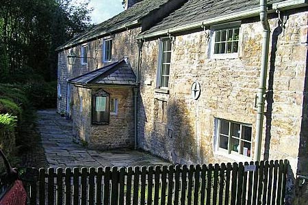
Click image to visit gallery of 6 images.
This is a nice short walk offering wonderful views and complements Walk 2567. The seasonal colour changes of the countryside make this walk worth repeating during the year. The start is from Disley on the A6, south of Stockport, convenient for anyone travelling by bus, rail or car.
Proceed up the minor road to the left of the Ram's Head (grid ref SJ974846) then turn right at the second road on the right. On reaching 'The Quaker Meeting House' turn left then right, to follow the footpath behind the houses. This footpath keeps to the boundary of the housing estate then turns left into the estate. At this point turn right to the top of the cul-de-sac then up the path on the left. On reaching a further path turn right down behind a house over a stile and up to Green Lane (grid ref 976840).
Turn left along this pleasant lane with its views of 'The Cage' in Lyme Park on your right. Just after the house on your right follow the bridleway straight on through some woods until you reach a stile, a bridleway and direction signs (grid ref 981832). Turn right down the bridleway in the direction of East Lodge passing the conservation area with its signs on your left. Just prior to reaching the Lodge turn left over the stile with its footpath sign (grid ref 977830). The clearly marked footpath proceeds over the fields to the remains of some buildings in trees. Go over the stream to your left and a stile towards a low barn. Keep to the left of this barn up to the road (grid ref 982827).
On reaching the road turn right passing Bolder Hall on your left. Go over the stile with its direction sign to 'Black Rocks' passing through a small field and over a further stile to reach a fingerpost sign. Do not turn left but keep straight-on through the wall then left over a wire fence aiming for top of the ridge where the wall ahead crosses over (grid ref 988825). Note there is no right of way on the wide path to your left that runs diagonally to the ridge. On reaching the ridge follow the path left.
Now it's views all the way along the ridge, on the left is Cheshire with the Peak District on your right. The path descends to a small field. Keep to the wall on the left then over the stile just after the gate. Head diagonally left for the corner of a wall (grid ref 985835). Here you will the see a further stile ahead and the path leading to the road. Cross over the road and stile and on reaching a wider path turn left. You will recognise this path as the one you used on the way up. On reaching the stile do not go over this time but turn right to follow the path that descends at first through woods and then alongside the boundary wall of Bollinhurst Reservoir to Cockhead Farm (grid ref 972837). On reaching the farm turn right along the lane then left at Green Lane to follow the lane back to Disley. If you have started from the railway station there is a footpath at the corner on your left, which leads down steps to the station.
Other walks nearby
| Walk 2622 | Sett Valley & Kinder from New Mills | moderate | 10.0 miles |
| Walk 2329 | The Disley Lanes from Lyme Park | easy | 4.0 miles |
| Walk 1474 | Park Moor and Birchencliff from Lyme Park | easy/mod | 7.3 miles |
| Walk 1481 | Dale Top (Park Moor) from Lyme Park | easy | 6.3 miles |
| Walk 2557 | Lyme Park from Poynton | moderate | 10.0 miles |
| Walk 2528 | Kettleshulme & Sponds Hill | moderate | 8.0 miles |
| Walk 2546 | Lantern Pike & Cown Edge from Rowarth | easy/mod | 8.0 miles |
| Walk 2507 | South Head & Edale Cross from Hayfield | moderate | 8.0 miles |
| Walk 3407 | Chinley to Edale without a car | moderate | 9.3 miles |
| Walk 2534 | Chinley Churn & South Head | easy/mod | 7.5 miles |
Recommended Books & eBooks
Great Mountain Days in the Pennines
 An inspirational guidebook to 50 classic walks on the rolling Pennine landscape. The graded routes, between 6 and 13 miles in length, cover classic Pennine fells and moorland such as Whernside, Ilkley Moor and Pendle Hill; exploring the North and South Pennines, Yorkshire Dales, Howgills and Dark Peak. Many routes are also suited to fell running.
More information
Dark Peak Walks
 Guidebook to 40 walks in the Dark Peak area of the Peak District National Park. 35 circular routes for most abilities, from 8km to 19km, around Edale, Marsden, Fairholmes, Baslow and Castleton, including Kinder Scout and Mam Tor, and 5 longer (25km to 45km) routes highlighting the best of the Gritstone Edges, High Moorland and Deep Valleys.
More information
Messaging & Social Media
Message Walking Britain and follow the latest news.

Mountain Weather
Stay safe on the mountains with detailed weather forecasts - for iOS devices or for Android devices.