Cheshire Lanes and Woodhouse Hill Fort
Cheshire Walk
County/Area - Cheshire
Author - Mike Bexley
Length - 7.0 miles / 11.4 km Ascent - 700 feet / 212 metres
Time - 4 hours 10 minutes Grade - easy/mod
Maps 

| Ordnance Survey Explorer 267 | Sheet Map | 1:25k | BUY |
| Anquet OS Explorer 267 | Digital Map | 1:25k | BUY |
| Ordnance Survey Landranger 117 | Sheet Map | 1:50k | BUY |
| Anquet OS Landranger 117 | Digital Map | 1:50k | BUY |
Walk Route Description
Click image to visit gallery of 3 images.
This walk starts close to Junction 12 of the M56. Outward the route uses some of the quiet Cheshire lanes returning via The Sandstone Trail, climbing up to Woodhouse Hill then walking the ridge to take in a wonderful view of Cheshire and one of the best in the County. The route is easy to follow with very little map reading required. Although care must be taken on the ridge path, it is not a difficult walk.
The start is the Beacon Hill Car Park (Grid ref SJ518766) near The Forest Hill Hotel. The car park is at the foot of two large beacon masts, which are navigation aids for planes crossing the Atlantic, one of many similar sites in this area.
Leave the car park and walk down the lane to take the footpath on the right just after the Golf Course Entrance. This path at first follows the hedge on the right heading south. At the stile cross over the farm road to the stile opposite then cut across the field to a further stile in the left hedge to the road. Turn right along the road then next left up the sandstone bridleway (Grid ref 519754). Passing a high-banked reservoir on your right continue until you reach a tarmac lane corner. Turn right here and continue down another bridleway, which forms part of the Delamere Way.
On reaching the next road turn right. Go left at the next lane and continue up to the cross roads. Turn right here and continue along the lane to a T Junction at Birch Cottage (Grid ref 518739). Proceed down the footpath opposite, following the right hedge down to the corner of the field, with electric transmission lines overhead. At this corner turn left walking up the same field, with the hedge on your right. Then, just prior to Claim Farm, go through the five bar gate in the hedge leading to the farm drive. Bear right to the drive exit. Go left along the road. After the woods turn right down a further lane that takes you past a large farm to a Sandstone Trail path crossing (Grid ref 511732).
Turn right at this point to follow well-managed paths, with walker friendly stiles and gates. The path goes over fields, skirts Alvanley Cliff Woods to a road crossing. It continues across further fields and over a brook bridge turning left in the woods to follow the brook prior to turning right up some steps to a Caravan Site entrance in Ridgeway Lane.
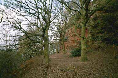
Turn left down the lane then right up the bridleway with the Caravan site on your right. Keep to this bridleway into Snidley Moor Wood, managed by The Woodland Trust. There are several footpath gates leading to tree nurseries. Ignore these and keep to the bridleway climbing through the old woods to the top (Grid ref 513756). Here you go left to join the wide path through the trees. On your left is the extensive site of the Iron Age Fort. All that remains now are a succession of earth wall bases and ditches.
The path splits at the remains of a stonewall. Keep to the left of the wall and continue straight on down to the view point at the cliff edge with its welcome seat. You now have an unrestricted view (depending on weather conditions) of Helsby Hill to your left, the M56 in the foreground and beyond Stanlow Refinery and Liverpool.
Caution should be taken from now on as the path narrows and has many exposed cliff edges.
Follow the edge on your left to the corner of the Golf Course. Keeping the Golf Course fence on your right, the path leads you to the steep wide steps cut into the rock down to the amazing Dunsdale Hollow (Grid ref 514762). Sitting on your bottom is an accepted way down these steps!
Go over the wooden bridge that leads you to the foot of the magnificent red sandstone cliffs, turn right and climb up the wooden steps that include 'The Baker's Dozen'. At the top finger post you can go straight on back to your start but to take in the best view on this ridge turn left indicated 'Mersey View'. The path hugs the fence (do not take any path on the left) and continues behind the Hotel, down some steps and up to the War Memorial (Grid ref 518770). The impressive view is over the Mersey estuary and no description by me would do it justice.
Leave by the path on your right through the high entrance gates. At the lane turn right to pass the Hotel entrance back to the start.
Other walks nearby
| Walk 2512 | Acton Bridge, Woodhouse Hill & the River Weaver | moderate | 13.0 miles |
| Walk 1416 | Exploring Liverpool City Centre | easy | 4.0 miles |
| Walk 3535 | River Dee from Farndon | easy | 4.0 miles |
| Walk 2480 | Siddington & Redes Mere Circular | easy | 4.2 miles |
| Walk 1259 | Foel Fenli & Moel Famau from Loggerheads | moderate | 9.5 miles |
| Walk 1912 | Moel Famau and the Clwydian Hills | moderate | 7.0 miles |
| Walk 2509 | Moel Arthur & Moel Famau | moderate | 10.0 miles |
| Walk 2550 | Cilcain, Moel Arthur & Moel Famau | mod/hard | 13.0 miles |
| Walk 2532 | Rivington Pike | moderate | 8.0 miles |
| Walk 1699 | Mow Cop Circular | easy/mod | 6.4 miles |
Recommended Books & eBooks
No suggestions for this area.Messaging & Social Media
Message Walking Britain and follow the latest news.

Mountain Weather
Stay safe on the mountains with detailed weather forecasts - for iOS devices or for Android devices.