Hoof Stones Height, Noah Dale and Colden Water
South Pennines Walk
Region - South Pennines
County/Area - West Yorkshire - South Pennines
Author - Peter Schofield
Length - 11.5 miles / 18.7 km Ascent - 1600 feet / 485 metres
Time - 7 hours 20 minutes Grade - moderate
Maps 

| Ordnance Survey Explorer OL21 | Sheet Map | 1:25k | BUY |
| Anquet OS Explorer OL21 | Digital Map | 1:25k | BUY |
| Ordnance Survey Landranger 103 | Sheet Map | 1:50k | BUY |
| Anquet OS Landranger 103 | Digital Map | 1:50k | BUY |
Walk Route Description
Click image to see photo description.
This linear walk includes some of the less frequently walked parts of upper Calderdale above Todmorden. Combining rough moorland sections with more gentle field walking towards the finish, it offers something for all tastes. Good bus links between the start and finish points make it easily accessible for those without their own transport.
The walk starts at the junction of the A646 and Station Parade at Portsmouth (GR SD898263). Cross over the level crossing and follow the lane up the hill past a mill and some houses until the lane ends at a stile. Cross the stile and from this point look out for the stylised "B" waymarkers which indicate the route of the Burnley Way, which the walk follows for the next two kilometres to Long Causeway.
Follow the clear path around Whitaker Naze and down the steep track to Pudsey Clough, passing through a gate and continuing upstream to the left of the stream. After about 300m, look out for a stile with a Burnley Way waymarker to your left leading into a new plantation which the adjacent signboard identifies as Burnley Forest. The stile is easy to miss so if you reach the packhorse bridge over Pudsey Clough (about a further 200m), you've gone too far. However the packhorse bridge with its unique circular section is well worth the detour!
At this point the Burnley Way briefly deviates from the route from that shown on the South Pennines OL map. The path follows the plantation boundary up the hill to another stile from where it can be clearly seen contouring along the hillside to rejoin the route coming up from Pudsey Clough. The wind farm at Warcock Hill is now clearly in view; an eyesore or an aesthetically pleasing piece of engineering depending on one's point of view! The route continues to the confluence of Pudsey Clough with a side stream and across the moor to Stiperden House Farm (GR909279), from where the farm access track is followed up to Long Causeway under the looming shadow of the windmills.
Turn right along the road for about 300m to a stile in the left hand fence adjacent to a North West Water sign. Although there is no obvious path across the moor from here, this way across the NWW access land may appeal to inveterate bog trotters. Others however may prefer to walk a little further along the road to a farm gate just prior to Stiperden Bar House from where a path can be seen heading over the boggy ground up to Hoof Stones Height. Note that sheep fences have been erected in the area but access is still permitted to walkers. As the top of the ridge is reached, the path can easily be lost. However, the trig point becomes visible at this point, so just head towards it over the peat outcrops.
Hoof Stones Height rewards the walker with splendid views in every direction (or so I am told by friends who have passed this way before). Unfortunately, on the day that I was there, nearby Pendle was barely visible let alone anywhere else. On a clear day however, a panorama opens up from the Three Peaks and Bowland in the north to the Derbyshire Peaks to the south. I hope to be able to see it sometime!
In the peat wastes, the permissive path leading from the trig point is not immediately apparent but head due east and the path will be picked up after about 100m, following a shallow depression gently downhill. The path has been well waymarked by Calderdale Countryside Unit and proceeds for about 1.5 km to the head of Noah Dale. Continue down Noah Dale, an atmospheric place with many ruined farmsteads. This area must have been a thriving community at one time - little remains now except dilapidated walls and collapsed buildings.
Keep to the north side of Noah Dale and leave the valley at Rough Hey (GR944297) to join the waymarked Pennine Bridleway track just beyond Egypt Farm. Go down the PB for a further kilometre until the track becomes tarmac. A little further on, turn sharp right into the entrance to Old Edge House and immediately left along a waymarked path which goes downhill to a bridge over Colden Water to rejoin the PB.
Cross the bridge to follow the PB past Land Farm with its garden of rare (for this area) plants and up the hill for 300m to a track crossing. Turn left and follow the PB downhill to meet Colden Water at the cottages and road at Jack Bridge. Go right up the road for 200m and turn left along the track as Colden Water drops down into the wooded valley. After 400m, descend down a flight of steps to the water at Hebble Hole Bridge which makes an ideal spot for a refreshment break (GR968282). This is also the point where the walk both crosses the Pennine Way and joins the Calderdale Way.
Go over the bridge and keep straight ahead at the point where the Pennine Way goes left after 50m. From here, the Calderdale Way with its easily recognised "CW" logo is followed for two kilometres of easy walking to Heptonstall, as Colden Clough opens out into a deep ravine to the right. Heptonstall with its cobbled streets and weavers cottages is one of the most attractive villages in the Pennines and well worth a stop if time permits. The old churchyard with its gravestones dating back over two hundred years, is a veritable goldmine of local history.
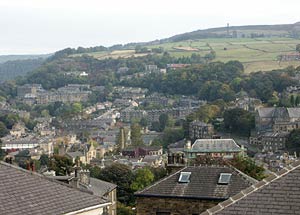
From Heptonstall, it's a short but steep descent to Hebden Bridge which is spread out below you in the valley. The quickest way is to leave the village down Towngate, Heptonstall's cobbled main street. After 300m, a steep path on the left descends to a road. Go on down the road for 200m where a waymarked path on the left drops down to Hebden Bridge centre.
On weekdays, up to four buses an hour link the start and finish points although some journeys will require a change at Todmorden. On Sundays, First 592 runs directly every hour. Full travel details can be found on the Metro website (www.wymetro.com)
Other walks nearby
| Walk 1458 | The Rossendale Way from Greave | easy/mod | 7.0 miles |
| Walk 2183 | Irwell Sculpture Trail | easy | 4.5 miles |
| Walk 1411 | Walsden & Warland Reservoir | easy/mod | 6.5 miles |
| Walk 2196 | Clowbridge Reservoir & Singing Ringing Tree | easy/mod | 4.0 miles |
| Walk 3719 | Ramsden Wood & Hades Hill from Walsden | easy/mod | 6.1 miles |
| Walk 3015 | Stoodley Pike & Withens Clough Reservoir from Lobb Mill | moderate | 9.0 miles |
| Walk 2121 | Crimsworth Dean, Lumb Bridge & Hardcastle Crags | moderate | 7.5 miles |
| Walk 1291 | Stoodley Pike | moderate | 11.0 miles |
| Walk 1849 | Blackstone Edge and the Pennine Way without a car | moderate | 8.0 miles |
| Walk 2260 | White Hill from Hollingworth Lake | moderate | 11.2 miles |
Recommended Books & eBooks
No suggestions for this area.Messaging & Social Media
Message Walking Britain and follow the latest news.

Mountain Weather
Stay safe on the mountains with detailed weather forecasts - for iOS devices or for Android devices.