Plush & Wessex Ridgeway
Dorset Walk
County/Area - Dorset
Author - Lou Johnson
Length - 4.7 miles / 7.6 km Ascent - 600 feet / 182 metres
Time - 3 hours 0 minutes Grade - easy/mod
Maps 

| Ordnance Survey Explorer 117 | Sheet Map | 1:25k | BUY |
| Anquet OS Explorer 117 | Digital Map | 1:25k | BUY |
Walk Route Description
Click image to see photo description.
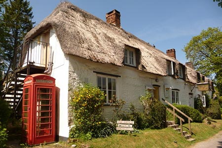
The rolling chalk landscape of Dorset is amongst the most beautiful in Britain. This walk combines a section of the Wessex Ridgeway, with views to Blackmore Vale, and other bridleways and footpaths in the area surrounding the pretty village of Plush, with its 16th century inn providing a source of refreshments during the walk.
The start is Folly Lane (grid ref. ST728031) where limited roadside parking is possible. Please ensure that you are not inconveniencing residents and road users. After parking take track heading east signed to "Dorset Gap" following the Wessex Ridgeway. After 400 metres, bear right when the track forks to reach a stile and a gate. Continue on the sunken track which curves to the south to reach a junction of tracks on Lyscombe Hill (grid ref. ST730023).
Bear half right walking along the ridge to "Dole's Ash Farm". Continue to the trig point of Higher Hill. Continue to follow the signed the bridleway through two gates to reach a small copse near Thorncombe Barn (grid ref. ST721017). Turn right here onto a footpath crossing a field to a stile. The path then descends steeply to reach a lane (grid ref. ST717022). Turn left along the lane to reach a T-junction by the Brace of Pheasants Inn.
To continue turn left towards Piddletrenthide. After 50 metres or so, turn right through a metal gate onto a track signed "Church Hill". The track climbs steadily with woodland on your right to reach open downland (grid ref. ST711026). Continue ahead on what is now a grassy track. This area is open access and your route parallels the hedge-line on your left. Continue walking uphill through a gate to join the Wessex Ridgeway at Church Hill (grid ref. ST711035). Turn right onto the Wessex Ridgeway and walk east with the hedge on your left. Continue through Watcombe Wood and across Ball Hill to return to the start.
Other walks nearby
| Walk 1868 | Plush from Piddletrenthide | easy/mod | 6.0 miles |
| Walk 3673 | Rawlsbury Camp, Lower Ansty, Hilton & Bulbarrow | easy/mod | 7.2 miles |
| Walk 1328 | Minterne Magna & the Cerne Giant | easy/mod | 6.8 miles |
| Walk 3748 | Southover Heath from Tolpuddle | easy | 5.0 miles |
| Walk 2189 | Sherborne Park & Oborne | easy/mod | 6.0 miles |
| Walk 3695 | Hambledon Hill & Hod Hill from Shroton | easy/mod | 6.0 miles |
| Walk 1597 | The White Horse & Sutton Poyntz from Osmington | easy/mod | 4.0 miles |
| Walk 2440 | White Nothe & Moigns Down from Osmington | moderate | 10.5 miles |
| Walk 2575 | Durdle Door & Lulworth Cove | moderate | 10.0 miles |
| Walk 3523 | Abbotsbury & Portesham Circular | easy | 5.2 miles |
Recommended Books & eBooks
Walking the Jurassic Coast
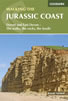 This guidebook includes 30 walks on the Jurassic Coast of Devon and Dorset. Covering the coast between Exmouth and Bournemouth, these delightful routes range from 3 to 16 miles (5 to 24km), exploring and explaining the spectacular geology of this World Heritage area with clear, easily understood descriptions, cross-sections and timelines.
More information
Messaging & Social Media
Message Walking Britain and follow the latest news.

Mountain Weather
Stay safe on the mountains with detailed weather forecasts - for iOS devices or for Android devices.