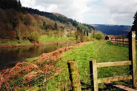
The Wye Valley from Brockweir
Wye Valley Forest of Dean Walk
Region - Wye Valley Forest of Dean
County/Area - Gloucestershire
Author - Lou Johnson
Length - 5.8 miles / 9.4 km Ascent - 900 feet / 273 metres
Time - 3 hours 50 minutes Grade - easy/mod
Maps 

| Ordnance Survey Explorer OL14 | Sheet Map | 1:25k | BUY |
| Anquet OS Explorer OL14 | Digital Map | 1:25k | BUY |
Walk Route Description
Click image to see photo description.
The areas to either side of the River Wye provides some excellent walks through lovely countryside. This route starts at Brockweir a mile or so miles along the A466 north from Tintern Abbey. The walk uses sections of the Offa's Dyke Path, which is generally well waymarked and easy to follow. Limited on street parking is available in Brockweir (grid ref. SO539011). In addition, the Brockweir Inn will allow parking providing walkers patronise the pub.
After parking take Underhill, a narrow lane unsuitable for motor vehicles just across from the Brockweir Inn. After 400 metres at Orchard Cottage (grid ref, SO 538015), turn right up the restricted byway and continue in a northerly direction for about 650 metres.to reach a junction with a lane at The Paddock (grid ref. SO539021). At this point the lane is also the route of the Offa's Dyke Path.
Turn left along the lane and in about 150 metres bear right off the lane and follow the Acorn waymarks of the Offa's Dyke Path. Across fields. Eventually the ODP re-joins the lane (grid ref. SO537031). Turn right and after 200 metres (where the lane bends right) continue ahead on the ODP (grid ref. SO538032). The ODP path leads onto another lane at grid ref. SO539037. Turn left and at the next junction bear right. A short way along on the left, turn left and continue along the ODP. The path soon enters woodland and descends into the Wye Valley.
You emerge from the woodland into open fields still descending. Away to your left is Bigsweir House. Reaching a flatter area and the driveway for Bigsweir House (grid ref. SO539048), turn left. The onward route bears to the right of Bigsweir House to re-join the valley route of the ODP at grid ref. SO537044). Continue south alongside the River Wye for about 5 km to return to the start.
Other walks nearby
| Walk 1272 | Tintern, Devil's Pulpit & Brockweir | moderate | 7.5 miles |
| Walk 1927 | Oldbury-on-Severn & Littleton-upon-Severn | easy | 5.2 miles |
| Walk 3214 | Symonds Yat, High Meadow Woods & Wye Valley | moderate | 12.0 miles |
| Walk 3302 | Symonds Yat Rock and the Biblins | easy/mod | 4.0 miles |
| Walk 3437 | The Severn Estuary from Thornbury | easy/mod | 9.3 miles |
| Walk 1874 | The River Usk from Bettws Newydd | easy/mod | 6.5 miles |
| Walk 3750 | River Severn from Arlingham | easy | 6.0 miles |
| Walk 1258 | The Tyndale Monument | easy/mod | 5.5 miles |
| Walk 2147 | Arlington Peninsula from Saul Junction | easy/mod | 6.2 miles |
| Walk 1877 | Uley Bury & Cam Long Down | easy/mod | 5.5 miles |
Recommended Books & eBooks
Walking in the Wye Valley
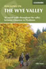 Guidebook to 30 varied walks of 3 - 10 miles, in the valley of the Wye, the most scenic river in England and Wales, between Chepstow in the south and Plynlimon. Landscape ranges from open moorland to wooded gorges and is dotted with the sites of Iron Age hillforts and castles. Centres include Ross-on-Wye, Hereford, Hay-on-Wye and Rhayader.
More information
Walking in the Forest of Dean
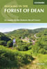 Guidebook to 25 walks in the Forest of Dean, between the Severn and Wye, from 4-mile routes to all-day sections of long-distance trails such as the Offa's Dyke Path and Gloucestershire Way, this guide is ideal for exploring the forest and its history and includes the information needed for walkers of all abilities to explore this ancient area.
More information
Messaging & Social Media
Message Walking Britain and follow the latest news.

Mountain Weather
Stay safe on the mountains with detailed weather forecasts - for iOS devices or for Android devices.