Aber Falls, Foel-fras & Drum from Abergwyngregyn
Snowdonia/Eryri Walk
Nat Park - Snowdonia - Eastern Carneddu
County/Area - Gwynedd
Author - Lou Johnson
Length - 9.0 miles / 14.6 km Ascent - 3600 feet / 1091 metres
Time - 8 hours 10 minutes Grade - mod/hard
Maps 

| Ordnance Survey Explorer OL17 | Sheet Map | 1:25k | BUY |
| Anquet OS Explorer OL17 | Digital Map | 1:25k | BUY |
| Ordnance Survey Landranger 115 | Sheet Map | 1:50k | BUY |
| Anquet OS Landranger 115 | Digital Map | 1:50k | BUY |
Walk Route Description
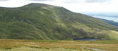
Click image to see photo description.
The Carneddau, located to the east of the A5 and south of the A55, contain the largest area of high ground over three thousand feet in England and Wales. Like many mountain ranges there are contrasts of landscape and this walk concentrates on the smooth grassy slopes and ridges rather than the rockier terrain further west. Despite this description this is a serious mountain route with some sections across unpathed territory. However once the summit of Foel Fras is gained the waking is easier. Starting from close to sea level the total ascent is also a serious consideration as is the likelihood of bad weather. Low cloud is a common problem and with little shelter on the hills rain and snow could also be very unpleasant.
The start of this Snowdonia (Eryri) walk is the Forestry Commission car park (grid ref. SH664719) a mile or so south of Aber village. This parking area can be quite busy as its main use is for visitors making the short walk to Aber Falls. Alternative parking is available towards the village but this adds unwanted extra mileage to the walk. From the car park take the track that heads south to Aber Falls on the eastern side of the Afon Rhaeadr-fawr. Where the path forks bear left and follow this rising route towards the waterfall, which soon comes into view.
Cross the screes to the left of the falls and continue with the path as it is climbs along rocky ledges into the valley above. Stay on the eastern bank of the Afon Goch following a faint path. Continue on the path past the sheepfolds to reach a string of small waterfalls. This is where the hard work begins as you leave the stream to climb east over unpathed territory to the summit of Llwytmor with its cairn. Despite its height the view is disappointing and limited to an arc in the west.
The onward route takes you southeast to a col before an easy ascent to the summit of Foel-fras with its summit over the three thousand feet mark. For most of the way there is a narrow trod following the direct line although if you cannot find this then the going is unlikely to cause any problems. Leave Foel-fras by following the wall in a northeasterly direction and head for Drum. This is good quality ridge walking and the going is generally fast. From the substantial summit cairn there are good views.
Stay with the watershed fence and continue north to Carnedd y Ddelw. From here descend northeast for a short way to reach a secondary cairn where the fence turns northeast. Below you on your left is a track and you should descend to meet this (grid ref. 701710). If time is short then you can use tracks back to the start. However the more interesting option is to follow the ridge. Here a succession of minor rocky summits provide interesting walking despite the lack of clear paths. After climbing Pen-Bryn-du continue over Yr Orsedd, Foel-ganol and Foel Dduarth. The descent from the last summit needs to be chosen carefully as there is some steep ground on the western flank. The most practical option seems to be a wide sweep in a northerly direction to meet the track where it meets the overhead power lines (grid ref. 676720). All that remains is a downhill stroll along the track to a gate. Go through this and follow the lane back to the start.
Other walks nearby
| Walk 2346 | Yr Orsedd ridge from near Bont Newydd | moderate | 4.8 miles |
| Walk 2833 | Moel Faban, Gyrn & Moel Wnion from Rachub | easy/mod | 5.0 miles |
| Walk 2547 | Carnedd Llewelyn from near Rowen | mod/hard | 12.0 miles |
| Walk 2115 | Yr Elen, Carnedd Llewellyn & Carnedd Dafydd | hard | 9.5 miles |
| Walk 3051 | Yr Elen from Gerlan | hard | 6.5 miles |
| Walk 3052 | Yr Elen & Carnedd Dafydd from Gerlan | hard | 9.0 miles |
| Walk 1315 | Drosgl and Gyrn Wigau from Rachub | moderate | 7.5 miles |
| Walk 3061 | Eastern Carneddau from near Rowen | mod/hard | 10.5 miles |
| Walk 2497 | Druid Circle, Moelfre and Foel Lus from Penmaenmawr | easy/mod | 6.0 miles |
| Walk 2558 | Carnedd Dafydd & Pen yr Ole Wen from Bethesda | mod/hard | 8.0 miles |
Recommended Books & eBooks
The Wales Coast Path
 A single guidebook to walking the whole Wales Coast Path - 1400km (870 miles) the length of Wales from Chester to Chepstow, including Anglesey, described in 57 stages. The route passes through the Snowdonia and Pembrokeshire National Parks and many AONBs and can be linked with the Offa's Dyke Path for a complete circuit of Wales.
More information
Snowdonia: 30 Low-level and easy walks - South
 Guidebook describing 30 walks in Snowdonia, Wales. Routes are mostly low level and on clear paths and showcase the region's beautiful scenery and rich history and culture. Part of a 2-volume set, this southern volume includes Trawsfynydd, Bala, Dolgellau, Machynlleth, the Harlech Coast and the valleys of the Mawddach and Dyfi.
More information
Messaging & Social Media
Message Walking Britain and follow the latest news.

Mountain Weather
Stay safe on the mountains with detailed weather forecasts - for iOS devices or for Android devices.