Moel Lefn & Moel yr Ogof from Cwm Pennant
Snowdonia/Eryri Walk
Nat Park - Snowdonia - Moel Hebog Nantlle Ridge
County/Area - Gwynedd
Author - Lou Johnson
Length - 7.0 miles / 11.4 km Ascent - 2400 feet / 727 metres
Time - 5 hours 50 minutes Grade - moderate
Maps 

| Ordnance Survey Explorer OL17 | Sheet Map | 1:25k | BUY |
| Anquet OS Explorer OL17 | Digital Map | 1:25k | BUY |
| Ordnance Survey Landranger 115 | Sheet Map | 1:50k | BUY |
| Anquet OS Landranger 115 | Digital Map | 1:50k | BUY |
Walk Route Description
Click image to visit gallery of 11 images.
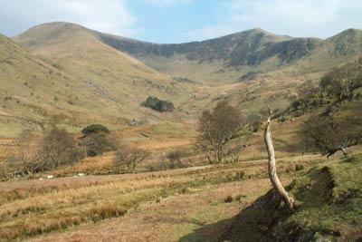
Cwm Pennant is wonderful unspoilt and secluded valley in the north-eastern part of the Snowdonia (Eryri) National Park. Once home to extensive slate quarries that were served by a narrow gauge railway, the valley has returned to peace and quiet. To visit the valley of Cwm Pennant, leave the A487 Porthmadog to Caernarfon road at Dolbenmaen (Grid ref. SH504431) and follow the narrow lane as it heads into the valley. Stay on this lane with its gates until you reach the end of the tarmac where there is a small parking area (fee payable to the local farmer at Braich-y-dinas).
After parking follow the waymarked path that leaves the parking area and climb eastwards to reach one of the old mine buildings marked on the OS Maps (Grid ref. SH 544493). From here continue east to reach a further and larger building that is not marked on maps (Grid ref. SH 546493). Go past the building and turn left up an old incline. At the top turn right along the northern shore of a small lake following a narrow and often ill-defined path to the col at the head of Cwm Trwsgl (Grid ref. SH 553497). It has been suggested that an easier route is to stay on the level section of the tramway from the old winding house and then climb the second incline as far as the second level, leaving right along the level to pick up the path into Cwm Trwsgl.
At the Col turn right. Do not cross the wall and enter Beddgelert Forest but the follow the path alongside the wall as it ascends towards the summit of Meol Lefn. The path climbs steadily to reach a crag, which is surmounted via a gully to reach easier ground above. Soon the highest point of the mountain is in view from where many peaks of Snowdonia are visible.
Moel yr Ogof, the next objective) is in view and the onward route descends south to a Col before ascending to the summit rocks. Sharing similar views to Moel Lefn it does benefit from a better prospect of Moel Hebog, the next summit south along the ridge.
Descend south on a clear path to reach Bwlch Meillionen (Grid ref. SH 560475). Go right over the ladder stile at the lowest point of the Col and descend southwest. The path stays on the northern side of the stream as it flows down Cwm Llefrith towards Cwm Pennant. The path is generally easy to follow, although one section across wetter ground is less well-defined. After approximately two kilometres the path reaches the old trackbed of a narrow gauge railway (Grid ref. SH 543466). Turn right along this easy graded route and follow it all the way back to the base of the incline ascended at the beginning of the walk. From here retrace your steps down to the parking area.
Other walks nearby
| Walk 2590 | Nantlle Ridge Walk from Rhyd Ddu (Route A) | moderate | 6.0 miles |
| Walk 2797 | Yr Aran and Snowdon from Rhyd-Ddu | mod/hard | 8.5 miles |
| Walk 3509 | Nantlle Ridge from Rhyd Ddu (Route B) | mod/hard | 8.3 miles |
| Walk 3198 | Snowdon via the South Ridge & Rhyd-ddu Path | mod/hard | 7.5 miles |
| Walk 1951 | Mynydd Mawr from Rhyd-Ddu | moderate | 6.0 miles |
| Walk 2729 | Snowdon by Rhyd-Ddu and Snowdon Ranger Paths | mod/hard | 7.5 miles |
| Walk 3117 | Garnedd Goch via Cwm Silyn (Two Lakes Walk) | moderate | 6.0 miles |
| Walk 2150 | Llyn Dinas and Cwm Bychan from Beddgelert | easy/mod | 6.0 miles |
| Walk 2560 | Moel Hebog, Moel yr Ogof & Moel Lefn from Beddgelert | mod/hard | 6.5 miles |
| Walk 1799 | Moel Hebog | moderate | 5.5 miles |
Recommended Books & eBooks
The Cambrian Way
 Guidebook to the Cambrian Way, a challenging three-week mountain trek through Wales from Cardiff to Conwy. The 470km un-waymarked route is presented from south to north. Often sticking to long, beautiful ridgelines, it crosses wild and rugged terrain and visits many of Wales's highest mountains, including Snowdon.
More information
Mountain Walking in Snowdonia
 Guidebook to 40 of Snowdonia's best day walks, with routes up Snowdon and Tryfan, including the Snowdon Horseshoe, Cadair Idris, Y Garn and The Rhinogs. The routes range from Grade 1 scrambles like Crib Goch or Bristly Ridge, to riverside and forest walks. Includes details of a 2-day traverse of all 15 of Snowdonia's 3000ft peaks.
More information
Messaging & Social Media
Message Walking Britain and follow the latest news.

Mountain Weather
Stay safe on the mountains with detailed weather forecasts - for iOS devices or for Android devices.