Broadway, Stanton & Laverton
Cotswolds Walk
Region - Cotswolds
County/Area - Worcestershire & Gloucestershire
Author - Lou Johnson
Length - 7.5 miles / 12.2 km Ascent - 1100 feet / 333 metres
Time - 4 hours 50 minutes Grade - easy/mod
Maps 

| Ordnance Survey Explorer OL45 | Sheet Map | 1:25k | BUY |
| Anquet OS Explorer OL45 | Digital Map | 1:25k | BUY |
| Ordnance Survey Landranger 150 | Sheet Map | 1:50k | BUY |
| Anquet OS Landranger 150 | Digital Map | 1:50k | BUY |
Walk Route Description
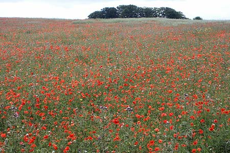
Click image to visit gallery of 12 images.
The Cotswold village of Broadway is well known for its attractive main street, which is lined with many fine buildings constructed in the mellow local stone. Located in Worcestershire, the village nestles beneath the main ridge of the Cotswold Hills to the east adding an attractive backdrop. This walk uses the Cotswold Way National Trail to explore three Gloucestershire villages to the south of Broadway with the route offering many fine views.
The main pay and display car park in Broadway is located just off the Cheltenham Road (Grid ref. SP090377). Exit the car park and walk towards the centre of the village. Take the road on the right signed to Snowshill (Snowshill Road) and walk south. Just after the houses, turn right onto the Cotswold Way. The path crosses meadows to reach West End Lane. Go right and then left onto the Cotswold Way and start the climb up hill alongside a coppice. Stay with the Cotswold Way ignoring the path signed right to Buckland. The path joins a track and you make good progress to reach a junction of paths and tracks (Grid ref. SP089354) on the edge of Buckland Wood.
Turn right along a track signed as the Cotswold Way. This reduces to a path as you turn south and rejoins a track near Laverton Hill Barn. Reaching a junction of paths and tracks (Grid ref. SP082341) take care that you continue south on the Cotswold Way, which skirts across the side of Shenberrow Hill to pass Shenberrow Buildings (Grid ref. SP080333). The path turns west and begins a pleasant descent into the attractive village of Stanton. The route is well waymarked and you join the village High Street.
Walk down High Street towards the Church. If you have time the village and its church are worth exploring. However for those continuing on the walk, turn right just before reaching the church and follow the signs. You go down a lane at first before joining a narrow enclosed path between fences. This leads to open fields and Hoo Farm (Grid ref. SP072354) on the outskirts of Laverton. Turn right down the lane and follow it left, left again and then right to arrive at a junction (Grid ref. SP073356). Go straight across here and follow the track, ignoring the footpath on the left, through to the lane at Buckland (Grid ref. SP978361). Turn right into the village and continue up the lane passing the small church on your right.
Just after the lane bends left, look out for the signed footpath on your left. The path goes to the left of a cottage (Grid ref. SP082359). Ignore the path left and go straight ahead and climb steeply up through the woods onto Burhill. Go straight across the field and follow the path as it skirts Broadway Coppice, which is on your left. You reach a path junction (Grid ref. SP087366). Turn left onto the Cotswold Way and retrace your route back to Broadway.
Other walks nearby
| Walk 2094 | Snowshill Circular | easy | 4.4 miles |
| Walk 3063 | Stanway & Snowshill circular | moderate | 8.0 miles |
| Walk 1308 | Broadway & Chipping Campden | moderate | 11.0 miles |
| Walk 3327 | Temple Guiting & Cutsdean from Stanway | moderate | 10.0 miles |
| Walk 1749 | Upper Quinton & Hidcote Bartrim from Mickleton | easy/mod | 6.8 miles |
| Walk 2541 | Hidcote & Foxcote from Mickleton | easy/mod | 7.5 miles |
| Walk 3212 | Ebrington & Foxcote circular | easy | 3.7 miles |
| Walk 2495 | Bredon Hill Circular | moderate | 10.6 miles |
| Walk 2402 | Bredon Hill from Elmley Castle | easy/mod | 5.5 miles |
| Walk 3064 | Hailes, Beckbury & Sudeley from Winchcombe | moderate | 10.0 miles |
Recommended Books & eBooks
The Cotswold Way Map Booklet
 Map of the 102 mile (163km) Cotswold Way National Trail, between Chipping Camden and Bath. This booklet is included with the Cicerone guidebook to the trail, and shows the full route on OS 1:25,000 maps. The trail typically takes two weeks to walk, and is suitable for walkers at all levels of experience.
More information
The Cotswold Way
 Guidebook to walking the Cotswold Way National Trail. Between Chipping Campden and Bath, the 102 mile route explores the Cotswolds AONB. Described in both directions over 13 stages, the Cotswold Way can be walked year round and is suitable for beginner trekkers. Includes separate OS 1:25,000 map booklet of the route.
More information
Messaging & Social Media
Message Walking Britain and follow the latest news.

Mountain Weather
Stay safe on the mountains with detailed weather forecasts - for iOS devices or for Android devices.