Saltersbrook and Lady Cross from Woodhead
Peak District Walk
Nat Park - Peak District - Black Hill Dovestone
County/Area - Derbyshire & South Yorkshire
Author - Peter Schofield
Length - 6.0 miles / 9.8 km Ascent - 980 feet / 297 metres
Time - 4 hours 0 minutes Grade - easy/mod
Maps 

| Ordnance Survey Explorer OL1 | Sheet Map | 1:25k | BUY |
| Anquet OS Explorer OL1 | Digital Map | 1:25k | BUY |
| Ordnance Survey Landranger 110 | Sheet Map | 1:50k | BUY |
| Anquet OS Landranger 110 | Digital Map | 1:50k | BUY |
Walk Route Description
Click image to visit gallery of 4 images.
The northeast corner of the Peak National Park is not its most well known area but nevertheless it offers some excellent walks. This one packs a bit of local history in with some typical Dark Peak walking and fine views, yet it can easily be completed in a half day.
This Peak District walk starts at a small car park south of the A628 on the Trans Pennine Trail close to the west entrance to the long closed Woodhead rail tunnel (Grid ref SK114998). Go up the track signed "TPT East" to the A628 and cross to a stile on the other side, continuing up the hill to meet a broad track at a junction. This is now the Trans Pennine Trail but was once the main packhorse route between Cheshire and Yorkshire and we will see evidence of its former role during the walk. Turn right and continue along the track below Longside Edge as views open to the south towards Bleaklow and the return route down Far Black Clough. The A628 is crossed again and the track descends to Lady Shaw Bridge at Saltersbrook.
Being located near the junction of two major routes, Saltersbrook was once a major hub on the packhorse network and the presence of the bridge here was first recorded in 1695. The extensive remains of an inn which existed here from 1795 to the mid 19thC, and a badly eroded milestone can also be seen. An information board tells the story of what must at one time have been a very lively and busy place. Meanwhile the modern bridge on the A628 can be seen a few metres upstream carrying today's incessant traffic over the Woodhead Pass.
Continue up the track from Saltersbrook to reach a track junction at grid ref SK140000. The packhorse routes from Wakefield and Barnsley met at this point which explains Saltersbrook's past importance as a "medieval service area". The TPT goes off to the left but our route continues straight ahead over a stile. A further 100m brings us to the end of a wall where the line of the track can be seen continuing ahead but it is now very wet and badly overgrown and therefore not used. To proceed, go 20m to the right where a path parallels the track over firmer ground, rejoining it higher up.
The track continues to climb to arrive at Lady Cross after a further 700m. The cross marks the boundary of the mediaeval monastic lands located around Glossop and there is evidence to suggest that it may date back to the 13thC. Sadly, only the base and a small part of the shaft remain. You should take time for a break here as there are extensive views in almost every direction except to the south where Round Hill obstructs the view. The transmitters at Holme Moss and Emley Moor are prominent and the panorama extends from Lad's Leap and Longdendale in the west to the power stations in East Yorkshire.
When you've had your fill of the view, head approximately south west over a clear but at times boggy path over Round Hill. On reaching the top of the hill, views open up towards Bleaklow as the path continues to meet the Derwent Skyline path at a small cairn (Grid ref. SK142986). Turn right on to the often boggy Skyline path as it undulates through numerous peat groughs. Barrow Stones are prominent on the ridge to the south and there are some fine views to be enjoyed of the Upper Derwent valley and edges.
There is no obvious point at which to leave the path to reach our next objective at Far Black Clough. However, approximately 600m after crossing a stile at Swains Head, the path takes a pronounced turn to the south (Grid ref SK126981). You should head due west from this point for 300m across the open moor to meet a clear path where you turn right to descend Far Black Clough.
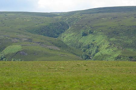
Far Black Clough is one of the Dark Peak's hidden gems and is a delightful place with numerous waterfalls and fine craggy outcrops. As the path descends, it becomes a vehicle track and views open up towards the outbound route along the TPT on the far side of the valley. Follow the track to the bottom and after crossing Far Black Clough by a ford, the car park is a further 500m of easy walking.
Other walks nearby
| Walk 1179 | Lad's Leap & Laddow Rocks from Crowden | moderate | 6.5 miles |
| Walk 2621 | Black Hill & Laddow Rocks | moderate | 9.0 miles |
| Walk 3022 | Black Hill | moderate | 9.0 miles |
| Walk 2375 | The Longendale Edges | mod/hard | 11.8 miles |
| Walk 2625 | Torside Clough from Longdendale | moderate | 4.5 miles |
| Walk 3027 | Bleaklow Head from Longdendale | moderate | 8.0 miles |
| Walk 2826 | Winscar Reservoir circuit from Dunford Bridge | moderate | 8.9 miles |
| Walk 1829 | Holme & Marsden Clough from Ramsden Reservoir | moderate | 9.0 miles |
| Walk 2630 | Upper Holme Valley & Ramsden Clough | moderate | 9.0 miles |
| Walk 1583 | Digley Reservoir | easy/mod | 5.0 miles |
Recommended Books & eBooks
Walking in the Peak District - White Peak East
 Guidebook describing 42 half-day and day walks in the limestone landscapes of Derbyshire's White Peak, part of the Peak District National Park. One of two volumes, this book covers the east of the region, with potential bases including Bakewell, Eyam, Castleton, Birchover, Matlock and Wirksworth.
More information
Walking in Derbyshire
 Walking guidebook to 60 circular day walks in Derbyshire and the Peak District. Includes the Derwent, Wye and Trent river valleys, near Derby, Matlock, Glossop, Bakewell and Ripley. Routes range from easy to moderate and are between 4 and 14km (2 to 10 miles). Walks focus on places of interest, from Stone Age forts to castles to grand estates.
More information
Messaging & Social Media
Message Walking Britain and follow the latest news.

Mountain Weather
Stay safe on the mountains with detailed weather forecasts - for iOS devices or for Android devices.