Pyecombe, Devil's Dyke & Upper Beeding
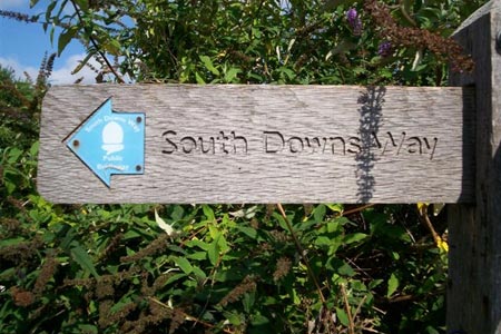
South Downs Walk
Nat Park - South Downs
County/Area - West Sussex
Author - Barry Mackie
Length - 8.0 miles / 13 km Ascent - 1000 feet / 303 metres
Time - 5 hours 0 minutes Grade - easy/mod
Maps 

| Ordnance Survey Explorer OL11 | Sheet Map | 1:25k | BUY |
| Anquet OS Explorer OL11 | Digital Map | 1:25k | BUY |
| Ordnance Survey Landranger 198 | Sheet Map | 1:50k | BUY |
| Anquet OS Landranger 198 | Digital Map | 1:50k | BUY |
Walk Route Description
Click image to visit gallery of 12 images.
This section of the South Downs Way is fairly typical of the route so far from Eastbourne, with much of the walk along the top of the Downs with the steep escarpment and the Sussex Weald easily visible to the right side. Also, similar to previous sections, there will also be occasional views of the English Channel some five miles away on your left. In Addition, a short diversion off the SDW to the viewpoint on Devil's Dyke is included. The walk ends alongside the River Adur in the Adur Valley which is the third such river valley met since the start of the SDW at Eastbourne.
Roadside parking is available near the Plough pub at the southern end of the village of Pyecombe (grid ref TQ292124) and from here you'll be able to see across the A23 dual carriageway to the SDW as it starts its journey up the slope of West Hill, a part of the National Trust area of Newtimber Hill. Don't attempt to take this perceived shortcut across this very fast and busy road though; instead walk along the side road alongside the A23 or up through the village itself, depending where you parked to reach the road bridge. Cross over here turn left to then come back down the other side passing the riding school on the right. Now go on to the concrete drive and follow the track in a south-westerly direction steadily gaining height to reach the summit of West Hill (211m). There are some good views over your left shoulder of Brighton to the south east and all around you of the magnificent downs.
From here the path descends and starts to veer west as it passes through the hamlet of Saddlecome to reach a minor road. The route ahead is slightly to the left as you cross the road and enter Summer Down, another National Trust property. Follow the path uphill past the reservoir on your right and the Devil's Dyke hotel now become visible near the summit of the next hill in front of you. Skirting to the left of the deep valley, (the actual Devil's Dyke) the path keeps near to the crest of the downs to reach the Devil's Dyke Road, (grid ref TQ258107) where a detour to the North is an absolute must! To take this detour, turn right along this road for a short distance to reach the hotel area with the viewpoint just down the grassed slope on the far side.
This place is so rich in history, geology and legend that it would be so easy to write a book on it. This isn't the time though. After all, we're just here as walkers passing through! But briefly, legend has it that the devil tried to flood the Weald and the Dyke is what's left of his actions. The Dyke itself is the deepest dry valley in Britain. At the viewpoint there are some excellent information boards depicted as paintings, explaining what you can see as you look around. A note on the bottom of one of the boards describes how the English landscape painter John Constable stood here and stated that "These are the grandest views in the world."
Personally I have never seen any pictures that get anywhere near to capturing the sheer scale and beauty of this place, but if you do get to stand here, what you will see are extensive views, particularly to the west of the top and escarpment of the Downs, the Weald in front of you stretching for some 25 miles to reach the foot of the North Downs, and the North Downs as well.
The information boards point out all the main places of interest including Leith Hill and Butser Hill, which are the second and fourth highest hills in South-East England respectively. Coincidentally, if you are planning to continue along the SDW using these walks, then Butser Hill (although not on the SDW) is visited. There is plenty to see and do round here and if the hotel is open you can get a drink and a bite to eat. Even if it is closed though, there are toilets to the left side of the hotel which should be open.
Eventually you have to move on from here and rather than retrace your steps back up the road, instead head west on the obvious path to pick up the SDW further along the slope. It is fairly straightforward from here on. In the distance are the radio masts on top of Truleigh Hill, which the way passes on the left side. This area is part of another National Trust property known as the Fulking Escarpment, and given the popularity of Devil's Dyke a welcome quieter section on the gently meandering track that makes for some pleasant walking over Edburton Hill to then reach Truleigh Hill.
Past Truleigh Hill there is the Youth Hostel (Tottington Barn) on your right and this section is a Byway. Where the road becomes asphalted for a while there is a parallel path behind a hedge to your right which is an alternative option. The way is now descending into the Adur Valley and this is as long and easy a slope imaginable, with more wonderful views opening up both into the valley and across to the Downs on the western slopes and beyond. At the bottom of the slope, turn left alongside the road for some fifty metres and cross to reach the car park on the far side alongside the River Adur where this walk finishes.
Footnote - There are drinking water taps at the Youth Hostel at Truleigh Hill and just behind the hedge alongside the river Adur at the end of this walk. The Harvey map of the SDW also shows a tap at the hamlet of Saddlecombe. We did not notice this tap, but then we were not looking for it.
Need transport to get back to Pyecombe? - There are bus stops close by at the finish of the walk for services into Shoreham, but this looks like a long and awkward route back using public services. We took a taxi back to Pyecombe from the car park at the end of the walk. This cost us £ 23 (2007 prices). Again more expensive than public transport, unless there are 4 or 5 in your party, but this was so much easier and quicker.
Other walks nearby
| Walk 3487 | Edburton Hill & Devil's Dyke from Saddlescombe | hard | 10.5 miles |
| Walk 3488 | Devil's Dyke Circular | easy | 2.5 miles |
| Walk 2236 | Wolstonbury Hill and Pyecombe from Patcham | moderate | 11.0 miles |
| Walk 1983 | Edburton Hill from Fulking | easy/mod | 6.1 miles |
| Walk 2903 | Stanmer to Streat | moderate | 12.5 miles |
| Walk 2486 | Plumpton Green & South Downs | easy/mod | 7.7 miles |
| Walk 2684 | Falmer to Pyecombe & Blackcap by South Downs Way | moderate | 8.8 miles |
| Walk 2109 | Upper Beeding to Washington by the South Downs Way | easy/mod | 7.0 miles |
| Walk 1782 | Steyning Round Hill and No Man's Land | moderate | 7.5 miles |
| Walk 1858 | Cissbury Ring and Chanctonbury Ring | moderate | 10.5 miles |
Recommended Books & eBooks
The South Downs Way
 Guidebook to walking the South Downs Way National Trail, a 100 mile (160km) route between Winchester and Eastbourne through the South Downs National Park, described in both directions over 12 stages. Easy walking on ancient and historical tracks, taking in wooded areas, delightful river valleys and pretty villages. With 1:25K OS map booklet.
More information
Walks in the South Downs National Park
 Guidebook with 40 circular walks throughout the South Downs National Park, exploring the beautiful chalk hills between Eastbourne and Winchester. The walks range from under 5 miles to 11 miles, including Beachy Head and the Seven Sisters, Ditchling Beacon and hundreds of prehistoric sites. Accessible all year, but wild flowers best in spring.
More information
Messaging & Social Media
Message Walking Britain and follow the latest news.

Mountain Weather
Stay safe on the mountains with detailed weather forecasts - for iOS devices or for Android devices.