Sgurr a'Ghreadaidh and Sgurr na Banachdich
Highland Walk
County/Area - Highland - Isle of Skye
Author - Tony Maries
Length - 5.5 miles / 8.9 km Ascent - 4100 feet / 1242 metres
Time - 6 hours 50 minutes Grade - very hard
Maps 

| Ordnance Survey Explorer 411 | Sheet Map | 1:25k | BUY |
| Anquet OS Explorer 411 | Digital Map | 1:25k | BUY |
| Ordnance Survey Landranger 32 | Sheet Map | 1:50k | BUY |
| Anquet OS Landranger 32 | Digital Map | 1:50k | BUY |
Walk Route Description
Click image to visit gallery of 8 images.
A challenging Cuillin ridge walk with two Munro summits, which involves a considerable amount of scrambling, and, on a fine day, stunning views in all directions. The Munros are Sgurr a'Ghreadaidh and Sgurr na Banachdich. Please note the attached GPS file should not be used for micro navigation and only used for general guidance about the route.
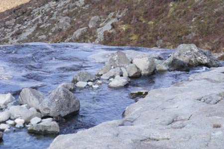
Start from the Youth Hostel in Glen Brittle. An improved path leads eastwards from the road, following the south bank of the Allt a'Choire Ghreadaidh. For the first 1 ½ km it is easy walking along a gently graded path. Enjoy being able to sally along with your hands in your pockets, because it won't last! Near to where the Allt Coire'an Eich meets the Allt a'Choire Ghreadaidh the path peters out. Cross the burn. This is easy in fine weather, but is much more tricky walking over slippery slabby rocks in wet weather if the stream is in spate. From here on the path is intermittent. Follow the north side of the main tributary of the Allt a'Choire Ghreadaidh eastwards and across a relatively level boulder field near the head of the corrie. Here many minor streams converge on the burn at the base of the corrie, the two southernmost issuing from vast gashes in the mountain side above.
The path now reappears and climbs much more steeply north-east until you reach a more level area at about 500m. Continue eastwards. The path is very indistinct now but you will soon see the rocky dome of Sgurr a'Mhadaidh straight ahead, the black sides of Sgurr Eadar da Choire to the right and An Dorus, a gash cleft between Mhadaidh and Ghreadaidh. You now have to cross an area of steep scree and climb up to An Dorus (the Door), which is the bealach between Mhadaidh and Ghreadaidh.
To the right of the crest of the bealach, climb up onto the rocky balcony which bars the way to Sgurr a'Ghreadaidh. There are plenty of handholds and footholds and there is nothing technical about the climbing, although there are some quite large steps between each foothold. Once on top of the balcony follow a narrow ledge on the east side of the summit ridge. There is a fair amount of exposure here and for the first time you get views into the interior of the Cuillin, with Loch Coruisk to the south and Blaven over to the east.
I am always struck by the apparent lack of bird life on the Cuillin. Skye is generally noted for its variety of bird species, and the sea cliffs usually teem with life. On the Cuillin, however, you will usually hear the hoarse "kaaah" of the hooded crow echoing off the steep sides of the corries, but you will probably not hear or see anything else. Even the moorland at the base of the Cuillin seems to be lacking in the bird life typical of Scottish moorland.
After about 150m you pass the mouth of Eag Dubh, a vast fissure which almost splits the mountain in two. Continue up and bypass a rocky protuberance called The Wart. You soon reach the top of Sgurr a'Ghreadaidh, which boasts a small cairn and awe-inspiring views, particularly to the south where Sgurr na Banachdich, Sgurr Alasdair, the Dubhs and Loch Coruisk are all visible.
Map-making of the Cuillin has posed a considerable challenge to the Ordnance Survey. The steepness of the mountains and their proximity to each other make the 1:50000 map virtually unusable. The 1:25000 is much better, but the contour lines still merge into a brown haze, and important features are obscured. Older pre-metric Ordnance Survey maps omitted the contours, and the rocks and scree were drawn as a series of squiggly lines and dots. The 6 inch to the mile map, originally drawn in 1889, has a wealth of detail which even includes features like the Eag Dubh, However the early mountaineers found that the surveyors had actually only climbed a few of the peaks. Much of the detail was somewhat lacking in accuracy, and almost all the heights were wrong! Many of their comments are recorded for posterity in contemporary accounts such as the journals of the Scottish Mountaineering Club.
From the top of Ghreadaidh, descend south west along the ridge, which is broken by three rocky pinnacles, all of which can be ascended by a bit of scrambling, then almost in the shadow of Sgurr na Banachdich, climb steeply up to the small summit of Sgurr Thormaid. Sgurr Thormaid is named after Norman Collie. Professor Collie was a notable pioneer in the early years of mountaineering in the last decades of the nineteenth century, and is credited with the first winter ascent of Tower Ridge on Ben Nevis, many early ascents in the Alps, the Caucasus and the Canadian Rockies, and also with the first serious attempt on a 8000m Himalayan peak, on Nanga Parbat in 1895. His grave is on Skye, outside the Free Presbyterian Church at Struan.
If, as is likely, it is now well into the afternoon, you will be in the shadow of the higher and much bulkier Sgurr na Banachdich. Although you are only about 200m from the top of Banachdich as the crow flies, you will have to scramble down to a rocky col and then back up again to reach it.
From the top of Sgurr na Banachdich, descend a boulder field in the WNW direction for 300m, then as you approach the 800m contour aim WSW and stay on the narrow and rocky crest of the west ridge of the mountain. Once down to about 580m the ridge rises again, to terminate at Sgurr nan Gobhar.
Once here, descend the steep western termination of the ridge down to the moorland below. Scrambling is needed in one or two places. An intermittent path, which happily appears at most of the more difficult sections, winds down the side of the hill. Once down to where the mountain levels off onto rough moorland at about 350m, aim just north of west back to the starting point at the Youth Hostel.
Warning - This walk includes some difficult mountain paths in an area known for unpredictable weather. Although the distance and ascent are not great, this is a very full day walk which should only be attempted by experienced walkers who are also confident scramblers and have the necessary skills and equipment. If in doubt - do not attempt this route.
Other walks nearby
| Walk 2197 | The Inaccessible Pinnacle and Sgurr Mhic Choinnich | very hard | 6.0 miles |
| Walk 1167 | Glen Brittle & Coire Lagan | moderate | 4.6 miles |
| Walk 2589 | Marsco from the Sligachan Hotel, Isle of Skye | moderate | 8.7 miles |
| Walk 1166 | Loch Coruisk | easy | 4.0 miles |
| Walk 3753 | Blabheinn via south ridge | mod/hard | 8.0 miles |
| Walk 3760 | Glamaig (Sgurr Mhairi & An Coileach) | mod/hard | 4.5 miles |
| Walk 2002 | Dun Caan, Isle of Raasay | moderate | 10.6 miles |
| Walk 1164 | The Storr Sanctuary | easy/mod | 3.2 miles |
| Walk 2640 | The Storr & Old Man of Storr from Loch Leathan | moderate | 5.5 miles |
| Walk 1886 | Carn a' Bhealaich Mhoir | easy/mod | 8.0 miles |
Recommended Books & eBooks
Great Mountain Days in Scotland
 Inspirational guidebook to 50 challenging routes for mountaineers, scramblers, hillwalkers and fell runners, many long enough to backpack over 2 days, especially in winter (12 to 25 miles). A mix of classic routes and unsung gems across Scotland from Galloway to the Outer Hebrides in widely differing wild landscapes. With customised OS mapping.
More information
Walking the Munros Vol 2 - Northern Highlands and the Cairngorms
 Guidebook to walking the northern Munros, covering the northern Highlands, the Cairngorms and the Isle of Skye. 70 routes are described, including those up Ben Macdui, Braeriach and Cairn Gorm. Routes range from 7 to 46km, requiring a fair level of fitness. The second of two guidebooks to walking Scotland's Munros: peaks higher than 3000ft.
More information
Messaging & Social Media
Message Walking Britain and follow the latest news.

Mountain Weather
Stay safe on the mountains with detailed weather forecasts - for iOS devices or for Android devices.