Dent & Gawthrop
Yorkshire Dales Walk
Nat Park - Yorkshire Dales - Three Peaks Country
County/Area - Cumbria
Author - Lou Johnson
Length - 6.0 miles / 9.8 km Ascent - 990 feet / 300 metres
Time - 4 hours 0 minutes Grade - easy/mod
Maps 

| Ordnance Survey Explorer OL2 | Sheet Map | 1:25k | BUY |
| Anquet OS Explorer OL2 | Digital Map | 1:25k | BUY |
| Ordnance Survey Landranger 98 | Sheet Map | 1:50k | BUY |
| Anquet OS Landranger 98 | Digital Map | 1:50k | BUY |
Walk Route Description
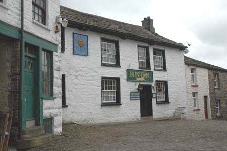
Click image to visit gallery of 12 images.
This Yorkshire Dales walk explores the southern side of Dentdale starting from the picturesque village of Dent. The route is generally easy to follow and offers a variety of scenery. Apart from the first section of the walk, the going is relatively easy with very little ascent.
The start is the main car park in Dent (Grid ref. SD703871). Exit the car park, cross over the main road through the village and take the street opposite. Keep straight on passing the green on your left. The road eventually becomes a rough track and starts to climb steadily. On your left is Flinter Gill with its pretty cascades and waterfalls. Leaving the light woodland the track enters open country. A worthwhile diversion is to visit the viewing point on the right (Grid ref. SD700862), which offers a grandstand view of beautiful Dentdale.
The gradient starts to ease and you soon reach a t-junction. Turn right and follow the Occupation Road as it meanders and undulates across the hillside. Reaching the Barbondale Road, turn right and, keeping an eye out for traffic, walk along the lane to reach a footpath sign on your left (Grid ref SD683864). Follow this path across a meadow and past some limestone outcrops to reach a stile. Cross this, and with the wall on your left, continue across the field to pick up the track heading north towards Combe House.
Pass this house and outbuildings and continue down the recently improved access road. The newly aligned access avoids Tofts Farm, which is on your left. Staying on the track descend past Bower Bank to reach a lane (Grid ref. SD688877). Go east along this lane past a cottage to the small village of Gawthrop. Keep straight on through the village looking out for the signed path on your left (Grid ref. SD694873). Follow this path, with Oliver gill, on your right to reach the road near Barth Bridge. Continue to Barth Bridge, taking the signed footpath (The Dales Way) on the right before crossing the river. The path crosses meadows, roughly following the river. Reaching the road continue upstream and take the footpath on your left, which regains the river bank. Continue ahead to the next bridge, Church Bridge (Grid ref. SD707871). Turn right up the road into the village bearing right in the centre to return to the start.
Other walks nearby
| Walk 2146 | Deepdale Circular (near Dent) | moderate | 7.0 miles |
| Walk 3135 | Dentdale & Bleamoor | moderate | 12.5 miles |
| Walk 1196 | The Calf | mod/hard | 10.5 miles |
| Walk 2438 | Cautley Spout & the Calf from Sedbergh | moderate | 10.0 miles |
| Walk 3008 | Winder & Arant Haw from Sedbergh | moderate | 7.0 miles |
| Walk 1970 | Great Knoutberry Hill & Dent Head | moderate | 9.5 miles |
| Walk 3032 | Gragareth & Great Coum from Yordas Cave | moderate | 9.0 miles |
| Walk 2409 | The Upper Eden valley without a car | moderate | 12.0 miles |
| Walk 3006 | Cautley Spout & The Calf | moderate | 5.5 miles |
| Walk 1393 | Yarlside | moderate | 4.0 miles |
Recommended Books & eBooks
Hadrian's Wall Path
 Hadrians Wall Path guidebook to walk the 84 mile National Trail. Described in both directions, the main description is west to east between Bowness-on-Solway and Wallsend, Newcastle, with extensions to Maryport and South Shields. With extensive historical information related to this World Heritage site and separate 1:25,000 OS map booklet included.
More information
Walking in the Yorkshire Dales: South and West
 Part of a two-book set, this guidebook describes 44 walks in the southern and western Yorkshire Dales, including the famous 23 mile Three Peaks circuit over Pen-y-Ghent, Whernside and Ingleborough. The other, mostly circular routes of 3½ to 13 miles cover the scenic region between Sedbergh, Kirkby Lonsdale, Settle, Skipton and Grassington.
More information
Messaging & Social Media
Message Walking Britain and follow the latest news.

Mountain Weather
Stay safe on the mountains with detailed weather forecasts - for iOS devices or for Android devices.