Llandeilo Hill from Aberedw
Powys Walk
County/Area - Powys - Powys Central
Author - Lou Johnson
Length - 6.2 miles / 10.1 km Ascent - 1100 feet / 333 metres
Time - 4 hours 10 minutes Grade - easy/mod
Maps 

| Ordnance Survey Explorer 188 | Sheet Map | 1:25k | BUY |
| Anquet OS Explorer 188 | Digital Map | 1:25k | BUY |
Walk Route Description
Click image to see photo description.
The rounded hills of Powys make for some excellent walking. This relatively short walk explores Llandeilo Hill which lies a few miles east of the village of Aberedw, which lies just off the A470 and A44 roads south of Builth Wells. On-street parking is available in the village (grid ref. SO080473), although be careful not to restrict access for local residents.
After parking walk east along the road through the village, passing the parish church and pub on your right. Reaching a road junction by a telephone box, keep right and continue along the lane for a further 500 metres to the next junction which lies just over the River Edw (grid ref. SO085471). Bear right up the lane signed unsuitable for heavy good vehicles and take the first track on your right (with a metal gate). Follow this track climbing steadily keeping left. You soon obtain better views to reach the ruins of Pantau Farm (grid ref. SO085467).
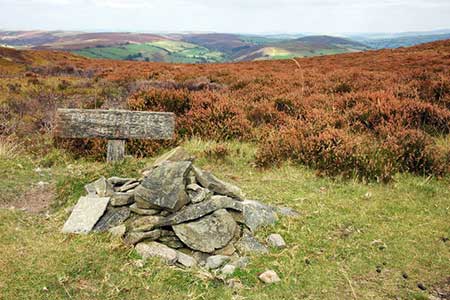
You are now in open access land and need to head roughly east on a track until you pass under some high tension power lines. In a further 100 metres turn right and head uphill on a clear path to reach the brow of the west ridge extending from the summit area of Llandeilo Hill. Turn left along the bridleway and follow the ridge upward passing an indistinct Farlen Pool on your left. You now can enjoy superb views as you walk across the heather clad hilltop. Continue on the bridleway, go past Glannau Pool on your right, to reach Twm Tobacco's grave (grid ref. SO109475) who was either a robber or a nice guy depending which story you read!
Some 200 metres past the grave, turn sharp left onto a track (grid ref. SO112476). This is followed downhill (steeply in places) in a northerly direction towards Pentwyn. Reaching the access track for Trosyglowty, bear left downhill and follow the track past Pentwyn and down to the valley road (grid ref. SO105487). Turn left and after just over a kilometre, turn right to cross the River Edw (signed weak bridge). Take the first signed footpath on your left and follow this alongside the River Edw for about a kilometre to reach a road (grid ref. SO084471). Turn right along this road which will lead you back into the centre of Aberedw village.
Other walks nearby
| Walk 3565 | The Hergest Ridge from Gladestry | easy/mod | 6.1 miles |
| Walk 1238 | Hay Bluff & Twmpa Circular | moderate | 6.0 miles |
| Walk 3023 | Great Rhos & the Radnor Forest from New Radnor | moderate | 9.0 miles |
| Walk 3210 | Pen-y-Crug hill fort from Brecon | easy | 3.0 miles |
| Walk 3564 | Groesfford and M & B Canal from Brecon | easy/mod | 6.2 miles |
| Walk 3236 | Pen-y-crug, Sarnau and Battle from Brecon | moderate | 10.0 miles |
| Walk 1106 | Waun Fach | mod/hard | 7.5 miles |
| Walk 2065 | Waun Fach & Y Grib from Pengenfford | moderate | 6.5 miles |
| Walk 3209 | Llanfrynach and Pencelli circular | easy/mod | 5.6 miles |
| Walk 1957 | Cefn Hill & Vagar Hill - Golden Valley | easy/mod | 5.5 miles |
Recommended Books & eBooks
The Cambrian Way
 Guidebook to the Cambrian Way, a challenging three-week mountain trek through Wales from Cardiff to Conwy. The 470km un-waymarked route is presented from south to north. Often sticking to long, beautiful ridgelines, it crosses wild and rugged terrain and visits many of Wales's highest mountains, including Snowdon.
More information
Messaging & Social Media
Message Walking Britain and follow the latest news.

Mountain Weather
Stay safe on the mountains with detailed weather forecasts - for iOS devices or for Android devices.