The hills near Kirk Yetholm seen from the Pennine Way
Walk Photo 120102
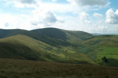
Caption - Height is soon gained as you head south on the Pennine Way with ever improving views on both sides. Rounded hills and remote valleys typify the landscape on both sides of the Border Fence.
Walk 1201 : Black Hag from Kirk Yetholm
Photographer : Lou Johnson
Use back button to return to the photo gallery lists.
Further Information
Location Map
Northumberland
Walking in the Northumberland National Park covers a diverse area of landscape between the Tyne and the Scotland England border. The highest point within the National Park is the Cheviot and besides this famous hill there are many other notable summits. The valleys are also of interest to walkers, although some have restricted access. More Information
Messaging & Social Media
Message Walking Britain and follow the latest news.

Mountain Weather
Stay safe on the mountains with detailed weather forecasts - for iOS devices or for Android devices.