A view of the Devil's Beef Tub
Walk Photo 205003
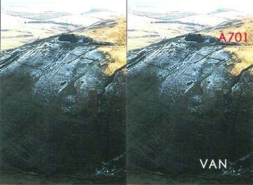
Caption - A view of the Devil's Beef Tub. In times past the Reivers mustered the cattle they had stolen from over the English Border here. If you look at the picture closely you can make out the A701 Moffat to Edinburgh road at the top. At the bottom right is a VW van that left the road and plunged some 500ft to the bottom. The driver lived to tell the tale.
Walk 2050 : The Crown of Scotland
Photographer : Simon Tweedie
Use back button to return to the photo gallery lists.
Further Information
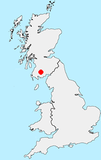
Location Map
Dumfries and Galloway
Dumfries and Galloway is located in south-west Scotland and shares a short border with England. The area has a lengthy coastline including along the Solway Firth. Inland there are ranges of hills including Merrick the highest hill rising to 843 metres above sea level. Long distance footpaths include the Southern Upland Way.
Messaging & Social Media
Message Walking Britain and follow the latest news.

Mountain Weather
Stay safe on the mountains with detailed weather forecasts - for iOS devices or for Android devices.