Snowdonia/Eryri WalksWalking Routes & Hiking Trails
Find Snowdonia/Eryri walks from the list below which features the best walking routes in the area. Most of routes are circular walks although there are a few linear hikes. The walks are listed from the shortest and easiest to the longest more challenging routes. The walks are divided into sub areas so you can find specific walks.
130+ Great Snowdonia (Eryri) walks with detailed route descriptions, excellent mapping, photos and GPX files. The walks listed below cater for walkers of all abilities from easy low-level walks to the high mountain summits. The walks reach all the major summits in the Snowdonia (Eryri) National Park including Snowdon the highest mountain in England & Wales. The list is divided into areas based on the key mountains ranges as an easy to use classification.
Area walks and walking guides
Useful guides to walks and walking from these popular centres. Includes places to stay, local amenities and the best walking routes.
Crib Goch & Snowdon Walks
Walking highlights. An ascent of Snowdon, the highest mountain in England & Wales, is a great Snowdonia walk. Nine different approach routes are available including the Llanberis path, Miners' Path, Pyg Track, Watkin Path and Snowdon Ranger Path. This section also includes the Snowdon Horseshoe, Crib Goch, Y Lliwyedd, Yr Aran and the outliers of Moel Eilio and Moel Cynghorion.
Where to stay - Beddgelert, Llanberis and Caernarfon are the most convenient centres to stay.
| Walk | Description | Grade | Miles |
|---|---|---|---|
| 1427★☩ | Craflwyn circular from near Beddgelert | easy/mod | 2.50 |
| 2122★☩ | Cwm Glas from Pen-y-pass | mod/hard | 4.00 |
| 3613★☩ | Moel Cynghorion from Llyn Cwellyn | moderate | 5.00 |
| 1136★☩ | Yr Aran (Route 2) from Bethania | moderate | 5.50 |
| 1192★☩ | Yr Aran from Bethania | mod/hard | 6.50 |
| 3073★☩ | Crib Goch, Garnedd Ugain and Snowdon from Pen-y-pass | hard | 6.50 |
| 3057★☩ | Moel Eilio from Llanberis | moderate | 7.00 |
| 2729★☩ | Snowdon by Rhyd-Ddu and Snowdon Ranger Paths | mod/hard | 7.50 |
| 1418★☩ | Snowdon and Y Lliwedd from Pen-y-pass | mod/hard | 7.50 |
| 3198★☩ | Snowdon via the South Ridge & Rhyd-ddu Path | mod/hard | 7.50 |
| 1958★☩ | The Snowdon Horseshoe from Pen-y-pass | hard | 7.50 |
| 1089★☩ | Snowdon by the Pyg and Miner's Tracks from Pen-y-pass | moderate | 7.50 |
| 1216★☩ | Y Lliwedd & Snowdon from Pen-y-pass | mod/hard | 7.50 |
| 2290★☩ | Snowdon via the Watkin Path & South Ridge from Bethania | mod/hard | 8.00 |
| 2692★☩ | Snowdon via Dinas Mot & Crib Goch from Pen-y-pass | hard | 8.00 |
| 3036★☩ | Snowdon via Crib Goch from Pen-y-pass | very hard | 8.50 |
| 2797★☩ | Yr Aran and Snowdon from Rhyd-Ddu | mod/hard | 8.50 |
| 1003★☩ | Snowdon by the Llanberis Path from Llanberis | moderate | 9.00 |
| 2626★☩ | Snowdon & Garnedd Ugain from Llanberis | moderate | 9.30 |
| 1681★☩ | Moel Eilio & Moel Cynghorion from Llanberis | mod/hard | 10.00 |
| 1103★☩ | Snowdon & Cwm Llan horseshoe | very hard | 13.00 |
| 3059★☩ | Moel Cynghorion & Snowdon from near Llanberis | very hard | 13.50 |
Glyders & Tryfan Walks
Walking highlights. The Glyders offer some great walking especially to Glyder Fach and Glyder Fawr. Elsewhere the summits of Y Garn and Elidir Fawr offer excellent routes. The Glyders are also home to the iconic peak of Tryfan which can be scaled using scrambling routes or a more gentle approach from Ogwen Cottage. Other great scrambles are available on Bristly Ridge and Y Gribin.
Where to stay - Llanberis, Capel Curig, the Ogwen Valley and Bethesda are convenient bases.
| Walk | Description | Grade | Miles |
|---|---|---|---|
| 2680★☩ | Circuit of Llyn Idwal from Ogwen Cottage | easy | 2.80 |
| 3001★☩ | Tryfan North Ridge from Ogwen Valley | hard | 3.50 |
| 2855★☩ | Gallt yr Ogof & Braich y Ddeugwm | moderate | 4.00 |
| 1186★☩ | Y Garn from Ogwen Cottage | mod/hard | 4.50 |
| 1137★☩ | Y Garn (Route 2) from Ogwen Cottage | mod/hard | 4.50 |
| 1088★☩ | Glyder Ridge traverse from Ogwen Valley | hard | 5.50 |
| 1454★☩ | Glyder Fawr & Glyder Fach from Pen-y-Pass | mod/hard | 5.50 |
| 1215★☩ | Tryfan & Llyn Ogwen from Ogwen Valley | mod/hard | 5.50 |
| 3026★☩ | Tryfan & the Eastern Tops from Ogwen Valley | hard | 5.75 |
| 1453★☩ | Elidir Fawr, Mynydd Perfedd & Marchlyn Mawr reservoir | moderate | 6.00 |
| 2417★☩ | Glyder Fach, Glyder Fawr and Tryfan from Idwal Cottage | mod/hard | 6.50 |
| 2650★☩ | Tryfan, the Glyders & Y Garn from Ogwen Valley | very hard | 8.00 |
| 3019★☩ | Y Garn & Carnedd y Filiast Ogwen Cottage | hard | 8.50 |
| 2300★☩ | Glyder Fach from Capel Curig | mod/hard | 11.50 |
| 1074★☩ | The Glyders Traverse from Capel Curig | very hard | 12.00 |
Western Carneddau, Ogwen, Bethesda & Capel Curig Walks
Walking Highlights. The Carneddau mountains form the largest area of high ground in Wales. The high summits of Carnedd Llywelyn and Carnedd Dafydd provide superb walking especially if combined with Pen yr Ole Wen and Yr Elen. Many of these Snowdonia walks provide wonderful views to other areas of the National Park.
Where to stay - Capel Curig, the Ogwen Valley and Bethesda are convenient bases.
| Walk | Description | Grade | Miles |
|---|---|---|---|
| 2766★ | Capel Pinnacle / Y Pincin from Capel Curig | easy | 1.00 |
| 3005★ | Clogwen from Bryntyrch, Capel Curig | easy | 2.00 |
| 1661★ | Crimpiau from Capel Curig | easy/mod | 4.50 |
| 2833★☩ | Moel Faban, Gyrn & Moel Wnion from Rachub | easy/mod | 5.00 |
| 3062★☩ | Pen yr Ole Wen from from Ogwen Valley | moderate | 5.00 |
| 3056★☩ | Pen yr Helgi Du from Ogwen Valley | moderate | 5.50 |
| 3051★☩ | Yr Elen from Gerlan | hard | 6.50 |
| 1315★☩ | Drosgl and Gyrn Wigau from Rachub | moderate | 7.50 |
| 2558★☩ | Carnedd Dafydd & Pen yr Ole Wen from Bethesda | mod/hard | 8.00 |
| 2200★☩ | Eastern Carneddau from Capel Curig | moderate | 8.50 |
| 3052★☩ | Yr Elen & Carnedd Dafydd from Gerlan | hard | 9.00 |
| 2115★☩ | Yr Elen, Carnedd Llewellyn & Carnedd Dafydd | hard | 9.50 |
| 2902★☩ | Creigiau Gleision & Llyn Cowlyd from Capel Curig | moderate | 9.50 |
| 1150★☩ | The High Carneddau from Ogwen Valley | hard | 10.00 |
| 2820★☩ | Carneddau traverse from Llyn Ogwen | mod/hard | 14.00 |
| 1232★☩ | Carnedd Llewelyn, Llyn Eigiau & Llyn Cowlyd | hard | 16.00 |
Eastern Carneddu, Sychnant Pass, Trefriw & Betws-y-Coed Walks
Walking Highlights. The Eastern Carneddau mountains have much to offer walkers. Access to Cwm Eigiau and the summits in this area offer a contrast to the approach from Ogwen. Walks from Llyn Crafnant and Llyn Cowlyd provide easier hikes. The area around the Sychnant Pass offers less strenuous but rewarding scenic routes.
Where to stay - Conwy, Trefriw, Betws-y-coed and Penmaenmawr are convenient bases.
| Walk | Description | Grade | Miles |
|---|---|---|---|
| 1435★ | Sychnant Pass, Alltwen, Penmaen-Bach, & Conwy Mountain | easy/mod | 3.00 |
| 2679★ | Circuit of Llyn Crafnant from Trefriw | easy | 3.50 |
| 2346★☩ | Yr Orsedd ridge from near Bont Newydd | moderate | 4.80 |
| 2285★ | Llyn Geirionydd & Llyn Crafnant | easy/mod | 5.50 |
| 2821★ | Melynllyn & Dulyn Reservoir from Llyn Eigiau parking | easy/mod | 5.50 |
| 3604★ | Foel Lus & Jubilee Path from Sychnant Pass | easy/mod | 5.90 |
| 2497★ | Druid Circle, Moelfre and Foel Lus from Penmaenmawr | easy/mod | 6.00 |
| 1332★ | Gwydir ForestLakes from Tyn Llwyn | easy/mod | 6.50 |
| 1037 | Two lakes of the Gwydir Forest - Llyn Elsi and Llyn Parc from Betws-y-Coed | easy/mod | 6.50 |
| 2638★ | Craig Eigiau, Melynilyn & Dulyn Resrs nr. Tal-y-Bont | moderate | 7.00 |
| 2608★ | Crimpiau & Creigiau Gleision from Llyn Crafnant | moderate | 7.50 |
| 2542★ | Foel Grach & Llyn Eigiau | moderate | 8.50 |
| 1635★ | Garnedd Uchaf & Llyn Eigiau from near Tal-y-Bont | mod/hard | 9.00 |
| 3020★☩ | Aber Falls, Foel-fras & Drum from Abergwyngregyn | mod/hard | 9.00 |
| 2592★☩ | Llyn Geirionydd & Llyn Bychan from Llyn Crafnant | moderate | 9.50 |
| 3047★☩ | The Carneddau from Llyn Eigiau | hard | 10.00 |
| 3061★☩ | Eastern Carneddau from near Rowen | mod/hard | 10.50 |
| 3021★☩ | Northern Carneddau from Abergwyngregyn | mod/hard | 12.00 |
| 2547★☩ | Carnedd Llewelyn from near Rowen | mod/hard | 12.00 |
| 2536★☩ | Llyn Crafnant, Capel Curig & Llyn Colwyd from Trefriw | mod/hard | 13.00 |
Moelwyns, Moel Siabod & Cnicht Walks
Walking Highlights. The Moelwyns, with their rich industrial heritage, offer excellent walks. Cnicht (or the Knight) is an excellent objective. Moel Siabod provides some good scrambling (avoidable) and great views to Snowdon and other mountains of Snowdonia. Care with navigation is essential and there is some soft ground in this area.
Where to stay - Capel Curig, Beddgelert, Croesor and Blaenau Ffestiniog are convenient bases.
| Walk | Description | Grade | Miles |
|---|---|---|---|
| 3074★ | Mynydd Sygun from Beddgelert | moderate | 4.50 |
| 1151★☩ | Moel Siabod from Pont Cyfyng | hard | 5.50 |
| 1426★ | Aberglaslyn and Cwm Bychan from Beddgelert | easy/mod | 5.75 |
| 2150★ | Llyn Dinas and Cwm Bychan from Beddgelert | easy/mod | 6.00 |
| 2919★☩ | Moel Siabod & Capel Curig | moderate | 6.00 |
| 1127★☩ | Cnicht from Croesor | moderate | 6.25 |
| 3402★ | Moel Siabod circular from Pont Cyfyng | moderate | 6.50 |
| 3035★☩ | The Moelwyns from Croesor | mod/hard | 7.50 |
| 1334★ | Cnicht from Tanygrisiau | moderate | 8.00 |
| 1422★☩ | Cnicht and Moelwyn Mawr from Croesor | moderate | 8.00 |
| 3024★☩ | North West of Blaenau Ffestiniog from Crimea Pass | mod/hard | 8.50 |
| 3058★ | Llyn yr Adar & Llyn Edno from near Bethania | moderate | 9.00 |
| 1010★☩ | Cnicht, Moel Druman & Allt-fawr from Croesor | moderate | 10.00 |
| 1515★ | Tops and Tarns of the Moelwyns from Bethania | mod/hard | 11.00 |
Moel Hebog & Nantlle Ridge Walks
Walking Highlights. Moel Hebog rises above Beddgelert and is a great walk. It can be combined with Moel yr Ogof and Moel Lefn to make a longer day in the hills. The Nantlle Ridge is a great Snowdonia walk and for many the finest ridge walk in Wales.
Where to stay - Beddgelert, Nantlle and Rhyd-Ddu are convenient bases.
| Walk | Description | Grade | Miles |
|---|---|---|---|
| 1131★ | Mynydd Mawr & Fron | easy/mod | 4.00 |
| 1799★ | Moel Hebog from Beddgelert | moderate | 5.50 |
| 2590★☩ | Nantlle Ridge Walk from Rhyd Ddu (Route A) | moderate | 6.00 |
| 3117★ | Garnedd Goch via Cwm Silyn (Two Lakes Walk) | moderate | 6.00 |
| 1951★☩ | Mynydd Mawr from Rhyd-Ddu | moderate | 6.00 |
| 2560★☩ | Moel Hebog, Moel yr Ogof & Moel Lefn from Beddgelert | mod/hard | 6.50 |
| 1988★☩ | Beddgelert, Moel Hebog, Meol yr Ogof & Moel Lefn | mod/hard | 6.75 |
| 3231★☩ | Moel Hebog, Meol yr Ogof and Moel Lefn from Beddgelert | mod/hard | 6.75 |
| 3060★☩ | Moel Lefn & Moel yr Ogof from Cwm Pennant | moderate | 7.00 |
| 3509★☩ | Nantlle Ridge from Rhyd Ddu (Route B) | mod/hard | 8.25 |
Rhinogs Walks
Walking Highlights. The Rhinog mountains offer contrasting terrain. Rhinog Fawr and Rhinog Fach are rocky with tough walking. In contrast the smooth grassy slopes of Y Llethr and Diffwys provide easier walking with great views.
Where to stay - Harlech, Llanbedr, Duffryn-Ardudwy and Barmouth are convenient bases.
| Walk | Description | Grade | Miles |
|---|---|---|---|
| 1194★ | Bwlch Drws-Ardudwy from Cwm Nantcol | easy | 4.50 |
| 1191★☩ | Rhinog Fawr & Gloyw Lyn from Cwm Bychan | mod/hard | 5.00 |
| 1173★☩ | Moel Ysgyfarnogod & Foel Penolau | moderate | 6.50 |
| 2544★☩ | Rhinog Fach circular from Coed y Brenin | moderate | 8.00 |
| 1036★☩ | Rhinog Fach & Y Llethr from Craigddu Isaf | moderate | 9.00 |
| 1746★☩ | Bwlch y Rhiwgyr & Pont Scethin | moderate | 9.80 |
| 1193★☩ | Y Llethr & Diffwys from Dyffryn Ardudwy | mod/hard | 11.50 |
| 2713★☩ | Traverse of the Northern Rhinogs from Trawsfynydd | mod/hard | 14.00 |
| 3227★☩ | Rhinog Fawr and tarns from Bronaber | mod/hard | 15.00 |
Cadair Idris Walks
Walking Highlights. Cadair Idris is a popular mountain with a number of routes to its summit and can be easily combined with other 'tops' on the ridge.The Precipice Walk near Dolgellau is an easy route offering some great views and easy walking. Finally the Cregennen Lakes make a wonderful objective with the route starting from Barmouth.
Where to stay - Dolgellau, Barmouth, Tywyn and Abergynolwyn are convenient bases.
| Walk | Description | Grade | Miles |
|---|---|---|---|
| 2334★ | The Torrent Walk near Dolgellau | easy | 1.60 |
| 1851★☩ | Cregennen Lakes & Pared y Cefn-hir | easy/mod | 2.50 |
| 1646★ | The Precipice Walk from near Dolgellau | easy | 3.50 |
| 3317★ | Happy Valley Circular | easy | 4.20 |
| 3230★ | Tarrenhendre from Abergynolwyn | easy/mod | 5.00 |
| 2668★ | Cadair Idris, Craig Cau and Cyfrwy by the Pony Path | mod/hard | 5.25 |
| 1647★ | Mawddach Bridge and Arthog from Barmouth | easy | 5.40 |
| 3582★ | Castell y Bere & Llanfihangel-y-pennant from Abergynolwyn | easy/mod | 5.70 |
| 1204★☩ | Cadair Idris Minffordd Path | mod/hard | 6.00 |
| 1643★ | Llanfihangel-y-pennant & Castell y Bere from Abergynolwyn | easy/mod | 6.80 |
| 1309★ | Tarren y Gesail from Abergynolwyn | moderate | 8.00 |
| 2450★ | Llynnau Cregennen & Mawddach Estuary from Arthog | moderate | 8.40 |
| 3229★ | Mawddach circular from Arthog near Fairbourne | moderate | 9.00 |
| 2707★☩ | Tyrrau Mawr and Craig-y-llyn from Llanfihangel-y-pennant | moderate | 9.50 |
| 2475★☩ | The Dyfi Hills Ridge | mod/hard | 9.80 |
| 2570★☩ | Cadair Idris from Llanfihangel-y-pennant | mod/hard | 10.00 |
| 1644★☩ | Cregennen Lakes from Barmouth | moderate | 11.00 |
| 2100★☩ | Circuit of Cadair Idris from Minffordd | mod/hard | 11.00 |
| 1107★ | Waun Oer and Maesglase near Dinas Mawddwy | mod/hard | 11.00 |
| 1172★☩ | Cadair Idris by the Pony Path | mod/hard | 11.00 |
Arans & Lake Bala Walks
Walking Highlights. Aran Fawddwy is the highest peak in Southern Snowdonia and an ascent is a straightforward walk. It can be combined with Aran Benllyn and Glasgwm to make a longer day in the mountains.
Where to stay - Bala, Dolgellau and Dinas Mawddwy are convenient bases.
| Walk | Description | Grade | Miles |
|---|---|---|---|
| 2059★ | Castell Carndochan near Bala | easy/mod | 2.50 |
| 3055★ | Glasgwm from Cwm Cywarch | moderate | 4.50 |
| 2055★ | Moel Emoel from near Bala | moderate | 6.00 |
| 1190★☩ | Aran Fawddwy from Cwm Cywarch | mod/hard | 7.50 |
| 2937★☩ | Aran Fawddwy northern approach from Esgair-gawr farm | mod/hard | 8.40 |
| 3017★☩ | Aran Benllyn & Aran Fawddwy from Llanuwchllyn | mod/hard | 10.00 |
| 1255★☩ | The Aran Ridge from Cwm Cywarch | hard | 11.20 |
| 1400★☩ | The Arans from Cwm Cywarch | hard | 14.00 |
Arenigs Walks
Walking Highlights. The Arenig mountains lie to the north of Bala. Arenig Fawr is the highest of the group with a straightforward ascent. The less visited summits of Rhobell Fawr and Ddualt see few walkers but require careful navigation.
Where to stay - Bala is the most convenient base.
| Walk | Description | Grade | Miles |
|---|---|---|---|
| 2551★☩ | Rhobell Fawr from near Rhydymain | moderate | 5.70 |
| 2302★☩ | Arenig Fawr from Arenig near Llyn Celyn | moderate | 8.00 |
| 2811★☩ | Rhobell Fawr and Ddualt from near Rhydymain | moderate | 8.50 |
| 1499★☩ | Rhobell Fawr and Dduallt from Llanfachreth | moderate | 12.00 |
Snowdonia Challenge Route Walks
Walking Highlights. This Challenge Route is a serious undertaking if completed in a day. However many walkers choose to complete the walk over two days. Certainly not a route for novices and the hardest Snowdonia walk listed on this page!
| Walk | Description | Grade | Miles |
|---|---|---|---|
| 3002★ | Welsh Three-Thousanders from Pen-y-Pass | severe | 31.50 |
★ GPS file ☩ Route profile
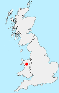
Location Map
Snowdonia/Eryri Guide
Walking in TSnowdonia (Eryri) National Park is much more than the highest mountain in England and Wales. Mainly mountainous, it encompasses a large area of beautiful and often spectacular wild landscapes. Located in North Wales, the National Park offers a tremendous variety of walks with many challenging mountain routes.
Snowdonia Walking Guide
Other walks in Britain - For a list of all the areas where walks are available go to the Main Walk Index.
Walk grading - Learn how each walk is assessed and select a walk to suit your ability and experience by going to Walk Grading Details.
Messaging & Social Media
Message Walking Britain and follow the latest news.

Mountain Weather
Stay safe on the mountains with detailed weather forecasts - for iOS devices or for Android devices.