Coombs Dale, Longstone Edge & Pilsley from Calver
Peak District Walk
Nat Park - Peak District - Abney Moor Chatsworth
County/Area - Derbyshire
Author - Peter Schofield
Length - 10.0 miles / 16.3 km Ascent - 1800 feet / 545 metres
Time - 6 hours 50 minutes Grade - moderate
Maps 

| Ordnance Survey Explorer OL24 | Sheet Map | 1:25k | BUY |
| Anquet OS Explorer OL24 | Digital Map | 1:25k | BUY |
| Ordnance Survey Landranger 119 | Sheet Map | 1:50k | BUY |
| Anquet OS Landranger 119 | Digital Map | 1:50k | BUY |
Walk Route Description
Click image to visit gallery of 6 images.
Even though the Peak District is a national park, a good deal of industrial activity still takes place within its boundaries. However nature has reclaimed a number of areas which were once extensively worked, often to the benefit of the local ecology. This walk visits one of those areas and concludes by going through part of the estate of one of our finest stately homes.
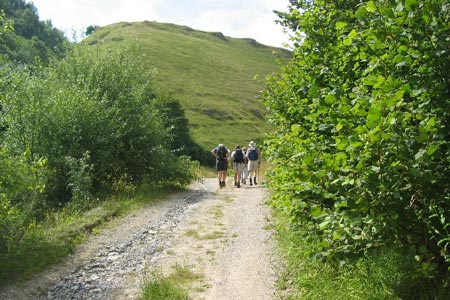
This Peak District walk starts at Calver crossroads (Grid ref. SK239748). Go west along the A623 for 400m before turning left on to the broad track which leads into Coombs Dale, a typical Peakland limestone valley which was once a centre of lead mining. Now its return to nature has made it a wildlife habitat of national importance which is home to a wide variety of flora and fauna and has been awarded SSSI status as a result. Continue up the dale for 3.5K as it gently rises to reach a lane (Grid ref. SK206742) where the modern economy in the form of quarrying temporarily returns.
Go left across the lane through a small gate signposted to Longstone Edge. The route gently climbs to arrive at a quarry access road at the top of the edge (Grid ref. SK205732). Cross the road and bear left over a stile to start the descent of the edge as industry is left behind. The path descends a grassy bank which makes an ideal location for a refreshment stop while to the right, extensive views open out southwards towards Bakewell.
The route continues downhill to reach a stile at the boundary of pasture land. Cross the stile and continue across the pasture for about 500m to arrive at a quiet lane near the hamlet of Rowland. Go left along the lane for 100m towards the houses and at a left hand bend, go right through a stile into a field following a clear path across the fields to reach a road after 400m (Grid ref. SK217722).
Turn left and walk along the road for 600m to Hassop. The wall to your right is the boundary of Hassop Hall, a 17thC house built by the Eyres, a family of local landowners and which is now a hotel. On the opposite side of the road, the classical pile of the Catholic All Saints church dominates the scene. Built for the Eyres in the early 19thC, it is totally out of proportion to the tiny community it serves!
Go right on to the B6001 for 200m to just beyond Home Farm. Turn left along a bridleway which descends to a ford and after crossing the stream, go left at a junction and follow the track as it gently climbs through the woods. The trees are left behind as it levels out to meet the A619 road at GR234713. Turn right along the road for 75m before turning left on to a sometimes muddy track which climbs up the hillside towards woodland above to arrive at a minor road on the edge of Pilsley. Go left along the road into the village to reach a road junction at the "Devonshire Arms".
This area is the Chatsworth Estate and Pilsley is a typical estate village. Both the village school and some of the houses were built around 1840 by Sir Joseph Paxton during his tenure as head gardener at Chatsworth, although other houses in the village date back to more than a century earlier. The village is well worth exploring should time permit.
To continue, go straight on down the minor road towards Baslow as views open out over the Derwent valley with Baslow Edge prominent. After 300m, go left over a stile and cross a pasture before descending steeply to reach the A619. Cross the road and climb steeply up the other side to a lane. Go right along the lane and after 100m, left over a stile. Follow the path for 150m to a wall but do not cross it. Instead, go left parallel to the wall as the path gently climbs over a couple of stiles and Chatsworth House comes into view to the left. Meanwhile on a hillside to the right, a royal "ER" cipher is somewhat oddly picked out in the trees.
The path crosses a field to reach a lane. Go right along the lane for 1.1K and as it starts to descend steeply, go right over a stile into a field and then another one into Bank Wood (Grid ref. SK231722). There is no problem route finding as the path continues along the ridge and further fine views of Chatsworth appear to the right. To the left, the sight of the Back Dale Quarry workings is not quite as appealing!
The route crosses over a lane to continue through Bramley Wood. There are views both up and down the Derwent valley, while Calver lies immediately below. At a path junction (Grid ref. SK242740), go left and descend steeply, crossing a field to arrive in Calver village. Go left and immediately right to the B6001. The crossroads and the start of the walk is just 150m to the right.
For those without their own transport, a reasonably good bus service goes to the start point (shown as Calver Sough in the timetables) with hourly services to Buxton and Sheffield and two hourly to Chesterfield.
Other walks nearby
| Walk 1240 | Curbar, Froggatt & White Edges | easy/mod | 8.0 miles |
| Walk 1169 | Baslow Edge & Wellington's Monument | easy | 3.5 miles |
| Walk 1273 | Burbage Rocks & Padley Gorge from Hay Wood | moderate | 11.0 miles |
| Walk 2515 | The River Derwent, Curbar, Baslow & Froggatt Edges | easy/mod | 7.5 miles |
| Walk 2520 | Higger Tor & the Longshaw Estate | moderate | 9.0 miles |
| Walk 1539 | Flask Edge and Bar Brook Moor from Shillito Wood | moderate | 9.4 miles |
| Walk 1093 | Higger Tor & Burbage Rocks | easy/mod | 5.3 miles |
| Walk 1100 | Abney Moor & Bretton Clough | moderate | 8.5 miles |
| Walk 3018 | Cracknowl and the Monsal Trail | easy | 3.5 miles |
| Walk 1270 | Abney Circular | easy/mod | 7.2 miles |
Recommended Books & eBooks
Walking in the Peak District - White Peak East
 Guidebook describing 42 half-day and day walks in the limestone landscapes of Derbyshire's White Peak, part of the Peak District National Park. One of two volumes, this book covers the east of the region, with potential bases including Bakewell, Eyam, Castleton, Birchover, Matlock and Wirksworth.
More information
Walking in Derbyshire
 Walking guidebook to 60 circular day walks in Derbyshire and the Peak District. Includes the Derwent, Wye and Trent river valleys, near Derby, Matlock, Glossop, Bakewell and Ripley. Routes range from easy to moderate and are between 4 and 14km (2 to 10 miles). Walks focus on places of interest, from Stone Age forts to castles to grand estates.
More information
Messaging & Social Media
Message Walking Britain and follow the latest news.

Mountain Weather
Stay safe on the mountains with detailed weather forecasts - for iOS devices or for Android devices.