Trollers Gill from Burnsall
Yorkshire Dales Walk
Nat Park - Yorkshire Dales - Lower Wharfedale
County/Area - North Yorkshire
Author - Lou Johnson
Length - 9.0 miles / 14.6 km Ascent - 1150 feet / 348 metres
Time - 5 hours 40 minutes Grade - moderate
Maps 

| Ordnance Survey Explorer OL2 | Sheet Map | 1:25k | BUY |
| Anquet OS Explorer OL2 | Digital Map | 1:25k | BUY |
| Ordnance Survey Landranger 98 | Sheet Map | 1:50k | BUY |
| Anquet OS Landranger 98 | Digital Map | 1:50k | BUY |
Walk Route Description
Click image to visit gallery of 6 images.
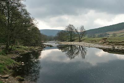
This Yorkshire Dales walk combines a variety of landscapes and starts from the village of Burnsall on the River Wharfe. Nowhere is the going hard although the traverse of Trollers Gill does require some nimble footwork and the occasional use of hands if it is to be safely negotiated.
There are a number of parking options in Burnsall (Grid ref. SE031610) although for the purposes of this description it is assumed you park in the large car park on the west side of the river. After parking cross the bridge over the River Wharfe and fork right following the Dales Way footpath sign to follow the Wharfe downstream.
The path stays close to the river except where it takes a short cuts and should be followed past Appletreewick (which is across the fields to your left) as far as the minor road (Grid ref. SE 060592). Go straight across and up the lane to Howgill (Grid ref. SE 063591). Turn left here and continue past the caravan site on your left to reach a signed path on your left (Grid ref. SE 065594). Fork left here and cross fields to reach the road in Skyreholme (Grid ref. SE 065603). Turn right along this quiet lane as far as the road junction at Middle Skyreholme.
Turn right at the junction and continue for a short way before taking the footpath on your left. This takes you across pastures to Ridge End Cottage (refreshments in season). Exit onto the lane and turn left. A short way down the lane take the footpath signed on your right. Stay on the valley floor following the course of Skyreholme Beck. Ignore the path forking left and stay with the beck as it enters Trollers Gill. Some care is needed as you make your way through this narrow cleft. Under normal circumstances the gill is dry or the water very shallow. After heavy or prolonged rain the stream may flow through Trollers Gill and this may make the walk through the narrow cleft a lot more difficult. You may find you will have to seek an alternative route.
Exiting Trollers Gill stay in the valley for approximately 400 metres. Cross the stile on your left and follow the path uphill towards the road (Grid ref. SE 063622). Turn left along the road. Turn right along the bridleway that crosses Appletreewick Pasture in a southwesterly direction. The going is good and excellent progress is made downhill to enter Kail Lane for the final descent into the valley. Reaching a road (Grid ref. SE 040607) go straight across to reach the Dales Way. Turn right and follow the path used on the outward route back to Burnsall village.
Other walks nearby
| Walk 2610 | Hebden Gill & Cupola Corner | easy/mod | 6.5 miles |
| Walk 2611 | Hebden Gill from Hebden | easy | 4.0 miles |
| Walk 1576 | Embsay Reservoir | easy | 1.0 miles |
| Walk 1292 | Linton & Thorpe Fell & Cracoe | moderate | 9.0 miles |
| Walk 1407 | Thorpe & Burnsall from Linton | easy/mod | 6.2 miles |
| Walk 1145 | Grassington, Mastilles Lane & Conistone Dib | moderate | 11.3 miles |
| Walk 1645 | Grassington, Mastilles Lane & Conistone Dib | moderate | 12.0 miles |
| Walk 1846 | Garnshaw House & Linton Falls from Grassington | easy | 3.0 miles |
| Walk 1946 | Valley of Desolation & Simon's Seat | moderate | 8.4 miles |
| Walk 1573 | Grimwith Reservoir | easy | 4.5 miles |
Recommended Books & eBooks
Walking in the Yorkshire Dales: North and East
 This guidebook contains 43 circular day walks in the north and east Yorkshire Dales. It explores the dales, hills and moors between Kirkby Stephen and Pateley Bridge. Walking ranges from gentle 3 mile strolls to more strenuous day-long rambles across the Howgills, Wensleydale, Swaledale, Nidderdale, Mallerstang and Coverdale.
More information
Trail and Fell Running in the Yorkshire Dales
 Guidebook to 40 of the best trail and fell runs in the Yorkshire Dales National Park. Ranging from 5 to 24 miles, the graded runs start from bases such as Ribblehead, Dent, Sedbergh, Malham and Grassington and take in the region's diverse delights, from castles and waterfalls to iconic mountains such as Whernside, Ingleborough and Pen Y Ghent.
More information
Messaging & Social Media
Message Walking Britain and follow the latest news.

Mountain Weather
Stay safe on the mountains with detailed weather forecasts - for iOS devices or for Android devices.