Thames Path - Cutty Sark to Tower of London
London Walk
County/Area - London
Author - Lou Johnson
Length - 6.0 miles / 9.8 km Ascent - 50 feet / 15 metres
Time - 3 hours 0 minutes Grade - easy
Maps 

| Ordnance Survey Explorer 161 | Sheet Map | 1:25k | BUY |
| Anquet OS Explorer 161 | Digital Map | 1:25k | BUY |
| Ordnance Survey Explorer 173 | Sheet Map | 1:25k | BUY |
| Anquet OS Explorer 173 | Digital Map | 1:25k | BUY |
| Ordnance Survey Landranger 176 | Sheet Map | 1:50k | BUY |
| Anquet OS Landranger 176 | Digital Map | 1:50k | BUY |
| Ordnance Survey Landranger 177 | Sheet Map | 1:50k | BUY |
| Anquet OS Landranger 177 | Digital Map | 1:50k | BUY |
Walk Route Description
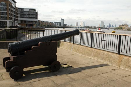
Click image to visit gallery of 15 images.
This walk from Greenwich Pier to the Tower of London follows the Thames Path on the south bank of the river. As for most of its route through London there is a "Thames Path" on either side of the river although do remember opportunities for crossing the Thames are limited and you need to plan ahead if you wish to swap sides of the River. This section of the Thames Path leaves the river on a number of occasions although overall most of the walk is alongside the river. Generally signs are in place although in one or two places these are inadequate and you need a detailed map and a good sense of direction.
From the Cutty Sark, walk upstream with the river on your right. Almost immediately you will leave the Thames to cross the Ravensbourne River. This diversion was reasonably well signed when the route was researched and a right run across the river alongside the main road followed by another right turn back to the River is fairly straightforward. Shortly after rejoining the Thames another diversion takes you through the streets of Deptford. This section is fine if you have a map but the signs leave something to be desired. Assuming you have discovered the way and crossed the park at grid ref. TQ367783 you will arrive back alongside the Thames.
Across the River is the Isle of Dogs with Canary Wharf dominating the skyline ahead. With the path staying by the river you reach Greenland Pier followed by Greenland Dock which is crossed by a pedestrian bridge. Back alongside the Thames a short diversion away from the river leads you to City Farm where refreshments may be available in the café. Reaching the Hilton Docklands Pier another diversion is well signed and you are soon back alongside the Thames. As the path turns west across the river is Limehouse. You have now reached Lower Pool and soon cross the Rotherhithe Tunnel.
The path now leaves the riverside again taking you past The Brunel Museum on your right. If the weather is bad you can escape to Rotherhithe Tube station here.
Tower Bridge is now getting closer and the relative solitude you have enjoyed since leaving Greenwich is about to be broken. The final diversion away from the River in Bermondsey soon has you back with the Thames and an excellent view of Tower Bridge ahead. Continue along the Thames Path and walk under the subway at Tower Bridge climbing the stairs to reach the bridge deck. You are now part of the tourist trail and crowds abound for the final stretch over the river to the Tower of London which is on your left. Close by is Tower Hill tube station and a Docklands Light Railway station.
Other walks nearby
| Walk 1398 | Greenwich Museum, Observatory & Park | easy | 2.3 miles |
| Walk 1470 | Thames Path - North Greenwich to Cutty Sark | easy | 2.5 miles |
| Walk 3084 | Limehouse to Little Venice by the Regent's Canal | easy/mod | 9.0 miles |
| Walk 1882 | The Limehouse Cut from Bow Locks | easy | 2.0 miles |
| Walk 2651 | The City of London from Hays Galleria | easy | 3.5 miles |
| Walk 1412 | The Monument to Trafalgar Square via Southwark | easy | 4.0 miles |
| Walk 1442 | St Paul's Cathedral to Green Park | easy | 5.6 miles |
| Walk 1310 | Chancery Lane to Trafalgar Square | easy | 4.0 miles |
| Walk 1570 | Westminster to Green Park via St. Paul's | easy/mod | 5.5 miles |
| Walk 3013 | Trafalgar Square circular | easy | 3.0 miles |
Recommended Books & eBooks
Walking in London
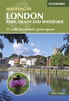 A guidebook to 25 walks in London's green spaces and nature reserves, covering both the city centre and Greater London area. Taking in woods and forests, parks and heaths, canals and rivers, the guide includes a wealth of information about some of the species you might encounter as well as the history and conservation of these areas.
More information
The Thames Path Map Booklet
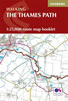 Map of the 180 mile (288km) Thames Path National Trail, from London's Thames Barrier to the river's source near Cirencester in Gloucestershire. This booklet is included with the Cicerone guidebook to the trail, and shows the full route on OS 1:25,000 maps. The easy riverside route takes around two weeks to walk.
More information
Messaging & Social Media
Message Walking Britain and follow the latest news.

Mountain Weather
Stay safe on the mountains with detailed weather forecasts - for iOS devices or for Android devices.