Flamborough Head from Flamborough
Yorkshire Wolds Walk
Region - Yorkshire Wolds
County/Area - East Yorkshire - Yorkshire Wolds
Author - Andy Chaplin
Length - 9.7 miles / 15.8 km Ascent - 915 feet / 277 metres
Time - 5 hours 50 minutes Grade - easy/mod
Maps 

| Ordnance Survey Explorer 301 | Sheet Map | 1:25k | BUY |
| Anquet OS Explorer 301 | Digital Map | 1:25k | BUY |
| Ordnance Survey Landranger 101 | Sheet Map | 1:50k | BUY |
| Anquet OS Landranger 101 | Digital Map | 1:50k | BUY |
Walk Route Description
Click image to visit gallery of 3 images.
With the North Yorks Moors so near it is easy to be a bit dismissive about East Yorkshire but a walk around Flamborough Head should serve to demonstrate that parts of this coast are as fine as anything further north. Park in Flamborough on Chapel Street (grid ref TA227706) where there is plenty of on road parking and the luxury of public toilets too.
Walk south down Tower Street, then follow the main route out westwards on Church Street and then Bridlington Road. At Water Street turn off left then take the fenced path off as the road bends round to the left - it is signed to Dane's Dyke. The path meets the corner of the Needles Plantation where a path is signed through the trees to the Dane's Dyke nature reserve.
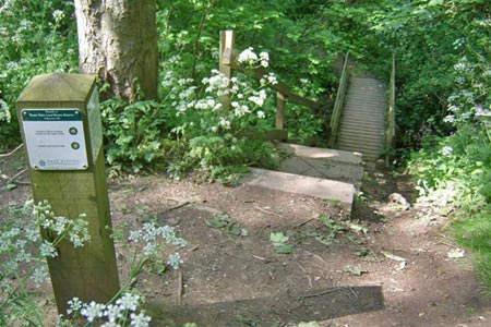
After half a mile in the trees you come to a fork in the paths and it is worth taking the right hand one down, then over the dyke on the footbridge. It gives some feel for the extent of this defensive dyke that stretches from coast to coast across the Head. Take the path to the left then rather than going to the parking/café keep on downhill to the beach. There are views eastwards along the cliffs and westwards to Bridlington.
Retrace your steps then take the steps up the cliffs on your right. From here it is 7 miles around the headland with some great sights on the way round - South Landing, Cough Hole, the Fog Signal Station and Lighthouse, Breil Nook, North Landing and Thornwick Bay. If you go in late spring or early summer the bird displays and noise is stunning.
After you have passed the Thornwick Bay café and continued west of the holiday/caravan park there is a path signed inland before Close Nooks which follows the fence next to the holiday park all the way back to Woodcock Road and then Chapel Street.
Other walks nearby
| Walk 2264 | Bridlington & Flamborough Head | easy/mod | 6.8 miles |
| Walk 3428 | Boynton from Rudston Circular | easy | 6.5 miles |
| Walk 1433 | Martin & Metheringham circular | easy | 6.3 miles |
| Walk 1630 | Filey, Camp Dale & Hunmanby | moderate | 10.5 miles |
| Walk 3247 | Stockingdale and Muston from Hunmanby | easy/mod | 7.8 miles |
| Walk 2482 | Fordon and Dales Circular | easy/mod | 5.2 miles |
| Walk 1631 | Scarborough to Filey | moderate | 10.2 miles |
| Walk 3740 | Cowlam & Cottam Circular | easy/mod | 8.0 miles |
| Walk 1575 | Tophill Reservoir | easy | 3.0 miles |
| Walk 1564 | Hayburn Wyke from Scalby | moderate | 10.2 miles |
Recommended Books & eBooks
No suggestions for this area.Messaging & Social Media
Message Walking Britain and follow the latest news.

Mountain Weather
Stay safe on the mountains with detailed weather forecasts - for iOS devices or for Android devices.