Moel Arthur and Penycloddiau
Clwydian Hills Walk
Region - Clwydian Hills
County/Area - Flintshire & Denbighshire
Author - Lou Johnson
Length - 7.5 miles / 12.2 km Ascent - 1255 feet / 380 metres
Time - 5 hours 0 minutes Grade - moderate
Maps 

| Ordnance Survey Explorer 265 | Sheet Map | 1:25k | BUY |
| Anquet OS Explorer 265 | Digital Map | 1:25k | BUY |
| Ordnance Survey Landranger 116 | Sheet Map | 1:50k | BUY |
| Anquet OS Landranger 116 | Digital Map | 1:50k | BUY |
Walk Route Description
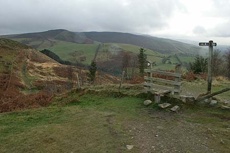
Click image to visit gallery of 6 images.
This walk visits the fort at Penycloddiau and takes you onto the highest summit of the Clwydian Hills, Moel Arthur, using a section of the Offa's Dyke National Trail. The walk offers some fine views as far afield as Snowdonia (Eryri) in periods of clear visibility. The start is the car park (grid ref. SJ139668) on the minor road across the hills between the village of Nannerch and Llangwyfan.
Exit the car park and turn north (right) onto the Offa's Dyke National Trail. The first section leads up along the edge of a forest to reach open country at a stile. Just after this stile you cross the outer ditch of the Penycloddiau Fort. The way ahead continues uphill along the ridge to reach the summit of the hill from where you can get a good idea of the size of this ancient fort. Staying on the Offa's Dyke path, descend north to the next col below Moel y Parc (Grid ref. SJ121689). Here a number of paths and tracks meet.
Turn sharp right here and follow the enclosed track for about 300 metres. At the end of this track take the gate on your right (Grid ref. SJ124689) and continue across fields and past a ruined building to reach a path junction (Grid ref. SJ135683). Go right here and continue to reach an enclosed track on the approach to Pen-y-bryn farm (Grid ref. SJ140680). Where the track bends to the left, go right through a gate and then immediately left with the hedge to your left. Cross the track leading to Blaen-y-cwm and continue to reach a lane (Grid ref. SJ145679).
Cross this lane and walk up the access road to Bryn-ffynnon and turn left over a stile. The route climbs steeply up a field to join a track. Follow this track until it fades and then go half left across the next field to a stile. Continue uphill over grass aiming for the right hand side of small conifer plantation ahead where you join a track (Grid ref. SJ155677). Turn right along this track and follows it for 2 km to a lane in to the col (Grid ref. SJ147657) just to the south of Moel Arthur. Reaching the small car park, turn right through a kissing gate and follow the path as its climbs across the eastern flank of Moel Arthur. A few minor paths go off left if you want to explore the summit otherwise stay on the Offa's Dyke path as it descends to a lane. The start is a few yards along this lane to the right.
Other walks nearby
| Walk 2509 | Moel Arthur & Moel Famau | moderate | 10.0 miles |
| Walk 2550 | Cilcain, Moel Arthur & Moel Famau | mod/hard | 13.0 miles |
| Walk 1912 | Moel Famau and the Clwydian Hills | moderate | 7.0 miles |
| Walk 1528 | Moel Famau | easy/mod | 10.0 miles |
| Walk 1259 | Foel Fenli & Moel Famau from Loggerheads | moderate | 9.5 miles |
| Walk 3655 | Rhewl, Moel y Gamelin & Moel Morfydd | moderate | 5.4 miles |
| Walk 1067 | Ruabon Mountain & The Limestone Edges of Llangollen | moderate | 11.0 miles |
| Walk 1845 | Castell Dinas Bran from Llangollen | easy/mod | 4.0 miles |
| Walk 2598 | Ruabon Mountain, World's End & Panorama Circular | moderate | 12.5 miles |
| Walk 2460 | Pontcysyllte Aqueduct Circular | easy | 4.5 miles |
Recommended Books & eBooks
No suggestions for this area.Messaging & Social Media
Message Walking Britain and follow the latest news.

Mountain Weather
Stay safe on the mountains with detailed weather forecasts - for iOS devices or for Android devices.