Tyrrel's Wood and Boudicca Way
Norfolk Walk
County/Area - Norfolk
Author - Norfolk Ramblers
Length - 8.5 miles / 13.8 km Ascent - 200 feet / 61 metres
Time - 4 hours 30 minutes Grade - easy/mod
Maps 

| Ordnance Survey Explorer 230 | Sheet Map | 1:25k | BUY |
| Anquet OS Explorer 230 | Digital Map | 1:25k | BUY |
| Ordnance Survey Explorer 237 | Sheet Map | 1:25k | BUY |
| Anquet OS Explorer 237 | Digital Map | 1:25k | BUY |
| Ordnance Survey Landranger 134 | Sheet Map | 1:50k | BUY |
| Anquet OS Landranger 134 | Digital Map | 1:50k | BUY |
| Ordnance Survey Landranger 156 | Sheet Map | 1:50k | BUY |
| Anquet OS Landranger 156 | Digital Map | 1:50k | BUY |
Walk Route Description
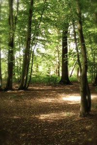
Click image to visit gallery of 3 images.
This walk starts from the car park at the southern end of Tyrrel's Wood. It is along Wood Lane, a turning off A140 about two miles south of Long Stratton. The wood, an SSSI, is owned and managed by the Woodland Trust. The Boudicca Way (BW) is a 36 mile walkers' route between Norwich and Diss, at the time of writing it is being upgraded and should be in good order by the time this is published. For more information visit www.boudiccaway.co.uk.
If the BW waymarks are all in place just follow them through the wood starting along the track from the car park. If in doubt bear left on a wide path at a fork, continue to a water course and cross a broad bridge to go ahead along path with boardwalk. When this path splits the direct route bears left, but it could be easier to go ahead to edge of the wood and turn left along boundary and follow it round to a BW sign (the first we saw when planning this walk). Keep to the path bearing right and north, join a right of way and continue out of the wood to join a road on a corner. Turn right for a short distance, then, still following BW, turn right just beyond a farm, along edge of Wood Green.
At a junction with a surfaced road leave the BW and turn right, first along a field edge path. All the definitive rights of way in this section have been realigned for quite logical reasons, but as these routes do not coincide with the OS map finding the way can be rather tricky. Follow the reinstated route forking left across the field - if at any time you find it unclear you may continue ahead along the field edge, then left at the field corner. On reaching the opposite corner go south through the field boundary then (again on a straightened version of the right of way) diagonally left across a field (again you may follow the field edge track if necessary). Go straight across Anson's Lane to follow a line at a right angle from the lane and go ahead through a gap on the opposite side of the field, then bear a little to the right and continue in a straight line to meet Hall Lane opposite another footpath. (If the route is not clear you could follow field edges commencing with the small wood on your right and eventually joining Hall Lane near Hardwick Hall)
Turn right along Hall Lane and right again along Mill Road. Cross Mill Lane to a footpath and keep ahead over two fields to join a short track, turn right along a road. Turn left on a footpath along a driveway, follow right fork towards Elmtree Farm, and bear left shortly before the farm. Follow a clear waymarked path, soon along a field edge then over a culvert and bear a little to the right across a field aiming for a corner with a waymark then out to the road. Turn right for a few yards then left along a field edge path. Follow the right edge then ahead across a field, over a footbridge and turn right. Follow the watercourse to a road, turn right and almost immediately left along Barnes Road.
Turn right through a narrow gap on a signed footpath, down steps, across a narrow field, then follow the clear path through a patch of woodland and over bridges. Follow path round to meet a field edge and BW, turn very sharply right, keep right on better field edge when they divide. Follow right edge into the narrow end of a field then wind round to go through small wood. Continue along right edges, over a footbridge then follow a cross field path. Rejoin right edge then turn right over bridge then shortly left. Immediately before Duck's Foot Road turn left over bridge and follow path alongside road to a corner, turn right across the road to a cross field path to Hardwick Road. Turn left, then left again a crossroads and return to Tyrrel's Wood.
Norfolk Ramblers welcome new members. If you are interested in walking in the company of like-minded people, visit www.norfolkra.org.ukor call 01508 538654. For queries about this walk phone 01953 861094
Other walks nearby
| Walk 3348 | River Yare & Claxton from Rockland Staithe | easy | 5.2 miles |
| Walk 2446 | Rockland St Mary Circular | easy/mod | 8.1 miles |
| Walk 3603 | Blythburgh from Wenhaston | easy | 5.0 miles |
| Walk 2127 | The Brecks from near Thompson | easy | 6.8 miles |
| Walk 2237 | Somerleyton & Herringfleet Hills | easy | 3.5 miles |
| Walk 2239 | River Bure and Tunstall Dike from Acle | easy | 6.1 miles |
| Walk 2240 | The River Bure & Upton from Acle | easy | 5.0 miles |
| Walk 2320 | Muck Fleet & River Bure from near Oby | easy/mod | 8.7 miles |
| Walk 1775 | Walberswick Circular | easy | 4.5 miles |
| Walk 2014 | Southwold | easy | 4.0 miles |
Recommended Books & eBooks
No suggestions for this area.Messaging & Social Media
Message Walking Britain and follow the latest news.

Mountain Weather
Stay safe on the mountains with detailed weather forecasts - for iOS devices or for Android devices.