Bristol Religious Trail
Bristol Walk
County/Area - Bristol
Author - Bristol Tourism & Conference Bureau
Length - 1.5 miles / 2.4 km
Ascent - nominal or unknown
Time - 0 hours 50 minutes Grade - easy
Maps 

| Ordnance Survey Explorer 155 | Sheet Map | 1:25k | BUY |
| Anquet OS Explorer 155 | Digital Map | 1:25k | BUY |
Walk Route Description
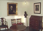
Click image to visit gallery of 2 images.
In medieval times Bristol became a centre for Christianity and churches, chapels, friaries, hospitals & almshouses were established. A Jewish community thrived in the city until expulsion in 1290, and the oldest known Hebrew inscription in Europe has been found above a Jewish ritual bath in Jacob's Wells Road. Queen Mary's bloody reign saw the burning of martyrs at St Michaels Hill, and in more tolerant times Huguenots were allowed to worship in The Lord Mayor's Chapel after exile from France. Bristol, however, is unique in its links with non-conformist denominations and their spread to the New World. It is these links which will be explored.
The walk will take approximately two hours.
1. Leave St Nicholas Church (closed to the public) in St Nicholas Street, turn right, then left to come to the intersection of Broad Street, Corn Street and the High Street.
2. In the early 17th century radical Protestants or Puritans began to meet in Bristol. They were encouraged by Matthew Hazzard the vicar of St Ewen's Church, which stood in Corn Street, and by his wife who bravely allowed gatherings to take place in her house in Broad Street. Puritans suffered much persecution and a group sailed to the New World in 1620 aboard the Mayflower, crewed by Bristol seamen.
3. Walk along Wine Street and turn second left into Union Street.
4. In 1640, a Baptist congregation formed in Broadmead, and from 1672 they met in Broadmead Baptist Church, (on the right at the bottom of Union Street), which had previously been used by Quakers. On the first floor of the present church are memorials which record the trials faced by early Baptists, and a stair rope is a reminder of the time when women and girls would block the stairway, grimly hanging onto the rope, to stop officers gaining entry to the worshippers above.
5. Retrace your steps and turn left into Broadmead. Walk straight ahead until turning right into Quaker's Friars.
6. Bristol's links with the Society of Friends date back to the 1650s with the arrival of missionaries from Swarthmoor Hall in Cumbria. Meetings took place in a house in Broadmead until this site, originally a Dominican Friary, was purchased in 1669, where William Penn, founder of Pennsylvania, was a visitor. William Penn's father, Admiral Sir William Penn, had loaned money to King Charles II, who granted the Admiral's son territory in America as a settlement. William and his wife Hannah lived in Bristol until first going to Philadelphia in 1699. The meeting-house was replaced in the 1740s and a new schoolroom added. James Logan, who followed his father Patrick as teacher, travelled to Pennsylvania as secretary to William Penn in 1699 and became Chief Justice and Governor of the State.
7. From Quakers Friars walk to Penn Street and turn left.
8. Missionary Baptists were killed in the 17th century and outsiders discouraged. George Whitefield, a friend of John Wesley, successfully preached to the mob and joined by Wesley in 1739, became very popular with the common people although attracting much hostility from the established Church. Whitefield was more inclined to Calvinism, erecting a Tabernacle in this street in 1753, and the two friends fell out.
9. Continue to the Horsefair where John Wesley's Chapel, the oldest Methodist building in the world, is at the far end on the left.
10. John Wesley purchased this plot of land in 1739 for the building of a Chapel, or New Room. This became an important centre of the Methodist Movement. It was from here that Francis Asbury left for America in 1771. Asbury spent 45 years travelling across the country and was described by the American President as one of the builders of the nation. Today, the world Methodist community numbers 60,000,000 - and it all started in this chapel. A fascinating museum above the Chapel contains many Wesley artefacts and is certainly worth a visit.
11. Leave the Horsefair and bear right. Cross under St James Barton taking the second exit, (straight ahead), and turn left. Turn right into Charles Street.
12. John Wesley was joined in his work by his brother Charles. In 1749 Charles settled into this street with his wife Sally and remained here until 1771. Number 4, (his main address), has been restored and was opened to the public in 1997. Charles is best known for his beautiful hymns, many of which were composed in Bristol. His was a very musical family as two of his sons became famous composers.
13. Turn left at the end of Charles Street and left again into Dighton Street.
14. At number 6 (now destroyed) John Wesley chose Dr Thomas Coke as Superintendent of work in America and ordained two presbyters Richard Whatcoat and Thomas Vasey as elders for service in America. The first act that Dr Coke performed on arrival in America was to ordain Francis Asbury. They became joint Superintendents (later Bishops) of America.
15. Walk to the end of the street and turn right. Cross at the pedestrian crossing and turn into Lower Maudlin Street.
16. St James Church, at the far end, was originally a priory and parts date back to the early 12th century. It was the parish church of the Wesleys and a solitary gravestone commemorates some of the children of Charles and Sally Wesley. Out of eight children, five died in infancy. The only girl to survive returned to live in Bristol at the age of 60 and is buried here with her infant brothers and sisters.
17. Turn right and walk down Lewins Mead.
19. Cross at the lights, bear right, cross at the next lights and walk up Christmas Street. Turn left into Nelson Street and right into All Saints Street to come to The Pithay.
20. A large bowling green stood here, and George Whitefield used this site for open air meetings in the 1730s.
21. Turn right at the top of the slope and follow the route back along High Street to St Nicholas Street.
22. This thoroughfare and Baldwin Street, on the other side of the Church were the scene of many early Quaker meetings.
Further information about walks can be obtained from Bristol Tourist Information Centre on 0117 926 0767 who are located at Wildscreen Walk, The Harbourside, Bristol (by the Explore-at-Bristol building)
Other walks nearby
| Walk 1518 | Brunel's masterpieces and the Avon Gorge | easy | 4.0 miles |
| Walk 1567 | Keynsham to Bath on the south side of the Avon | easy/mod | 11.1 miles |
| Walk 2426 | Wraxall circular from Tyntesfield | easy | 3.2 miles |
| Walk 3278 | Hinton & Dryham Circular | easy | 3.0 miles |
| Walk 2097 | Blagdon Lake | easy/mod | 5.7 miles |
| Walk 2804 | Bath to Keynsham over Kelston Round Hill | easy/mod | 9.0 miles |
| Walk 3437 | The Severn Estuary from Thornbury | easy/mod | 9.3 miles |
| Walk 3332 | Cameley & Hinton Blewett from Litton | easy | 5.6 miles |
| Walk 1891 | Solsbury Hill from Northend | easy | 3.0 miles |
| Walk 2087 | The Cam Brook Valley from Southstoke | easy | 5.5 miles |
Recommended Books & eBooks
No suggestions for this area.Messaging & Social Media
Message Walking Britain and follow the latest news.

Mountain Weather
Stay safe on the mountains with detailed weather forecasts - for iOS devices or for Android devices.