Hertfordshire Way from Nuthampstead to Great Hormead
Hertfordshire Walk
County/Area - Hertfordshire
Author - Donald Morton
Length - 10.0 miles / 16.3 km Ascent - 500 feet / 152 metres
Time - 5 hours 30 minutes Grade - easy/mod
Maps 

| Ordnance Survey Landranger 166 | Sheet Map | 1:50k | BUY |
| Anquet OS Landranger 166 | Digital Map | 1:50k | BUY |
| Ordnance Survey Landranger 167 | Sheet Map | 1:50k | BUY |
| Anquet OS Landranger 167 | Digital Map | 1:50k | BUY |
Walk Route Description
Click image to see photo description.
Nuthampstead is a hamlet within the parish of Barkway about 5 miles SE of Royston. This circular walk as described starts at the public telephone box in Nuthampstead (Grid Ref TL401347).
Having parked at the side of the road by the phone box, walk east through the collection of varied cottages which make up this hamlet and continue to a junction. Here turn right (signed Anstey) to join the Hertfordshire Way and walk along the lane to the Woodman pub. Just before the pub is a memorial to the men of the 398th Bombardment Group USAF. Turn left between this memorial and the pub, cross the pub car park and continue down a green path with a hedge on the left and you will come out onto the site of the airfield from which this group operated from 1944 through 1945, preceded by a fighter group from 1943.
The green path becomes worn concrete which terminates at the airfield perimeter track. Turn right and walk along the now rapidly disintegrating concrete through a quiet rural scene of fertile arable fields. But as you walk in the peace imagine, if you will, the war time scene: B17s on their dispersal points being made ready by their ground crews, bombs being loaded, crews arriving and then a procession of aircraft round the perimeter to line up for take off on the main runway, some for the last time. You get to the remains of this main runway on your left just after a belt of trees and here you turn right down the side of woods on the left. Ignore a footpath going left and continue along the side of the woods, curving left.
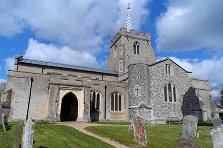
At the end of the woods go straight on to pass farm buildings on the left. Once past the farm buildings dog leg left (through a fence) and right down a track to the road. Turn right and then left at a junction to pass through the village of Anstey. As you go there is the old well head and winding machinery on the right, the Blind Fiddler pub (previously The Chequers) on the left, an old AA distance roundel (London 34) on the wall of Rose Cottage on the right and the Norman church of St George also on the right with its lych-gate unusually incorporating the village lock-up. (A detour round the back of the church brings you to the moat which surrounded the one time Norman castle and was the last resting place of a B17 which crashed after takeoff.)
At the church the road swings left. When it swings right again, leave the road to follow the footpath going left. Follow this broad green track to the end of the first field and then turn left to go up hill - hedge on left. When the path becomes an enclosed track look out for a waymark with bridge and kissing gate on the right. From the gate go diagonally across the meadow to a kissing gate left to the left of a cottage and then along a cut path through a wildlife meadow to the road. Cross the road and go straight on down a gravel track. The track becomes rubble, does a left/right dogleg through a hedge, becomes grass and at a field corner turns right and then left over a bridge and through a hedge gap.
From here if the way over the next arable field is not well trod aim for the middle of the three ETL pylons seen ahead. Emerge on to a lane and turn right. After a little while the road runs under the ETL. Where the road and the ETL start to diverge turn left along a broad track down the field edge - hedge on right. Just after entering a farm yard look for a stile on the right. Go slightly diagonally left over the next field to a second stile. Once over this turn left along the field edge to a wide hedge gap. Dogleg left and right through this to continue down what appears to be a tarmac drive but which becomes a public lane leading out onto the B1038. Here turn right and, leaving the Hertfordshire Way, walk along to The Three Tuns pub.
Opposite the pub turn right up a quiet lane. Follow this to a road junction and turn left onto a bridleway. This goes down a field edge - hedge on left - to a concrete bridge and a gate into a paddock before what appears to be a modern faux timbered house. Turn right to walk with a fence on the left, a ditch on the right. This path turns left to come to a drive: turn left and follow the drive to the B1368 (Grid Ref TL 393 309). Turn right, walk about 100yds and turn left down a broad green track (designated as a road used as a public path with no sign but a warning that motorcycles are illegal). After this passes under an ETL and before the brow of the hill look out for a waymark on the right. Turn right here and follow the field edges - hedge on right - until you arrive at Beauchamps, an 18th Century house but looking older since it was the last timber dwelling of this status to be built in the county. It is protected by a moat, and carefully planted trees ensure that only glimpses are to be had as one turns right to follow a concrete drive round the perimeter. Follow the concrete drive out to the road, where across to the left is a good view of Wyddial Hall, a late 18th Century mansion. Turn right and follow this fairly quiet road to the junction with the B1368 at Cave Gate. Cross over and continue up the quiet lane opposite to a T-junction. Here turn left (unsigned road) and when you reach the junction by the golf club turn right to arrive back in about1/4 mile at Nuthampstead.
Other walks nearby
| Walk 2107 | Reed to Nuthampstead Circular | easy/mod | 7.3 miles |
| Walk 1118 | Roe Green and Sandon from Therfield circular | easy/mod | 7.3 miles |
| Walk 1812 | Therfield to Royston & Reed Circular | easy/mod | 10.0 miles |
| Walk 2306 | Furneux Pelham Circular | easy/mod | 7.0 miles |
| Walk 1599 | Therfield Heath circular from near Royston | easy/mod | 6.5 miles |
| Walk 1663 | Cottered Warren & Wakeley | easy | 6.4 miles |
| Walk 2411 | Albury Circular | easy/mod | 7.5 miles |
| Walk 1265 | Clothall & Roe Green | easy/mod | 7.3 miles |
| Walk 2970 | The Beane Valley from Walkern to Hertford | moderate | 14.3 miles |
| Walk 1503 | Weston & Clothall circular Weston | easy | 5.5 miles |
Recommended Books & eBooks
No suggestions for this area.Messaging & Social Media
Message Walking Britain and follow the latest news.

Mountain Weather
Stay safe on the mountains with detailed weather forecasts - for iOS devices or for Android devices.