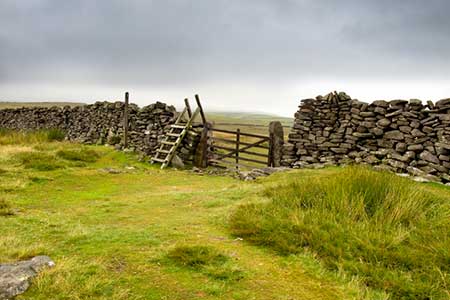
Capplestone Gate & Conistone Pie from Conistone
Yorkshire Dales Walk
Nat Park - Yorkshire Dales - Upper Wharfedale
County/Area - North Yorkshire
Author - David McMahon
Length - 6.8 miles / 11.1 km Ascent - 1300 feet / 394 metres
Time - 4 hours 40 minutes Grade - easy/mod
Maps 

| Ordnance Survey Explorer OL2 | Sheet Map | 1:25k | BUY |
| Anquet OS Explorer OL2 | Digital Map | 1:25k | BUY |
| Ordnance Survey Landranger 98 | Sheet Map | 1:50k | BUY |
| Anquet OS Landranger 98 | Digital Map | 1:50k | BUY |
Walk Route Description
Click image to see photo description.
This Yorkshire Dales walk offers some of the best limestone scenery that Wharfedale offers. The route takes you high above the dale with some glorious views so do choose a fine day to take this walk. Parking is at a premium in Conistone, so leave the Grassington to Kettlewell Road just before Kilnsey Crag, and park on the downstream side of the bridge over the Wharfe (grid ref. SD978675).
From the bridge walk into the village. In the centre continue past the maypole and take the left hand lane to a gate. Continue uphill on a very stony surface. The path (now the Dib) narrows and you find yourself walking through a high-sided limestone gorge to arrive at an open area, where the gully spreads wide, and the sides are covered with vast spills of limestone rocks that are most dramatic. The path is easy to follow and you will arrive at a second gate (grid ref. SD990679). Ignore the path going right to Grassington and continue ahead. The path continues to climb steadily to reach a junction with the Dales Way (grid ref. SD992682). Turn left along the Dales Way for a short distance to turn right onto a track known as Bycliffe Road.
This track continues to climb and becomes enclosed by walls. Reaching a junction of tracks and paths where Bycliffe Road goes sharp right (grid ref. SD997686), go left through a gate and follow a track/path towards a small plantation. The path climbs across the hillside passing to the right of the plantation and continues to pass a small rocky outcrop to pass through a gate and make for the OS trig point at Capplestone Gate (grid ref. SE001699).
To continue follow the sometimes indistinct path that heads just east of north for just over 800 metres to a stile in the wall on your left (grid ref. SD997708). The path descends steeply at first and continues roughly south-west becoming a clearer track as you descend. Exit this field through a gate (grid ref. SD984704) near the right-hand corner of this long field. Continue heading roughly north-west towards a gate into a plantation (grid ref. SD981705). Do not go through the gate but turn sharp left and follow the level path. You are back on the Dales Way and this should be followed for just over one and a half miles. On the way you will pass the distinctive Conistone Pie on your right before reaching Bycliffe road again (grid ref. SD992682).
Turn right down the Bycliffe Road (now named Scot Gate Lane on OS maps), with Conistone Dib below on your left. The track passes a radio mast on your right and then descends Wassa bank towards the Conistone to Kettlewell road. Turn left along this to return to the start.
Other walks nearby
| Walk 2332 | Mastilles Lane & Bordley from Kilnsey | easy/mod | 6.8 miles |
| Walk 1145 | Grassington, Mastilles Lane & Conistone Dib | moderate | 11.3 miles |
| Walk 1645 | Grassington, Mastilles Lane & Conistone Dib | moderate | 12.0 miles |
| Walk 1846 | Garnshaw House & Linton Falls from Grassington | easy | 3.0 miles |
| Walk 1250 | Great Whernside | moderate | 8.0 miles |
| Walk 1277 | Starbotton & Kettlewell circular | easy/mod | 5.0 miles |
| Walk 1294 | Arncliffe & Kettlewell Circular | moderate | 7.0 miles |
| Walk 1632 | Arncliffe & Starbotton from Kettlewell | moderate | 7.0 miles |
| Walk 1292 | Linton & Thorpe Fell & Cracoe | moderate | 9.0 miles |
| Walk 1407 | Thorpe & Burnsall from Linton | easy/mod | 6.2 miles |
Recommended Books & eBooks
Trail and Fell Running in the Yorkshire Dales
 Guidebook to 40 of the best trail and fell runs in the Yorkshire Dales National Park. Ranging from 5 to 24 miles, the graded runs start from bases such as Ribblehead, Dent, Sedbergh, Malham and Grassington and take in the region's diverse delights, from castles and waterfalls to iconic mountains such as Whernside, Ingleborough and Pen Y Ghent.
More information
Walking in the Yorkshire Dales: North and East
 This guidebook contains 43 circular day walks in the north and east Yorkshire Dales. It explores the dales, hills and moors between Kirkby Stephen and Pateley Bridge. Walking ranges from gentle 3 mile strolls to more strenuous day-long rambles across the Howgills, Wensleydale, Swaledale, Nidderdale, Mallerstang and Coverdale.
More information
Messaging & Social Media
Message Walking Britain and follow the latest news.

Mountain Weather
Stay safe on the mountains with detailed weather forecasts - for iOS devices or for Android devices.