Craig Eigiau, Melynilyn & Dulyn Resrs nr. Tal-y-Bont
Snowdonia/Eryri Walk
Nat Park - Snowdonia - Eastern Carneddu
County/Area - Conwy
Author - Mike Bexley
Length - 7.0 miles / 11.4 km Ascent - 1400 feet / 424 metres
Time - 4 hours 50 minutes Grade - moderate
Maps 

| Ordnance Survey Explorer OL17 | Sheet Map | 1:25k | BUY |
| Anquet OS Explorer OL17 | Digital Map | 1:25k | BUY |
| Ordnance Survey Landranger 115 | Sheet Map | 1:50k | BUY |
| Anquet OS Landranger 115 | Digital Map | 1:50k | BUY |
Walk Route Description
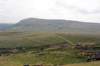
Click image to visit gallery of 3 images.
OK this is not a walk on the tops - it's not really a hard walk - it isn't a test of map reading as you can see most of the path ahead - but you won't be disappointed. It is a perfect way to enjoy a walk away from the crowds in a glaciated valley walled in by mountains. Just one warning - the latter part of the walk down the valley is subject to flash-flooding in torrential rain and it's a long walk around back to your car.
This Snowdonia (Eryri) walk starts at the end of a narrow steep gated lane from the village of Tal-y-Bont in the Vale of Conwy. The start of this lane is not sign posted but is situated left of the 'y Bedol' pub. Proceed up to the end of the lane (approx 3 miles) where you will find limited parking (Grid ref. SH731662).
Go over the stile to the north side of the parking area and proceed up the wide stoned track and through the gate at the end. Continue on the track ahead climbing right then swinging round left until you reach a gate set into the fence (Grid ref. SH 720 669). Do not go through this gate but climb up the hill on the left to the wall then cross over the fence via the stile that can be seen from the gate.
With the wall and top fence close to your left continue on a feint path up hill. The wall eventually ends at rocks. Continue still following the feint path, uphill to the higher Craig Eigiau (Grid ref. SH713654). You can then proceed with care through the rocks on your left to take in the superb views across Llyn Eigiau and your car parked far below. Also in view on the ridge opposite and right are the tops of Pen Lithrig y Wrach, Pen yr Helgi Du and Carnedd Llewelyn.
We have now to return to the wide stoned track. Proceed back down to the wall and follow to loose height, then turn left at any place through the rough ground down to the track. On reaching the track turn left. Follow it down to a disused quarry building. The track then gently climbs up to the shores of Melynillyn Reservoir (Grid ref. SH 702 658), which makes a convenient drink stop. This reservoir and the lower one, which is our next stop, are part of an electricity generating scheme. Later in the walk you will see signs indicating buried power cables.
To reach the lower reservoir turn right and cross over the narrow outflow stream, via a foot bridge. Follow the stream down then just after the left hand rocks pick out the interesting path left that steeply descends to Dulyn Reservoir with its dramatic sheer cliffs plunging down into the deep water.
Leave Dulyn via the path to the left of the outflow and left of a bothy. Look out for the plane wreckage (Whitworth Whitley that crashed Sept 1942) just after the trees and stile. The path picks its way down Pant y Griafolen with Afon Dulyn on your right. Keep to the right path at any forks and you will reach a low building, a footbridge across the damned Afon and a water tunnel (Grid ref. SH 724 675). Cross over the bridge and turn left to follow the wide track that swings right to join the original track from the car park.
Other walks nearby
| Walk 2592 | Llyn Geirionydd & Llyn Bychan from Llyn Crafnant | moderate | 9.5 miles |
| Walk 2608 | Crimpiau & Creigiau Gleision from Llyn Crafnant | moderate | 7.5 miles |
| Walk 2679 | Circuit of Llyn Crafnant | easy | 3.5 miles |
| Walk 3061 | Eastern Carneddau from near Rowen | mod/hard | 10.5 miles |
| Walk 2547 | Carnedd Llewelyn from near Rowen | mod/hard | 12.0 miles |
| Walk 2536 | Llyn Crafnant, Capel Curig & Llyn Colwyd from Trefriw | mod/hard | 13.0 miles |
| Walk 2285 | Llyn Geirionydd & Llyn Crafnant | easy/mod | 5.5 miles |
| Walk 3056 | Pen yr Helgi Du from Ogwen Valley | moderate | 5.5 miles |
| Walk 1232 | Carnedd Llewelyn, Llyn Eigiau & Llyn Cowlyd | hard | 16.0 miles |
| Walk 2855 | Gallt yr Ogof & Braich y Ddeugwm | moderate | 4.0 miles |
Recommended Books & eBooks
Great Mountain Days in Snowdonia
 Inspirational guidebook to 40 great mountain day walks and scrambles in Snowdonia. Inspirational routes for all abilities across the National Park with routes up Snowdon and Moel Eilio, the Glyderau, the Carneddau, Eifionydd, Siabod and the Moelwynion, Rhinogydd (the Harlech Dome), Migneint and the Arans and Cadair Idris and the Tarrens.
More information
Snowdonia: 30 Low-level and easy walks - South
 Guidebook describing 30 walks in Snowdonia, Wales. Routes are mostly low level and on clear paths and showcase the region's beautiful scenery and rich history and culture. Part of a 2-volume set, this southern volume includes Trawsfynydd, Bala, Dolgellau, Machynlleth, the Harlech Coast and the valleys of the Mawddach and Dyfi.
More information
Messaging & Social Media
Message Walking Britain and follow the latest news.

Mountain Weather
Stay safe on the mountains with detailed weather forecasts - for iOS devices or for Android devices.