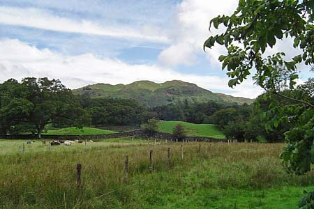
Skelwith Bridge & Loughrigg from Elterwater
Lake District Walk
Nat Park - Lake District - Lake District Central Fells
Wainwrights - Loughrigg Fell
County/Area - Cumbria
Author - Peter Lane
Length - 5.5 miles / 8.9 km Ascent - 1600 feet / 485 metres
Time - 4 hours 20 minutes Grade - easy/mod
Maps 

| Ordnance Survey Explorer OL7 | Sheet Map | 1:25k | BUY |
| Anquet OS Explorer OL7 | Digital Map | 1:25k | BUY |
| Ordnance Survey Landranger 90 | Sheet Map | 1:50k | BUY |
| Anquet OS Landranger 90 | Digital Map | 1:50k | BUY |
Walk Route Description
Click image to visit gallery of 8 images.
This Lake District circular walk on one of the lower fells is ideal for a half day excursion or one of those times when the high fells are blanketed by mist. It boasts spectacular views of Grasmere and also joins the popular tourist route alongside Elterwater with its much photographed views to the Langdales, plus the dramatic (especially when in spate) Skelwith Force.
There are two options for a start - the easiest being the National Trust car park at Elterwater NY328047. The alternative is a small parking area on a minor road near Fell Foot Farm, Little Loughrigg NY345039. As the former is easier to find, the route is described from Elterwater.
Follow the masses along the easy path from the car park along the picturesque Great Langdale Beck to Elterwater itself where there are superb retrospective views across to the Langdales (try and catch their reflections in the lake!). Continue along the (now) River Brathay as it flows out of the lake to Skelwith Force - an awesome sight in spate. Viewing platforms provide access to this magnificent natural spectacle. Continue on to the hamlet of Skelwith Bridge with its slate picnic tables and eponymous bridge.
At the A593 main road turn left past the hotel (excellent food) and at the junction just ahead take the steeply rising minor road prohibited to all vehicles except for access. Climb this steep hill past Neaum Crag holiday village (recommended!). At the top of this hill on the right is the alternative start point for this walk. Turn right briefly at the junction and then take the bridlepath past Fell Foot farm heading North-east.
A minor deviation just past the farm along the path to Little Loughrigg Tarn is well worthwhile for keen photographers in order to snap those perennial Langdales once again set against this lovely little lake. Return to the bridlepath and follow the wall past Ivy Crag until an indistinct path rises to the left near a small Beck NY357044. Ascend this path, meeting another larger path, rising to the crest of Loughrigg and a summit cairn. The route is now cairned fairly regularly and, although it is not always obvious which is the main route, maintains a pretty constant bearing of 320 degrees. Set your compass to this, and you shouldn't be tempted to take any deviating paths. There are superb views in all directions if you're not stuck in the mist!
After reaching the trig point, descend steeply towards Grasmere presenting itself in all its glory down below. Reaching the start of Loughrigg Terrace at the bottom, bear left and go through a gate past woods to a minor road. Turn right briefly along the road and then in a few metres pick up a footpath on the left running through Redbank Wood. When this path eventually emerges at a junction, take the uphill route to Elterwater. After a gate near the top of the hill, the path veers to the right and descends towards Elterwater village. Cross the roads as you come to them and enter the village, past the Britannia Inn (or not as the case may be!) and return safely to the car park.
Other walks nearby
| Walk 1141 | Elterwater circular | easy/mod | 4.0 miles |
| Walk 1059 | Colwith Force and Skelwith Force | easy/mod | 4.8 miles |
| Walk 1823 | Fairfield Horseshoe & Loughrigg from High Close | mod/hard | 14.0 miles |
| Walk 1134 | Wetherlam and The Carrs | mod/hard | 10.8 miles |
| Walk 2270 | Tilberthwaite and Holme Fell Little Langdale | easy/mod | 5.5 miles |
| Walk 3697 | Loughrigg Fell from Skelwith Bridge | easy/mod | 4.5 miles |
| Walk 1154 | Between Grasmere and Langdale | moderate | 9.5 miles |
| Walk 1472 | Alcock Tarn & Rydal Water | easy/mod | 7.0 miles |
| Walk 1565 | Rydal Water & Grasmere circular | easy/mod | 6.0 miles |
| Walk 1682 | Rydal Water & Grasmere | easy/mod | 5.5 miles |
Recommended Books & eBooks
Walking the Lake District Fells - Buttermere
 Part of the Walking the Lake District Fells series, this guidebook covers a wide range of routes to 32 Lakeland summits that can be climbed from the Buttermere, Lorton and Newlands valleys, with highlights including Haystacks, High Stile, Grasmoor and the fells of the Coledale Round. Suggestions for longer ridge routes are also included.
More information
Walking the Lake District Fells - Mardale and the Far East
 Part of the Walking the Lake District Fells series, this guidebook covers a wide range of routes to 36 Lakeland summits that can be climbed from the Ullswater, Haweswater, Troutbeck, Kentmere and Longsleddale valleys, with highlights including High Street, Place Fell and the Kentmere fells. Suggestions for longer ridge routes are also included.
More information
Messaging & Social Media
Message Walking Britain and follow the latest news.

Mountain Weather
Stay safe on the mountains with detailed weather forecasts - for iOS devices or for Android devices.