The Moelwyns from Croesor
Snowdonia/Eryri Walk
Nat Park - Snowdonia - Moelwyns Moel Siabod Cnicht
County/Area - Gwynedd
Author - Lou Johnson
Length - 7.5 miles / 12.2 km Ascent - 3020 feet / 915 metres
Time - 6 hours 50 minutes Grade - mod/hard
Maps 

| Ordnance Survey Explorer OL17 | Sheet Map | 1:25k | BUY |
| Anquet OS Explorer OL17 | Digital Map | 1:25k | BUY |
| Ordnance Survey Explorer OL18 | Sheet Map | 1:25k | BUY |
| Anquet OS Explorer OL18 | Digital Map | 1:25k | BUY |
| Ordnance Survey Landranger 115 | Sheet Map | 1:50k | BUY |
| Anquet OS Landranger 115 | Digital Map | 1:50k | BUY |
Walk Route Description
Click image to visit gallery of 7 images.
On a very hot summer's day this walk proved to be hard going especially mentally on the ascents of Moelwyn Mawr and Moelwyn Bach. However in cooler conditions this should prove a rewarding hike to some of the less visited tops in northern Snowdonia (Eryri) with a little industrial heritage thrown in for good measure. All in all, a great walk full of contrasts.
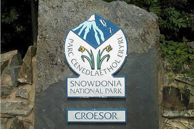
The start of this Snowdonia (Eryri) walk is the pleasant National Park car park in Croesor (grid ref. SH631446). Leave the car park and turn right into the lane, turning right again after a short way to join the footpath that follows the old Croesor tramway northeast into Cwm Croesor. The views are instantly spectacular with the "conical" summit of Cnicht dominant to your left and the steep slopes of Moelwyn Mawr to your right. Stay on the path until you reach Bryn-hyfryd where you fork right to take the main track that climbs steadily to Croesor Quarry. Although the OS map shows other rights of way, the track to the quarry is the only one that can be easily seen on the ground.
The ruins of Croesor Quarry are soon reached. Here the winding house of the old incline provides a spectacular reminder of the hard work that once took place winning slate from the mountains. Reaching a large single storey building turn right, following a clear track which zig-zags upwards. Don't be surprised when it fades to nothing and stay on a easterly bearing as you climb to the south of Llyn Croesor over rough mountainside in the direction of the upper workings of Rhosydd Quarry.
As in any area where there have been extensive workings, do be careful as there are many adits and unfenced chasms that could cause problems. Remains of some of the old buildings can be seen and it is easy to imagine how awful the weather could have been on this windswept mountain moorland as men toiled for a pittance. The first summit of the day lies ahead. Moel-yr-hydd looks uninspiring but it does have some fine views towards Tanygrisau far below and across to Moel Druman and Allt-fawr (two summits visited in walk x024 - north west of Blaenau Ffestiniog).
I spent quite some time perched on Moel-yr-hydd, which I suspect sees very few visitors, building up energy to face what appears to be an intimidating/boring climb to the summit of Moelwyn Mawr, the next summit on this walk. Heading back across the rough moor follow the fence which climbs roughly westwards. Ignore the gate on your left and plod ever upward to the domed summit of this the highest summit of the Moelwyns.
As can be expected the views from Moelwyn Mawr are superb with a glorious panorama to all points of the compass covering almost all the mountains of Snowdonia (Eryri). Leaving the grassy summit turn south. At first the path is indistinct but as you lose height you should pick up a clear path as you make for the rocky minor summit of Craigysgafn. This is a delightful section of the walk and there are opportunities for scrambling if desired. Continuing along this rocky ridge descend to Bwlch Stwlan with the reservoir of Llyn Stwlan down to your left and an interesting circular stone shelter beside the path.
The route to the final summit, Moelwyn Bach, has been in view since leaving Moelwyn Mawr. It is not as bad as it looks in ascent and soon leads you to the summit despite a few loose sections. All the hard work is now behind you and with a long slow descent ahead you can pick up speed! The path is generally clearly marked and when you reach an area of forest turn north along the boundary to a stile in the northeastern corner of the plantation (grid ref. 639437). Cross the stile and follow the path along the edge of the woods until you reach a minor road. Turn right and in under a mile you are back at the car park.
Other walks nearby
| Walk 3058 | Llyn yr Adar & Llyn Edno from near Bethania | moderate | 9.0 miles |
| Walk 1427 | Craflwyn circular from near Beddgelert | easy/mod | 2.5 miles |
| Walk 2150 | Llyn Dinas and Cwm Bychan from Beddgelert | easy/mod | 6.0 miles |
| Walk 2560 | Moel Hebog, Moel yr Ogof & Moel Lefn from Beddgelert | mod/hard | 6.5 miles |
| Walk 1799 | Moel Hebog | moderate | 5.5 miles |
| Walk 1988 | Beddgelert, Moel Hebog, Meol yr Ogof & Moel Lefn | mod/hard | 6.8 miles |
| Walk 3074 | Mynydd Sygun | moderate | 4.5 miles |
| Walk 3231 | Moel Hebog, Meol yr Ogof and Moel Lefn from Beddgelert | mod/hard | 6.8 miles |
| Walk 1426 | Aberglaslyn and Cwm Bychan | easy/mod | 5.8 miles |
| Walk 1334 | Cnicht from Tanygrisiau | moderate | 8.0 miles |
Recommended Books & eBooks
The Cambrian Way
 Guidebook to the Cambrian Way, a challenging three-week mountain trek through Wales from Cardiff to Conwy. The 470km un-waymarked route is presented from south to north. Often sticking to long, beautiful ridgelines, it crosses wild and rugged terrain and visits many of Wales's highest mountains, including Snowdon.
More information
Great Mountain Days in Snowdonia
 Inspirational guidebook to 40 great mountain day walks and scrambles in Snowdonia. Inspirational routes for all abilities across the National Park with routes up Snowdon and Moel Eilio, the Glyderau, the Carneddau, Eifionydd, Siabod and the Moelwynion, Rhinogydd (the Harlech Dome), Migneint and the Arans and Cadair Idris and the Tarrens.
More information
Messaging & Social Media
Message Walking Britain and follow the latest news.

Mountain Weather
Stay safe on the mountains with detailed weather forecasts - for iOS devices or for Android devices.