Caer Caradoc & The Lawley from Church Stretton
Shropshire Hills Walk
Region - Shropshire Hills
County/Area - Shropshire
Author - Lou Johnson
Length - 10.0 miles / 16.3 km Ascent - 2480 feet / 752 metres
Time - 7 hours 30 minutes Grade - moderate
Maps 

| Ordnance Survey Explorer 217 | Sheet Map | 1:25k | BUY |
| Anquet OS Explorer 217 | Digital Map | 1:25k | BUY |
| Ordnance Survey Landranger 137 | Sheet Map | 1:50k | BUY |
| Anquet OS Landranger 137 | Digital Map | 1:50k | BUY |
Walk Route Description
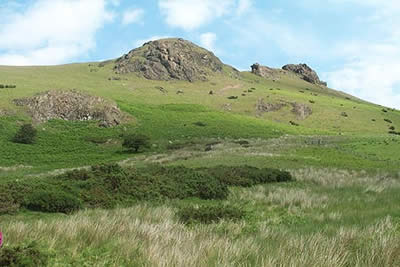
Click image to visit gallery of 12 images.
The Shropshire countryside to the east of Church Stretton is beautiful formed from a complex series of hills and ridges. Less accessible and therefore much quieter than the Long Mynd to the west, the area provides a number of energetic walks. Do not be misled into thinking this is a gentle Shropshire walk as the total ascent is similar to many Lakeland walks with one of the hardest climbs occurring towards the end of the route!
The start is the Church Stretton where car parking is available together with a train service. To start locate Sandford Avenue which runs from the traffic lights on the A49 into the main centre. Take Essex Road, which leads north from this avenue, and continue north to reach a footpath sign on your right at the northern end of a sheltered housing unit (Grid ref. 457939).
Follow this footpath across the railway to reach the A49. Cross this busy main road and continue along the track opposite. This leads to a housing estate. Do not go into the estate but turn left along a lane, which is followed as far as gate leading to New House Farm. Take the second footpath on the right and follow the path around a field to join a track that leads you to a footbridge (Grid ref. 471943). Cross this and walk east following a decent track that soon swings northwards and begins to climb.
Stay on this track towards a wide col with Caer Caradoc rising to your left. This area is well endowed with footpaths and care is needed to ensure you stay on route. After passing Cwms Cottage locate the footpath leading onto the Wilderness. This leaves the lane through a gate (Grid ref. 485951). The path is not clear but walk to the highest point (spot height 321m) and continue north with the hedge on your right. This leads you along the Wilderness without further problem to a track. Go right through the gate and head east down this track to reached a metalled road. Turn left downhill to a cross-roads. Take the signed bridleway opposite and follow this to reach a lane in the hamlet of Enchmarsh.
Turn left uphill and right at a T-junction. Almost immediately turn left down a track (Grid ref. 502966). Follow this north and then northeast along Hoar Edge to reach a lane. Turn left and follow this quiet lane downhill with views of the Lawley ahead. Stay on this lane to reach the north end of the Lawley's ridge where a path leads up from the lane and stays on the ridge all the way to the summit.
The views are superb in all directions and it is worth spending some time on the grassy summit to enjoy the Shropshire countryside. Descend steeply southwest and exit onto the lane near Comley Farm. Turn left along the lane taking the right fork at the first junction. Continue up this lane ignoring the footpath signs at a hairpin bend. After approximately 200 metres take the signed path on the left. Head up this path for 100 metres before turning left again. Almost immediately you will see a path on your right that climbs steeply onto Little Caradoc. Ahead lies a fence with a stile. Cross this and continue the steep climb to the summit of Caer Caradoc. At the end of a walk this seems much steeper than it really is!
From the summit head southwest staying on the ridge path to reach Three Fingers Rock. Shortly afterwards the path descends steeply to a stile. Cross this and continue the descent to reach the footbridge crossed in the early stages of the walk. All you need to do is retrace your steps back to Church Stretton where there are plenty of opportunities for refreshment.
Other walks nearby
| Walk 3308 | Ragleth and the Long Mynd | mod/hard | 11.0 miles |
| Walk 3449 | Ragleth, the Long Mynd & Ratlinghope | hard | 18.0 miles |
| Walk 1374 | Lightspout Waterfall and Pole Bank | easy/mod | 5.8 miles |
| Walk 1180 | Pole Bank (Long Mynd) from Carding Mill | moderate | 6.5 miles |
| Walk 1409 | Haddon Hill and Bodbury Hill | easy/mod | 4.4 miles |
| Walk 2159 | Lightspout Hollow, Pole Bank & Ashes Hollow | moderate | 7.3 miles |
| Walk 1097 | Caer Caradoc | easy/mod | 3.5 miles |
| Walk 3447 | Caer Caradoc, Hope Bowdler & Willstone Hills | moderate | 7.0 miles |
| Walk 1844 | The Portway & Betchcott Hill from Picklescott | easy/mod | 5.0 miles |
| Walk 2022 | Wenlock Edge & Aston Munslow | moderate | 7.8 miles |
Recommended Books & eBooks
Hillwalking in Shropshire
 Guidebook to 32 walking routes in Shropshire in the West Midlands. The routes range from 3 miles (5km) to 12 miles (19km), taking in highlights such as The Wrekin, Wenlock Edge, Long Mynd and Stiperstones, Castle Ring and Bury Ditches. Many routes start near delightful towns and villages including Church Stretton, Ludlow and Bishops Castle.
More information
Messaging & Social Media
Message Walking Britain and follow the latest news.

Mountain Weather
Stay safe on the mountains with detailed weather forecasts - for iOS devices or for Android devices.