Knock Fell & High Cup Nick from Dufton
North Pennines Walk
Region - North Pennines
County/Area - Cumbria - North Pennines
Author - Lou Johnson
Length - 12.0 miles / 19.5 km Ascent - 2500 feet / 758 metres
Time - 8 hours 30 minutes Grade - mod/hard
Maps 

| Ordnance Survey Explorer OL19 | Sheet Map | 1:25k | BUY |
| Anquet OS Explorer OL19 | Digital Map | 1:25k | BUY |
| Ordnance Survey Landranger 91 | Sheet Map | 1:50k | BUY |
| Anquet OS Landranger 91 | Digital Map | 1:50k | BUY |
Walk Route Description
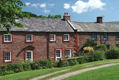
Click image to visit gallery of 12 images.
This walk includes two lengthy sections of the Pennine Way and a section of cross country walking where no path is visible on the ground. The high fells in this area are subject to rapid changes in weather so be prepared for crossing difficult terrain and be able to use a map and compass or other navigational aid.
The start is the village of Dufton (Grid ref. NY689249). There is a small carpark and on street parking although please ensure you do not obstruct access. From the car park exit onto the road and turn right. The village green is on your left. Continue along the road past the large house on your left built in 1779 and continue straight ahead on the Pennine Way. After a short way the path goes left (Grid ref. NY 691 252) and continues through farmland to reach a lane. Turn right along this lane and stay on the Pennine Way for approximately a mile. Reaching a bridge over Great Rundale Beck (Grid ref. NY 692 273) continue on the track as it gently climbs the fellside.
The Pennine Way is clear and well waymarked and despite the uphill work you make good progress as your climb steadily with ever improving views to your left. On reaching the Knock Old Man (Grid ref. NY 720 300) continue a short way to the summit of Knock Fell. There is a good view ahead to Great Dun Fell and beyond to Cross Fell.
The next section is pathless and you need to be careful as there are some boggy sections. The next objective is the 692 m. trig point on Backstone Edge (Grid ref. NY 725 275) and the best approach was to head just east of south working around the boggy sections but taking care to maintain the general bearing. At about NY 722 281 you drop down into a gully to cross a track that leads east to Great Rundale Tarn before climbing up across rough ground to reach Backstone Edge.
Continue south along the edge ensuring that you do not lose too much height and also making sure that you do not go too far onto the flat plateau to your left as you will lose the views across the Vale of Eden. There is an intermittent path of sorts and this leads you roughly south at first before turning east to provide you with a spectacular view of High Cup Nick. Find a suitable spot and descend on grass towards the Nick.
Having enjoyed this spectacular location turn west and follow the Pennine Way as it descends to Dufton. This is a well blazed trail and there is no danger of getting lost so a detailed description is superfluous! Reaching a tarmac lane at Town Head (Grid ref. NY 694 247) turn right and follow the lane back into Dufton village.
Other walks nearby
| Walk 1715 | Dufton Pike & Dufton | easy | 5.0 miles |
| Walk 1784 | Rutter Force & Hoff Beck | easy/mod | 8.0 miles |
| Walk 3071 | Cross Fell & Great Dun Fell from Kirkland | mod/hard | 12.0 miles |
| Walk 3274 | Cronkley Scar & Cauldron Snout | moderate | 8.0 miles |
| Walk 1683 | High Cup Nick & Cow Green Reservoir | moderate | 12.8 miles |
| Walk 3336 | Cauldron Snout | easy | 3.6 miles |
| Walk 3593 | Meldon Hill from Cow Green Reservoir | moderate | 9.2 miles |
| Walk 2453 | Askham Fell from Lowther Castle | easy/mod | 7.4 miles |
| Walk 3758 | Tynehead and Ashgill Force from near Garrigill | easy/mod | 8.2 miles |
| Walk 1084 | Garrigill, Alston & Nenthead | moderate | 13.1 miles |
Recommended Books & eBooks
Walking the Lake District Fells - Langdale
 Part of the Walking the Lake District Fells series, this guidebook covers a wide range of routes to 25 Lakeland summits that can be climbed from the Great Langdale valley, Ambleside and Grasmere, with highlights including Scafell Pike, Bowfell, the Langdale Pikes and Helm Crag (the Lion and the Lamb). Includes suggestions for longer ridge routes.
More information
Hadrian's Wall Path
 Hadrians Wall Path guidebook to walk the 84 mile National Trail. Described in both directions, the main description is west to east between Bowness-on-Solway and Wallsend, Newcastle, with extensions to Maryport and South Shields. With extensive historical information related to this World Heritage site and separate 1:25,000 OS map booklet included.
More information
Messaging & Social Media
Message Walking Britain and follow the latest news.

Mountain Weather
Stay safe on the mountains with detailed weather forecasts - for iOS devices or for Android devices.