Moel Siabod circular from Pont Cyfyng
Snowdonia/Eryri Walk
Nat Park - Snowdonia - Moelwyns Moel Siabod Cnicht
County/Area - Conwy
Author - Paul Gasson
Length - 6.5 miles / 10.6 km Ascent - 2700 feet / 818 metres
Time - 6 hours 0 minutes Grade - moderate
Maps 

| Ordnance Survey Explorer OL17 | Sheet Map | 1:25k | BUY |
| Anquet OS Explorer OL17 | Digital Map | 1:25k | BUY |
| Ordnance Survey Landranger 115 | Sheet Map | 1:50k | BUY |
| Anquet OS Landranger 115 | Digital Map | 1:50k | BUY |
Walk Route Description
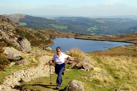
Click image to visit gallery of 6 images.
Moel Siabod is one of those mountains so often ignored, being less than the magic 914 metres or 3000ft, and, from the roads nearby, of fairly featureless appearance, but, believe me, it is a Snowdonia (Eryri) walk for the connoisseur of mountain walking.
Park on the side of the road immediately past the National Mountain Centre, Plas y Brenin, (grid ref. SH715578) if you can. Alternatively, in the car park to the rear of Joe Brown's shop in the village of Capel Curig. If using the car park a somewhat hazardous section of road walking can be avoided by turning right out of the car park, then left at a farm and following the clear track down to the start.
From the roadside parking, walk back a few metres towards Plas y Brenin, and go over the stile on the right which leads steeply down, past the dry ski slope, to the Jubilee Bridge. If the weather is kind to you, this is a perfect spot for a view of the Snowdon massif across Llynau Mymbyr. Cross the bridge and a few metres further on, turn left on the forest road. Follow this road through the woods, ignoring another forest road that descends from your right, and a few metres further on, take the right hand fork in the road. At the end of the road the route continues as a narrow footpath, high above the river. Ignore a left fork and continue to a footpath sign indicating left. Descend carefully over slippery rocks but don't cross the footbridge to the pub (however tempting!). Turn right to follow the river. The path is difficult here, but only for a very short distance, soon becoming much clearer and breaking out of the forest into a grassy pasture. Follow the river bank, then head half right across the pasture to the woods on the opposite side, where a wooden footbridge leads to a broad track. Go left here, through a gate and onto a minor road near Pont Cyfyng.
Turn right along the metalled road until, after about 100 metres, a private drive leads steeply off to the right, over a cattle grid. Go up here and onto the clearly marked footpath. This section is very steep but, as you emerge from the trees, gives some excellent views down the valley to the East. The footpath meets a wider track beyond the farm where we go left, and should now see the great conical mass of Moel Siabod immediately ahead.
Continue along the track, over a stile and past a small, nameless lake. Beyond the lake the track gets rougher as it climbs up to some ruined quarry buildings on the left and the quarry, containing a deep pool, on the right. The slate from this quarry was reputed to be of unusually high quality, having a low sulphur content. From the quarry pool the path rises steeply to the left, then turns right to pass above the quarry, before turning left again and continuing up the hillside towards a small col, or 'bwlch'. The path is unmistakeable from above the quarry pool, and badly eroded. Reaching the bwlch, yet another small lake, Llyn y Foel, can be see below and to the left, with the jagged East Ridge of Moel Siabod rising beyond.
The path descends towards the North side of the lake, but be warned, the ground there is very boggy, making for a miserable crossing! Far better to look for a narrow path heading right, just after you start to descend and immediately after passing a prominent rocky outcrop. This path heads up into the cwm to the North of the lake, towards a steep scree slope which some have been tempted to use as a route to the summit, but this would miss the easy scrambling delights of the East Ridge. Look for a vague path leaving the footpath to the left, descend slightly into the cwm and climb back up the grassy slope on the far side, a little wet but a much better prospect than the bog by the lake. From the top of the rise a path can be seen heading for the ridge and joining it at the start of the scramble.
There is no real path on the ridge, just turn right and start climbing, generally keeping as close to the crest as possible, and taking your choice of a variety of lines, with easier ground always available further left. The rock is of excellent quality, with good friction, and the scrambling is no more than Grade 1, and mostly low in the grade, though with occasional exposed spots offering superb views and excellent photo opportunities. The route is however quite long and sustained, and certainly the most tiring section of the walk.
The ridge terminates about 100 metres East of the summit cairn, which on a good day is a superb viewpoint for the whole of North Snowdonia (Eryri), and a spot where you will want to linger for a while and soak up the atmosphere as you try to identify the surrounding peaks.
The descent route can be tricky to find! Leave the summit trig point roughly NE, keeping a boulder field and large wind shelter to your left, and descend an easy grassy slope with just the trace of a path here and there. Near the bottom of the slope the path turns left ( North) across a boulder field, immediately beyond which you should find the path becomes clear as it descends directly towards the village of Capel Curig (025 degrees True). The path crosses a few boggy areas as it descends towards the forestry plantations, which are entered via stile. Follow the clear path beyond to a forest road, then turn left for about 100 metres on the road before leaving it right on a clear footpath that eventually brings you back to the Jubilee Bridge where the walk started.
The walk could be done in about 5 hours, but 7-8 is probably a more realistic estimate, to allow a leisurely pace and time to take in the views. If a meal and a drink is beckoning at the finish, where better than the Snowdon Bar at Plas y Brenin?
Other walks nearby
| Walk 2766 | Capel Pinnacle / Y Pincin | easy | 1.0 miles |
| Walk 2902 | Creigiau Gleision & Llyn Cowlyd from Capel Curig | moderate | 9.5 miles |
| Walk 2200 | Eastern Carneddau | moderate | 8.5 miles |
| Walk 2300 | Glyder Fach | mod/hard | 11.5 miles |
| Walk 1661 | Crimpiau | easy/mod | 4.5 miles |
| Walk 3005 | Clogwen | easy | 2.0 miles |
| Walk 1151 | Moel Siabod | hard | 5.5 miles |
| Walk 2919 | Moel Siabod & Capel Curig | moderate | 6.0 miles |
| Walk 3056 | Pen yr Helgi Du from Ogwen Valley | moderate | 5.5 miles |
| Walk 1232 | Carnedd Llewelyn, Llyn Eigiau & Llyn Cowlyd | hard | 16.0 miles |
Recommended Books & eBooks
Great Mountain Days in Snowdonia
 Inspirational guidebook to 40 great mountain day walks and scrambles in Snowdonia. Inspirational routes for all abilities across the National Park with routes up Snowdon and Moel Eilio, the Glyderau, the Carneddau, Eifionydd, Siabod and the Moelwynion, Rhinogydd (the Harlech Dome), Migneint and the Arans and Cadair Idris and the Tarrens.
More information
Snowdonia: 30 Low-level and easy walks - South
 Guidebook describing 30 walks in Snowdonia, Wales. Routes are mostly low level and on clear paths and showcase the region's beautiful scenery and rich history and culture. Part of a 2-volume set, this southern volume includes Trawsfynydd, Bala, Dolgellau, Machynlleth, the Harlech Coast and the valleys of the Mawddach and Dyfi.
More information
Messaging & Social Media
Message Walking Britain and follow the latest news.

Mountain Weather
Stay safe on the mountains with detailed weather forecasts - for iOS devices or for Android devices.