The Stiperstones from the Knolls
Shropshire Hills Walk
Region - Shropshire Hills
County/Area - Shropshire
Author - Lou Johnson
Length - 2.0 miles / 3.3 km Ascent - 350 feet / 106 metres
Time - 1 hours 20 minutes Grade - easy
Maps 

| Ordnance Survey Explorer 216 | Sheet Map | 1:25k | BUY |
| Anquet OS Explorer 216 | Digital Map | 1:25k | BUY |
| Ordnance Survey Explorer 217 | Sheet Map | 1:25k | BUY |
| Anquet OS Explorer 217 | Digital Map | 1:25k | BUY |
| Ordnance Survey Landranger 137 | Sheet Map | 1:50k | BUY |
| Anquet OS Landranger 137 | Digital Map | 1:50k | BUY |
Walk Route Description
Click image to visit gallery of 3 images.
Amongst the highest hills in Shropshire, the Stiperstones with their quartzite outcrops offer superb views over the surrounding countryside including the Long Mynd, Corndon Hill and mid-Wales. The ridge runs north south with totally different aspects on is eastern and western flanks. Facing the Long Mynd to the east the slopes are gradual in total contrast the other side. Here deep, steep sided valleys cut into the ridge to form great "amphitheatres".
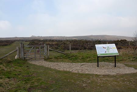
This walk starts from the Knolls Car Park (grid ref SO369976). Here an information board illustrates the geology and wildlife of the Stiperstones, an area of upland moorland, which is a National Nature Reserve and part of the Shropshire Hills Area of Outstanding Natural Beauty.
From the car park go through the gate adjacent to the information board and follow the clear broad path uphill. Ahead on the skyline you can already see the quartzite outcrops that are a characteristic of this ridge. Already excellent views of the Long Mynd can be enjoyed behind you. The climb is fairly gentle and you can make good progress on this section of the path. To your left is the large rocky outcrop of Cranberry Rock, which can be visited on the return route.
Keeping on the main path, the conditions underfoot get rockier and care is needed as the path becomes less steep. It is here that you get your first view of Manstone Rock, which at 536 metres above sea level is the highest point of the ridge. Continue to the summit from where there are superb views in all directions. If you decide to clamber up to the concrete trig point then do take care. Remember it is always harder to descend!
The walk continues north along the ridge to the next large rocky outcrop, the Devil's Chair. From just north of here you can get a good view down into the deep valley of Perkins Beach with its very steep sides. Having enjoyed the scenic delights return to the car park using the outward route. During the descent you have the option of leaving the main path and continuing down the ridge to the Cranberry Rock from where a narrow path takes you back to the main route.
Other walks nearby
| Walk 1809 | Shelve & the Stiperstones from The Bog | moderate | 9.0 miles |
| Walk 2083 | Linley Hill and Linley from The Bog | moderate | 8.5 miles |
| Walk 2745 | Betchcott Hills & Pole Bank | moderate | 9.0 miles |
| Walk 1205 | Adstone Hill, Medlicott and the Long Mynd | moderate | 9.5 miles |
| Walk 1072 | Stiperstones low level circular | easy | 4.0 miles |
| Walk 3529 | Stiperstones from Snailbeach | easy/mod | 7.0 miles |
| Walk 1871 | Snailbeach & the Stiperstones | moderate | 7.0 miles |
| Walk 2054 | Linley Hill & Beeches from Wentnor | easy/mod | 7.0 miles |
| Walk 1832 | The Hollies & Poles Coppice from near Habberley | easy/mod | 5.0 miles |
| Walk 2814 | Corndon Hill from Priest Weston | easy | 1.5 miles |
Recommended Books & eBooks
Hillwalking in Shropshire
 Guidebook to 32 walking routes in Shropshire in the West Midlands. The routes range from 3 miles (5km) to 12 miles (19km), taking in highlights such as The Wrekin, Wenlock Edge, Long Mynd and Stiperstones, Castle Ring and Bury Ditches. Many routes start near delightful towns and villages including Church Stretton, Ludlow and Bishops Castle.
More information
Messaging & Social Media
Message Walking Britain and follow the latest news.

Mountain Weather
Stay safe on the mountains with detailed weather forecasts - for iOS devices or for Android devices.