Zennor & St Ives coast path
Cornwall AONB Walk
Region - Cornwall AONB
County/Area - Cornwall
Author - Lou Johnson
Length - 11.0 miles / 17.9 km Ascent - 1900 feet / 576 metres
Time - 7 hours 20 minutes Grade - mod/hard
Maps 

| Ordnance Survey Explorer 102 | Sheet Map | 1:25k | BUY |
| Anquet OS Explorer 102 | Digital Map | 1:25k | BUY |
| Ordnance Survey Landranger 203 | Sheet Map | 1:50k | BUY |
| Anquet OS Landranger 203 | Digital Map | 1:50k | BUY |
Walk Route Description
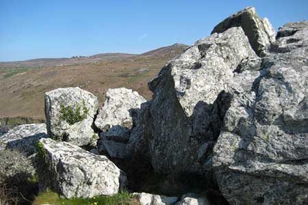
Click image to see photo description.
Walking the South West Coast Path should never be seen as an easy undertaking unless you have prior knowledge of the route. This walk in particular includes as much length and ascent as many a high level fell walk with much of the climbing left to the end of the route. Combining an inland walk along the "Tinners Way" the route takes you to St Ives where you have the option of exploring the town before returning along the coastal path.
To start this Cornwall walk, park in the small car park at Zennor (grid ref. SW 454384) and pick up the path that begins at the western end of the churchyard and make for Tremedda, the first of a number of farms that are passed on the outward leg of the route. Many of the small fields with their stone walls date from prehistoric times and they certainly add character to the landscape.
Reaching Tremedda continue to Tregerthen where the path maintains its almost straight line as it continues to Wicca where a farm track leads to nearby Boscubben. Stay with the track past the farm for about 50 metres and take the path over a stile on the right. At Trendrine you have to pass through the farmyard keeping the house on your right. Navigation is easy with Trevessa the next target across some more fields.
At Trevessa turn left on to the lane and then immediately right by Little Trevega to take a path that cuts across some fields to reach the lane again. Climb the stile into the lane, turn right, and after 200 metres turn left on the Tinners' Way to Trevalgan farm.
The path goes to the left of the farm with the Trowan, the next farmstead, in a straight line ahead. Continue in the same direction to reach a crossroads of paths (grid ref. 502405). You can shorten the walk here by turning left to reach the costal path at Hellesveor Cliff. However we continue ahead staying with the footpath for a further half kilometre to reach the outskirts of St Ives. You reach a road and this leads you down to Porthmeor Beach.
After exploring St Ives perhaps including a visit to the Tate Gallery you need to locate the coastal path at the western end of Porthmeor Beach and follow this back to Zennor. As mentioned in the introduction this section of path is not easy with many switchbacks from the shoreline to cliff top. You soon learn as the first climb starts shortly after leaving St Ives where a steep ascent helps you regain the route taken by those using the "shortcut".
On the initial section there are some wonderful retrospective views across St Ives Bay to Godrevy lighthouse and beyond. The path becomes more rugged and reaching Pen Enys headland the view back is superb. Trevega Cliff is occupied by a trig point (91 metres) and after this the view west to Pendeen lighthouse begins to improve.
Forward progress can be slower than the map suggests and from Mussel Point the view to Zennor and Gurnard's headlands helps boost your spirits. At least the end of the route is in sight although the toughest section is yet to be covered! From Tregerthen the path can only be described as spectacular dropping down to the shore before soaring upward again to the cliff tops.
Reaching Zennor point the temptation is to take the short cut over the headland but you are recommended to stay true to the coastal path before clambering up to the trig point to enjoy the view. With a kilometre remaining the path to Zennor village follows a valley, which leads to the church and the Tinners Arms.
Other walks nearby
| Walk 1224 | Men-an-tol & Ding Dong Mine | easy | 3.0 miles |
| Walk 2206 | St. Ives - a town stroll | easy | 1.5 miles |
| Walk 3325 | Chun Quoit & Carn Kenidjack | easy | 4.0 miles |
| Walk 2207 | Penzance - a town stroll | easy | 1.5 miles |
| Walk 3501 | Penzance to Porthcurno via Mousehole and Lamorna | moderate | 11.0 miles |
| Walk 2205 | Newlyn - a village trail | easy | 1.0 miles |
| Walk 1028 | Chun Quoit and Botallack | moderate | 8.0 miles |
| Walk 2208 | Marazion - a town stroll | easy | 1.0 miles |
| Walk 1225 | Sennen Cove & Botallack from St Just | moderate | 7.5 miles |
| Walk 2616 | The moors and hills of Penwith | moderate | 14.0 miles |
Recommended Books & eBooks
The South West Coast Path
 Guidebook to walking the entire South West Coast Path National Trail. The route runs for 630 miles from Minehead to Poole along the north Devon, Cornish, south Devon and Dorset coastline. Divided into 45 stages, this long-distance coastal trek could be completed within 4 weeks, or walked in sections. Guide includes maps and essential information.
More information
South West Coast Path Map Booklet - Minehead to St Ives
 Map of the northern section of the 630 mile (1014km) South West Coast Path National Trail. Covers the trail from Minehead to St Ives along the north Devon and Cornish coastline. This convenient and compact booklet of Ordnance Survey 1:25,000 maps shows the route, providing all of the mapping you need to walk the trail in either direction.
More information
Messaging & Social Media
Message Walking Britain and follow the latest news.

Mountain Weather
Stay safe on the mountains with detailed weather forecasts - for iOS devices or for Android devices.