Fairfield Horseshoe (short route) from Ambleside
Lake District Walk
Nat Park - Lake District - Lake District Eastern Fells
Wainwrights - Dove Crag, Fairfield, Great Rigg, Hart Crag, High Pike, Low Pike
County/Area - Cumbria
Author - Lou Johnson
Length - 9.5 miles / 15.4 km Ascent - 3410 feet / 1033 metres
Time - 8 hours 10 minutes Grade - mod/hard
Maps 

| Ordnance Survey Explorer OL5 | Sheet Map | 1:25k | BUY |
| Anquet OS Explorer OL5 | Digital Map | 1:25k | BUY |
| Ordnance Survey Explorer OL7 | Sheet Map | 1:25k | BUY |
| Anquet OS Explorer OL7 | Digital Map | 1:25k | BUY |
| Ordnance Survey Landranger 90 | Sheet Map | 1:50k | BUY |
| Anquet OS Landranger 90 | Digital Map | 1:50k | BUY |
Walk Route Description
Click image to visit gallery of 6 images.
This Lake District circular walk is a variation on the popular Fairfield horseshoe (See walk 1002), which traditionally starts and ends in Ambleside. By using the bus service between Grasmere and Ambleside, the walk can be shortened with the attractive descent from Stone Arthur adding an interesting finale. It is suggested you park in Grasmere and take the bus to Ambleside as this means you are not under pressure at the end of the day to catch the bus - the Tourist Information Centre in Grasmere was particularly helpful in providing schedules.
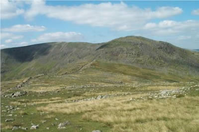
From the centre of Ambleside take the Kirkstone Road for a short way turning down the first lane on the left. This leads to Low Sweden Bridge from where the views of the Fells begin to improve. The onward path to Low Pike is well-trodden and you soon find yourself alongside the ridge wall. This leads onwards over high Pike and onto Dove Crag. As you climb, the views on both sides are excellent and improve with each step.
Although you are now in the high fells, progress is easy. Although you are climbing most of the time there is nothing too strenuous and you feel as though you are covering a lot of ground. By the time you reach Dove Crag, you have earned a rest, and this is an excellent place to see the majority of the Fairfield horseshoe. Suitably refreshed head on to Hart Crag where the view north opens out with St Sunday Crag dominating the view. The ascent is nearly over and after dropping off the northern side of Hart Crag to Link Hause a steep rocky upward pull brings you onto Fairfield.
As the name suggests, this mountain is a grassy plateau. However on its north eastern flanks there are some superb crags and rather than follow the main path it is better to keep to your right following the narrow trod which skirts around the top of the cliffs. Besides an excellent view into Deepdale, you are able to appreciate the full extent of Fairfield's rocky aspect. Suitably impressed, you should arrive at the summit cairn from where the far ranging views are excellent. However because of the domed nature of the plateau it is better to explore a little with a short walk north to inspect Cofa Pike and Grisedale Hause particularly rewarding.
Having reached the highest point of the walk it is downhill almost all the way back to Grasmere. In poor visibility do be careful to take the correct path off Fairfield as it can be a confusing place in low cloud. Keeping on the main path to Great Rigg you will find it easy to keep a good pace with an excellent Lakeland panorama ahead. Reaching the cairn on Great Rigg descend but fork right off the main Heron Pike path along the subsidiary ridge leading to Stone Arthur.
Not nearly as busy as the main path, you descend gently to the rocky outcrop named Stone Arthur. The views to Grasmere and Easedale are particularly good and after a little scrambling the path descends more abruptly before levelling off again. The route is waymarked and soon you reach the main road (grid ref. 339083). From here it is short walk into the centre of Grasmere where there are ample opportunities for refreshment.
Other walks nearby
| Walk 2026 | Loughrigg from Pelter Bridge near Rydal | easy/mod | 4.0 miles |
| Walk 3034 | Red Screes & Other Fells from Ambleside | mod/hard | 10.0 miles |
| Walk 3697 | Loughrigg Fell from Skelwith Bridge | easy/mod | 4.5 miles |
| Walk 1823 | Fairfield Horseshoe & Loughrigg from High Close | mod/hard | 14.0 miles |
| Walk 1472 | Alcock Tarn & Rydal Water | easy/mod | 7.0 miles |
| Walk 1565 | Rydal Water & Grasmere circular | easy/mod | 6.0 miles |
| Walk 1682 | Rydal Water & Grasmere | easy/mod | 5.5 miles |
| Walk 2715 | Skelwith Bridge & Loughrigg | easy/mod | 5.5 miles |
| Walk 1684 | Lingmoor Fell & Langdale | easy/mod | 7.0 miles |
| Walk 1141 | Elterwater circular | easy/mod | 4.0 miles |
Recommended Books & eBooks
The Cumbria Way
 A guidebook to the 73 mile Cumbria Way, an easy long-distance walk though the heart of the Lake District National Park, from Ulverston in the south to Carlisle in the north, with good transport links to either end. The route is largely low-level but this guide offers alternative mountain days to climb some of the famous fells en route.
More information
Great Mountain Days in the Lake District
 An inspirational guidebook to 50 challenging walks on the high fells of the Lake District. The graded circular routes, between 4 and 14 miles in length, cover classic Lakeland summits like Fairfield, Scafell Pike, Great Gable and Blencathra, to the lesser-known High Spy, King's How and Brund Fell.
More information
Messaging & Social Media
Message Walking Britain and follow the latest news.

Mountain Weather
Stay safe on the mountains with detailed weather forecasts - for iOS devices or for Android devices.