Chrome Hill (Dragon's Back) from Hollinsclough
Peak District Walk
Nat Park - Peak District - Dove Valley Chrome Hill
County/Area - Staffordshire & Derbyshire
Author - Lou Johnson
Length - 4.5 miles / 7.3 km Ascent - 925 feet / 280 metres
Time - 3 hours 10 minutes Grade - easy/mod
Maps 

| Ordnance Survey Explorer OL24 | Sheet Map | 1:25k | BUY |
| Anquet OS Explorer OL24 | Digital Map | 1:25k | BUY |
| Ordnance Survey Landranger 119 | Sheet Map | 1:50k | BUY |
| Anquet OS Landranger 119 | Digital Map | 1:50k | BUY |
Walk Route Description
Click image to visit gallery of 6 images.
The Staffordshire sector of the Peak District National Park is less visited than its Derbyshire neighbour. However it does have much to offer, not least the fact there are fewer walkers! This particular walk provides an excellent insight into the area as well giving you a look at the upper reaches River Dove. Although not included in the walk, the nearby village of Longnor is worth a visit as it displays a microcosm of North Staffordshire life.
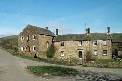
There is limited parking in the village of Hollinsclough (grid ref. SK065665) and your attention will be immediately drawn to the fine chapel, which was built when the village was a thriving centre for silk weaving. Take the lane heading east out of the village and you will soon be rewarded with a good view of Chrome Hill (or the Dragon's Back) on your left. Continue down this lane until you reach a signed footpath on your left and take this as it heads across fields in the direction of Parkhouse Hill (Chrome Hill's little brother/sister).
Continuing over a footbridge you cross the River Dove, which forms the Staffordshire/Derbyshire border. Reaching a lane turn left and follow the tarmac for a short way. On your left a signed path leads you onto the permissive footpath for an ascent of Chrome Hill. (You might be tempted to ascend nearby Parkhouse Hill which is now open access land.) The initial climb is quite steep and for occasional walkers may seem daunting. However upward progress is fast and with improving views you soon reach the summit.
From here the true nature of Chrome Hill can be seen. It is a large steep-sided lump of limestone with a serrated ridge and was once connected with Parkhouse Hill with which is shares the same geology. The onward route is interesting as you descend the northwestern ridge with the path twisting and turning between limestone outcrops. The path is way-marked and leads you across the eastern flanks of Tor Rock to reach the Stoop Farm access road. Continue via Booth farm to Leycote where the track descends to the Dove. Cross Washgate Bridge and follow the rights of way on the Staffordshire side of the river back to Hollinsclough.
Other walks nearby
| Walk 1861 | Chrome and Parkhouse Hills from Earl Sterndale | easy/mod | 5.0 miles |
| Walk 1862 | Earl Sterndale and High Wheeldon from Longnor | easy/mod | 6.0 miles |
| Walk 2723 | Pilsbury Castle, Hartington & Sheen from Longnor | easy/mod | 9.6 miles |
| Walk 2272 | Flash Circular from Cistern Clough | moderate | 8.0 miles |
| Walk 1043 | Chelmorton & the Monsal Trail | easy/mod | 8.1 miles |
| Walk 3709 | Sparklow, Crowdicote & Pilsbury Circular | easy/mod | 9.0 miles |
| Walk 1652 | Three Shires Head | easy | 4.5 miles |
| Walk 2233 | Flash & Three Shires Head | easy/mod | 6.2 miles |
| Walk 2577 | Hawk's Nest, Goldstitch Moss & Lud's Church | moderate | 8.0 miles |
| Walk 1596 | Lud's Church and Roach End from Gradbach | easy/mod | 4.5 miles |
Recommended Books & eBooks
Walking in the Peak District - White Peak East
 Guidebook describing 42 half-day and day walks in the limestone landscapes of Derbyshire's White Peak, part of the Peak District National Park. One of two volumes, this book covers the east of the region, with potential bases including Bakewell, Eyam, Castleton, Birchover, Matlock and Wirksworth.
More information
Dark Peak Walks
 Guidebook to 40 walks in the Dark Peak area of the Peak District National Park. 35 circular routes for most abilities, from 8km to 19km, around Edale, Marsden, Fairholmes, Baslow and Castleton, including Kinder Scout and Mam Tor, and 5 longer (25km to 45km) routes highlighting the best of the Gritstone Edges, High Moorland and Deep Valleys.
More information
Messaging & Social Media
Message Walking Britain and follow the latest news.

Mountain Weather
Stay safe on the mountains with detailed weather forecasts - for iOS devices or for Android devices.