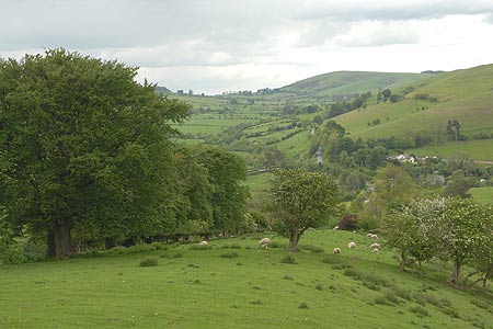
Adstone Hill, Medlicott and the Long Mynd from Bridges
Shropshire Hills Walk
Region - Shropshire Hills
County/Area - Shropshire
Author - Lou Johnson
Length - 9.5 miles / 15.4 km Ascent - 1625 feet / 492 metres
Time - 6 hours 20 minutes Grade - moderate
Maps 

| Ordnance Survey Explorer 217 | Sheet Map | 1:25k | BUY |
| Anquet OS Explorer 217 | Digital Map | 1:25k | BUY |
| Ordnance Survey Landranger 137 | Sheet Map | 1:50k | BUY |
| Anquet OS Landranger 137 | Digital Map | 1:50k | BUY |
Walk Route Description
Click image to visit gallery of 9 images.
Using sections of the Shropshire Way this walk is a mix of valleys and hills on the western flanks of the Long Mynd. Fewer walkers use these paths than those nearer Church Stretton so you can usually have most the route to yourself. Generally speaking the paths are easy to follow although low cloud on the Long Mynd might make navigation tricky. The start is the hamlet of Bridges (Grid ref SO393964) where there is limited parking on the road to Overs. The Horseshoe Inn has a parking area for customers and you are requested not to abuse this.
After parking walk up the lane to Overs and Medlicott. As the lane climbs gently take the footpath on your right signed the "Shropshire Way". The path climbs steadily across fields following the ridge of Adstone Hill. The views to your right include the Stiperstones. The path crosses the summit and descends through a pleasant avenue of trees to reach a road (Grid ref. SO389941). Turn left into Adstone. Where the road turns sharp right continue straight ahead down a track. This descends to a stream before climbing up to Medlicott. Turn right along the lane and continue straight on, ignoring the right turn.
The road becomes a track and climbs to a cottage (Grid ref. SO406944). Go through the gate and continue into open country. The track climbs easily across the flank of Pole Bank. Reaching a junction (Grid ref. SO416946), turn right up to Pole Bank, which is the highest point on the Long Mynd. After enjoying the extensive view (we could easily see Cadair Idris) return down the path you have just walked. Continue straight ahead to reach a road (Grid ref. SO420953). Go straight ahead here continuing to follow a clear, wide path. Ignore paths going off left and right and continue to reach a road (Grid ref SO432964). Go straight ahead here following the road. At grid ref. SO434966 turn left off the road to join a track. This is the "Portway" an ancient route across these hills.
Stay on the Portway as it meanders across pleasant hillsides, past the trig point on the Betchcott Hills. Passing a derelict farm building on your left, look out for a stile with a sign on your left (Grid ref. SO420985). Go over the stile and follow the path, a section of the Shropshire Way, through Golden Valley and down towards Darnford Brook. The waymarking is good and reaching the valley floor, the path stays on the north side of the brook all the way past Ratlinghope to reach a lane (Grid ref. SO401970). This section is very pretty in places and to me sums up the Shropshire Hills. At the lane turn right and it is a short walk back to the start.
Other walks nearby
| Walk 3395 | The Stiperstones Ridge | easy/mod | 5.5 miles |
| Walk 3422 | Ratlinghope & the Stiperstones from the Knolls | moderate | 7.5 miles |
| Walk 3596 | The Stiperstones from the Knolls | easy | 2.0 miles |
| Walk 3045 | The Stiperstones & Blakemoor Flat from the Knolls | easy/mod | 5.0 miles |
| Walk 2054 | Linley Hill & Beeches from Wentnor | easy/mod | 7.0 miles |
| Walk 1809 | Shelve & the Stiperstones from The Bog | moderate | 9.0 miles |
| Walk 2083 | Linley Hill and Linley from The Bog | moderate | 8.5 miles |
| Walk 1072 | Stiperstones low level circular | easy | 4.0 miles |
| Walk 1180 | Pole Bank (Long Mynd) from Carding Mill | moderate | 6.5 miles |
| Walk 1409 | Haddon Hill and Bodbury Hill | easy/mod | 4.4 miles |
Recommended Books & eBooks
Hillwalking in Shropshire
 Guidebook to 32 walking routes in Shropshire in the West Midlands. The routes range from 3 miles (5km) to 12 miles (19km), taking in highlights such as The Wrekin, Wenlock Edge, Long Mynd and Stiperstones, Castle Ring and Bury Ditches. Many routes start near delightful towns and villages including Church Stretton, Ludlow and Bishops Castle.
More information
Messaging & Social Media
Message Walking Britain and follow the latest news.

Mountain Weather
Stay safe on the mountains with detailed weather forecasts - for iOS devices or for Android devices.