Cadair Bronwen from Llandrillo
Denbighshire Walk
County/Area - Denbighshire
Author - Lou Johnson
Length - 9.5 miles / 15.4 km Ascent - 2435 feet / 738 metres
Time - 7 hours 10 minutes Grade - moderate
Maps 

| Ordnance Survey Explorer 255 | Sheet Map | 1:25k | BUY |
| Anquet OS Explorer 255 | Digital Map | 1:25k | BUY |
| Ordnance Survey Landranger 125 | Sheet Map | 1:50k | BUY |
| Anquet OS Landranger 125 | Digital Map | 1:50k | BUY |
Walk Route Description
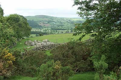
Click image to visit gallery of 9 images.
The Berwyn mountains provide some excellent walking. Rising to 827 metres, the highest point is Cadair Berwyn from which the area gets its name. Further north along the main ridge is Cadair Bronwen, 790 metres, and this rounded mountain provides the main objective of this walk.
The start is the village of Llandrillo in the Dee Valley. The start is the free car park (Grid ref. SJ035371) adjacent to the river in the centre of the village on the north side of the B4401. Exit the car park and turn left (east) along the B4401 forking right just after the village hall on your right. Follow this lane, ignoring the lane on the right, to climb towards some woods.
Reaching the end of the tarmac, go through the gate and continue along a walled track that continues to climb with improving views across the Dee Valley to the Arenig mountains. This track is followed for nearly five kilometres to the col at Pen Bwlch Llandrillo (Grid ref. 091366). The climb is steady and there is a good feeling of spaciousness as you gain height. The only notable landmark en-route is the pack-horse bridge (Pont Rhyd-yr-hydd), which is marked on the 1:25000 map. Reaching the Col you will discover a memorial to a cyclist and also have the opportunity of a quick ascent to the unnamed summit (621m) on the north side of the col.
The diversion completed, leave the track you have followed from Llandrillo and turn right along the signed concessionary path and head south for the ascent of Cadair Bronwen. In places the path is a little wet but nothing too bad and you soon reach the cairn that marks the highest point of the mountain. Views are good with the high peaks of Snowdonia (Eryri) probably gaining your attention in clear weather.
Descend south off the summit along sections of recently installed boardwalk to reach the Col at Bwlch Maen Gwynedd. (If you have the energy you can continue straight ahead and visit the summit of Cadair Berwyn. This option adds another 120 metres of ascent and just over 2 kilometres to the walk.) Turn left at the Col and begin the descent to Llandrillo. Where the path forks take the left hand path and descend alongside a stream - Ffynnon Maen Milgi - as far as the conifer plantation, which is visible from the col. Approaching the plantation the path improves to a track.
Care is needed on the next section. There is a path (very wet and boggy in places) that stays close to the stream. It is better to stay with the track and continue parallel to the stream on higher and drier ground. In places the route is not clear and the best advice is to stay above, north of, the reedy grass that indicates wet ground. This route eventually leads to the 473m spot height and track (Grid ref. 053356). Follow this track to reach a fence. Keep the fence on your right and descend to a gate (Grid ref. 043353). Go through the gate and follow the rough track dropping steeply down to Blaen-y-dre-uchaf and a metalled lane. Continue on this quiet country lane into Llandrillo.
Other walks nearby
| Walk 1086 | Post Gwyn and Craig-y-Mwn from Pistyll Rhaeadr | moderate | 6.5 miles |
| Walk 3053 | Berwyn Tops from Tan Y Pystyll | moderate | 14.0 miles |
| Walk 3031 | Cadair Berwyn | moderate | 9.3 miles |
| Walk 2055 | Moel Emoel from near Bala | moderate | 6.0 miles |
| Walk 1989 | Llanarmon Dyffryn Ceiriog Circular | moderate | 6.0 miles |
| Walk 3655 | Rhewl, Moel y Gamelin & Moel Morfydd | moderate | 5.4 miles |
| Walk 3017 | Aran Benllyn & Aran Fawddwy from Llanuwchllyn | mod/hard | 10.0 miles |
| Walk 3102 | Bwlch Sych and Tynygarreg from Lake Vyrnwy | moderate | 8.5 miles |
| Walk 1845 | Castell Dinas Bran from Llangollen | easy/mod | 4.0 miles |
| Walk 2059 | Castell Carndochan near Bala | easy/mod | 2.5 miles |
Recommended Books & eBooks
No suggestions for this area.Messaging & Social Media
Message Walking Britain and follow the latest news.

Mountain Weather
Stay safe on the mountains with detailed weather forecasts - for iOS devices or for Android devices.